There is a region in California that experiences more frequent damaging earthquakes and tsunami than anywhere on the U.S. West Coast outside Alaska. It is a region where subduction is still active and catastrophic earthquakes over 8 magnitude are capable of producing tsunami up to 15m (45 feet) high. Entire strips of coastline and even patches of forests have been submerged under water as other landscapes have been lifted higher by these tectonic events that have left recent footprints throughout the state’s northwest coast. This is a region that more resembles the Oregon coast, a region seismologists and geologists label the Cascadian Subduction Zone.
Here, accomplished award-winning geophysicist Dr. Lori Dengler guides us through these broken landscapes on a field trip sponsored by the California Geographical Society in the spring of 2015. A series of buckles and thrusts in the crust are evident here, north of where the north-south trending San Andreas system is cut off by the east-west Mendocino Fault. This Cascadian Subduction Zone megathrust belt runs about 700 miles from Cape Mendocino to Vancouver Island. The plate boundary gently slopes from the ocean floor about 45 miles offshore to about 8 miles below Humboldt Bay, then deeper below the surface farther inland. The result is a youthful fold and thrust belt landscape that includes at least 6 active thrust faults in the Humboldt Bay region.
Each fault breaks with occasional earthquakes that have been thrusting up deformed marine terraces and downwarping the bays and marshes. The greatest events have dropped the bays and lagoons after marsh peats were established during centuries of relative stability. These lowlands are susceptible to liquefaction, soil amplification, subsidence, and tsunami inundation during these spasmodic events. Thick layers of mud and other sediment are suddenly deposited, burying the old peat and building up a new surface where another stable layer of peat can grow. A few more centuries pass until the next mega earthquake continues these cycles that have been correlated in time with similar tectonic shifts along the Oregon and Washington coasts. The last major event (January 1700) was so large, it sent a teletsunami that was still several meters high when it arrived in Japan. There are even Native American (Yurok) stories of how these megaquakes and their tsunami flooded bays in the region before recorded history.
The good news is this tectonic activity has produced diverse and scenic topographic features that give unique beauty to this quiet coast of cool mist. The bad news is there have been 24 tsunami recorded on this northwest coast since 1855, though 19 came from great distances, and Crescent City has suffered more tsunami damage than any West Coast city outside Alaska. And though smaller damaging earthquakes are likely within the next few years, seismologists estimate the probability of the big one at about 15-20% within 50 years. Join us as we explore evidence of these compressional forces and catastrophic events from the top of the thrusts and anticlines into the downwarped lagoons and bays.
Special thanks to Dr. Lori Dengler, Humboldt State University, and the California Geographical Society.
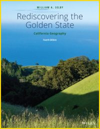
If you are looking for more, consult Chapters 2 and 3 of our book and try these sources:
- Recently completed relative tsunami hazard maps of the Humboldt Bay region
- Relative tsunami hazard mapping for Humboldt and Del Norte Counties, California
- Living on Shaky Ground: How to Survive Earthquakes and Tsunamis in Northern California
- Redwood Coast Tsunami Work Group


