In early July 2019, a series of powerful earthquakes fractured the desert, generating violent seismic waves that eventually rippled across the state and dissipated into California’s distant cities. A secluded outpost was suddenly thrust on to the global stage. Within seconds, the forces of nature had reaffirmed the common ground between California’s most dissimilar landscapes and people; places that previously seemed worlds apart were reconnected.

It was dinnertime when serpentine seismic waves suddenly began rippling and then rolling through our creaking house. We watched and braced ourselves as the light fixture hanging above the trembling dinner table began swaying, as if to dance in choreography with other objects that were not solidly secured. Seasoned Californians who have experienced too many tremblors over the decades recognize these seismic waves, lasting several seconds or more, as eerie messengers propagating from a strong but distant earthquake, perhaps hundreds of miles away. This version of California vertigo is quite different from the short jolts and lurches of smaller quakes originating from nearby epicenters. Thankfully, the undulations subsided several seconds later, leaving little or no damage here, so that we could connect to the best media to answer our questions: How big was this one, who and where were the latest distant victims, and could we expect more or even greater terra convulsions? Thanks to technologies scientists have developed in recent years, and we have explored in previous stories on this web site, the answers came within minutes, a mere instant compared to the hours of anxious anticipation that would pass after sizable earthquakes in past decades.

Though some shaking was felt as far away as Sacramento and San Diego and Las Vegas, the epicenter and greatest damage was located in the sparsely populated desert about 120 miles (195km) north of major southern California cities. Their seclusion could not spare the victims of small communities around Trona and Ridgecrest or the Naval Air Weapons Station at China Lake from violent shaking that cracked buildings, set fires, crumbled walls, threw mobile homes off their foundations, and destroyed infrastructure until more than $1 billion damage was done. It would be recorded as another powerful earthquake, but perceived as another case of how most Californians dodged the dreaded “Big One” bullet.

This was the largest (M7.1) in a series of earthquakes that fractured and violently shook the mostly remote desert floor of Searles Valley and the adjacent rugged desert mountains to its west during the first week of July 2019. It was also the largest earthquake to hit within the borders of California in two decades. Interestingly, the Hector Mine earthquake of 1999 and the Landers quake of 1992 were similar temblors just above magnitude 7 that also sheared dramatic cracks and horizontal and vertical displacements of several feet on the desert floor to the south; they also tore through remote desert regions, sparing distant population centers from major damage. An image in our publication shows this author standing next to a vertical fault scarp of more than 6 feet (2 meters) high, lifted in less than 30 seconds by the Landers earthquake. These major seismic events in our remote deserts contrast with the disastrous and deadly 1989 Loma Prieta quake (M7.0) in the Bay Area and the 1994 Northridge cataclysm (M6.7), two of the most costly natural disasters in U. S. history up to those times, both with epicenters under or near major cities, but both leaving less conspicuous surface fissures that were a lot more difficult to find and measure.

Scientists named these more recent July 2019 tremors the “Ridgecrest Earthquake Sequence”, including that largest July 5th M7.1 event described at the start of this article. It was preceded by a major foreshock of M6.4 about 34 hours earlier, which had likewise been preceded by a series of smaller foreshocks. That first big M6.4 tremor on July 4, and its foreshocks, activated a southwest-northeast-trending fault across Searles Valley, causing noticeable left-lateral displacements. The larger M7.1 main event and its aftershocks spread along a northwest-southeast-oriented fault with dramatic vertical and even more dramatic right-lateral displacements on the desert floor that were locally greater than 12 feet (>3.5 meters). These two perpendicular faults cross in Searles Valley; the complexity of these displacements resembles major geologic structures in the region. They are all part what geologists have labelled the Eastern California Shear Zone.

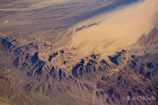
Just to the south of Searles Valley, the east/northeast-trending Garlock Fault (transverse to most other California geologic structures) is the most dramatic left-lateral feature on the state’s landscapes. A series of aftershocks were measured along this Garlock Fault as part of this sequence that started with left-lateral faulting in the Searles Valley. In contrast, north and northwest of Searles Valley are the numerous Basin and Range horsts and grabens of uplifted rugged mountains and down-dropped desert valleys cut along more common right lateral and vertical faults that trend north into the Basin and Range’s Death Valley, Panamint Valley, Owens Valley, and their adjacent mountain ranges. The main 7.1 earthquake (more aligned with tectonic activity and geologic structures common to the north) was followed by aftershocks that eventually rippled all the way up toward Olancha and the Owens Valley, which is also being dropped down below the dramatic vertical faulting that lifts the eastern Sierra Nevada Mountains. You might imagine how extensional forces are tearing at the crust in this region as the Pacific Plate to the west shears toward the northwest and away from this western edge of the North American Plate. And so, there is Searles Valley, at the northern edge of the Mojave Desert and the southern edge of the Basin and Range, being broken by tectonic forces common to two major physiographic provinces.


Such recent and ancient tectonic activity has lifted adjacent and more distant mountain ranges above a downwarped Searles Valley. An amazing mélange of rock formations many millions of years old have been exposed on these desert mountain slopes. Those rocks with their assorted chemistries continue to weather and crumble into smaller pieces that can be transported by wind or the rare downpours that will deliver mud and debris flows through desert canyons and into the valleys. These materials are further broken down into finer sediments and dissolved chemicals that can be deposited on valley floors. With no outlets to drain these inland basins, they are stranded and often baked into desert playas with their high concentrations of salts.

But it hasn’t always been so dry here. More than 11,000 years ago, when the climate was cooler and wetter and glaciers were carving the distant Sierra Nevada, a chain of Pleistocene lakes connected many of these desert basins. You can also learn more about them in our publication. Searles Valley filled with more than 600 feet (about 200m) of water. These inland lakes would eventually vanish as conditions evolved into the warmer and drier periods that ended the Ice Ages and characterize today’s climates and landscapes. Thick layers of minerals were precipitated as the trapped waters evaporated over thousands of years. Brief wetting and shallow flooding during occasional wet periods delivered and concentrated more minerals into these desert basins to be dried and baked. These carbonates, sulfates, borates, and halides rich in sodium and potassium have encouraged commercial mining operations here ever since prospector John W. Searles recognized their value. Searles established the San Bernardino Borax Mining Company in the 1870s and gained attention for using his mule teams to haul borax out of Searles Valley, through Salt Wells (AKA Poison) Canyon, so that it could eventually be delivered all the way to San Pedro.


After Searles’ death and throughout the 1900s, mining companies that operated in this valley evolved through good and bad times with different owners and names. The small company town of Trona also grew as the railroad made it more accessible since the early 1900s; the highway (today’s 178) made further connections. By the mid-1900s, Trona had become a mining boom town with a population soaring over 6,000. Today, Searles Valley Minerals continues to pump brine from below the mostly dry lake so that it can be processed into an astonishing variety of tons of valuable mineral products that include borax and boric acid.


And it’s not all about work. More than a thousand mineral and geology enthusiasts flood the valley during the annual October Gem-O-Rama, when Trona and surroundings are packed with excited visitors who participate in field trips sponsored by the Searles Lake Gem & Mineral Society. The few small local museums, stores, and eateries become the center of at least 36 hours of fame when folks show and share their rock and mineral and lapidary arts collections, and venture out on the playa. They are guided to collect spectacular crystals that include some of the finest samples of six-sided hanksite in the world and beautiful specimens of pink halite that have been stained by salt-loving bacteria. These annual gatherings are advertised as the most exciting mineral collecting field trips in the U.S. (After more than 75 years of tradition, these treasure hunts were temporarily cancelled in 2019 due to lingering infrastructure damage from the earthquakes, and scratched again during the 2020 COVID-19 pandemic.)

We can appreciate that had it not been for the tectonic activity that has been dropping and isolating these desert basins and lifting surrounding mountain ranges, these mineral-laden desert playas would not exist. It is more than ironic that the seismic activity of July 2019 we examine here had visibly damaged one of the tall Searles Valley Minerals chimneys that erupt as dominant landmarks above this valley, as if humans were trying to recreate the nearby Trona Pinnacles.


The July 2019 Ridgecrest Earthquake Sequence even knocked a few of the more precarious rocks and boulders down from those Trona Pinnacles across the valley. This is a roughly 15-square-mile accumulation of tufa spires that rise over 100 feet above Searles Dry Lake. These towers that define natural landscape oddities were forming more than 11,000 years ago as underground springs transported calcium up to meet the carbonates that were becoming more concentrated in the evaporating inland lake. Algae bonded to these calcium carbonate deposits, growing the tufa reefs that emerged as the drying and warming climate finished off the lake. (You might notice some of the stranded ancient shoreline contours, or strandlines, along slopes that ring the valley.) As a National Natural Landmark, the Trona Pinnacles have earned recognition from landscape admirers and gained attention in the numerous movies and TV productions that have exploited them, often as background scenery to simulate the topography on other planets, at least in our imaginations.


We can also blame tectonic activity for building the Coast Ranges and Sierra Nevada Mountains to the west, as they have been blocking moist air masses that would otherwise invade from the Pacific and bring precipitation and accumulated runoff that might dissolve and dilute these mineral deposits. As with other California desert basins, air masses can only invade Searles Valley by flowing down the very mountains that have already wrung out moisture from otherwise promising storms, resulting in more compressional heating and drying by the time they reach the valley floor, at about 1,700 feet above sea level. With average annual precipitation below 4 inches (<10cm), exceptionally low specific humidities, and relative humidities frequently below 10%, this alkaline dust bowl remains nearly as dry as Death Valley and one of the driest places on Earth. You can also thank the dry continental air masses for summer daytime high temperatures that average well above 100 degrees and overnight lows in winter that average around freezing. Winter’s coldest storms can even deliver a rare dusting of “dry” snow. Abundant sunshine rules year round, but radiation escapes quickly and temperatures usually plummet after sunset. Add the occasional fierce winds and you have classic desert extremes that many people, plants, and animals may consider hostile.


And so it is not surprising that the plants and animals that survive around here must be adapted to extreme aridity and the wild variations in radiation and temperature. Although you may encounter Joshua Trees and other high desert woodlands while climbing into cooler and more moist surrounding mountains, the valley is only decorated with the most resilient desert scrub (such as desert holly) and brief spring wildflower blooms. As you approach the floor of the valley, limiting factors multiply, as only the most salt-tolerant plants can survive in what becomes an increasingly toxic soil. Parts of this desert erupt with activity during the brief spring blooms that can attract many animal species. These include a wide variety of insects, various herbivores, and their predators. Ravens, prairie falcons, and peregrine falcons may soar above horned lizards, desert iguanas, kangaroo rats, desert tortoises, coyotes, and kit foxes. Some species, such as falcons and tortoises, are highly sensitive to human disturbances in these fragile ecosystems. Please remain especially distant from falcon nests, as they are often built in the very cavities that people enjoy exploring.


Beyond social media, today’s Searles Valley and its Trona is connected to the world mostly through the many human passersby on Hwy 178 who are headed for Death Valley National Park or other popular ecotourist hot spots. Still, more powerful global connections exist that may not, at first, be as evident in this isolated desert town. The dominant company (Searles Valley Minerals) is a subsidiary of a major international corporation as it ships tons of mineral products each day to California ports and then to at least 52 different countries. The community is dependent on this company that provides necessities for its residents and employs more than 700 people. Many of the other families are anchored by workers who provide essential services in this company town.


After the July 2019 earthquakes hit, Trona’s people (less than 2,000 within census-designated Searles Valley, but thousands more in surrounding communities) and its schools and its cultures were thrust into the national and global spotlights. Clamoring for the latest compelling stories, national media converged on and then unveiled what some popular culture urban observers considered foreign or unimaginable, as folks weighed the advantages and disadvantages of living in such seclusion. For instance, it was shown that roughly 250 students populate the Trona Joint Unified School District that includes one elementary and one high school. When the local high school (The Tornadoes) football team gained praise for training on the only known all-dirt field in the nation, the power of limitations quickly became apparent. The harsh climate and high salt content in the soils and the lack of financial resources eliminated traditional turf options on what became known as “The Pit.” Unreliable attendance from the small pool of young athletes necessitated 8-man football. As unlikely students and other locals were interviewed, a common thread emerged: the kids and adults here are tough and their resilience would carry them through earthquake recovery in this place that requires adaptations to limitations.

The power of social media continues to add to the push and pull factors that tempt young people and others to move out and on, toward what they may perceive as better and more exciting opportunities. It certainly is not the booming mining community that grew to over 6,000 people in the mid-1900s. But you will also find great pride within the people and cultures that have developed in this community. You don’t see locals running on the endless treadmills that torture California city dwellers struggling just to make ends meet so they can pay rents or mortgages that rank highest in the nation. Here, the average cost of a home is well below the national average; you can still buy a modest house on a large lot for less than $100,000. There are multiple apartments and small houses around the greater region (that includes Ridgecrest) renting for less than $1,000/month. Seismologists and engineers have already used some of them as examples of how modern earthquake building codes kept damage and losses in the region much lower in the relatively new construction, compared to the oldest structures. The result is more housing inventory remained after the earthquakes so that fewer people were tempted or forced to move on to those other horizons and opportunities.

This dusty, solitary place feels perfectly separate and disconnected from the mild climates and overcrowded, unaffordable giant urban centers closer to the coast, on the opposite sides of the great California ranges. Searles Valley may even appear other worldly to urban dwellers celebrating their popular cultures. Here is where primary extractive industries fuel a different kind of economic system where the cost of living and household incomes remain well below the state average. It’s easy to find peace and quiet, there are more than enough bright stars to count at night, and a wealth of desolate, crystalline desert and mountain landscapes call out to the adventurer. Life is slower paced within these more traditional cultures where neighbors know one another and people may live and celebrate “Trona Strong.”


Searles Valley and other remote places may define the other California, but they are powerfully connected to the world and to rest of us by a lot more than natural resources, the chemicals we use each day, and social media. These connections become especially evident when seismic waves ripple through our communities from another distant and different place. They will announce the latest earthquake that is building mountains and rearranging landscapes and creating new victims of the very powerful forces that continue to sculpt such a spectacular and diverse California. Nature will connect us whether we like it or not. We wonder: which landscapes are soon to be rearranged and who might be the next “victims”?


This story was informed by scientists from the United States Geological Survey, Seismological Society of America, Southern California Earthquake Center, California Geological Survey, Bureau of Land Management, and the Searles Lake Gem and Mineral Society.
A few other sources:
View this short video about Trona, created by ghost towns and mines enthusiast Ray Dunakin, just three weeks after the earthquakes:
Here is the Bureau of Land Management introduction to Trona Pinnacles: https://www.blm.gov/visit/trona-pinnacles
Here is information about the Searles Lake Gem and Mineral Society’s Annual Gem-O-Rama Field Trips: http://www1.iwvisp.com/tronagemclub/General-info.htm
Check out the Kim Stringfellow’s Mojave Art Project and her coverage of the annual Gem-O-Rama on KCET:
https://www.kcet.org/shows/artbound/gem-o-rama-mojave-playa-interventions-part-ii
