It doesn’t seem to add up: vacant or underutilized office space in a city with a severe housing shortage. But these are two major problems that are slowing recovery and progress in our cities and preventing Los Angeles from realizing its true potential. Enter problem-solver John Hart. Working under the direction of Jing Liu, in her Geographic Information Systems class, he used the power of GIS to feed two birds with one scone.
John organized a seemingly disconnected maze of data into a remarkably relevant and impactful map story. The result is nothing short of a Wilshire Renaissance, which is a perfect title. Now, if we can only encourage urban planners, property owners, residents, and city officials to see the GIS light as John Hart sees it. Click here toward a brighter LA future.
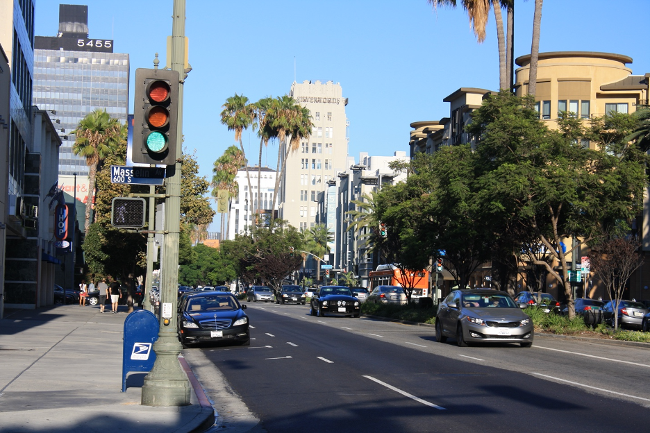
Some of LA’s iconic architectural landmarks can be found along Wilshire Blvd. This strip that includes mixed uses extending along the Miracle Mile, Museum Row, and the edge of Koreatown, is one of the most densely populated corridors in the nation. The Miracle Mile Tower (5455) rises on the left.
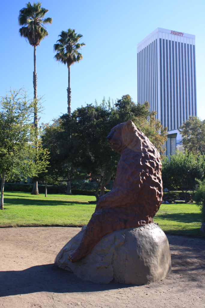
This statue of a ground sloth resting at the La Brea Tar Pits decorates cherished open space along Museum Row and the Wilshire Corridor. When these Ice Age animals couldn’t adapt to their changing environments, they went extinct. (This photo is already history since Variety Magazine and its media brands moved out of that 31-story office tower (5900 Wilshire) in the background many years ago.) Let’s hope that folks in LA can learn to use space (such as the existing skyscrapers and buildings around Wilshire) and other resources more efficiently so that they will adapt before meeting the ground sloth’s fate. Here’s that link to John Hart’s more promising urban future.