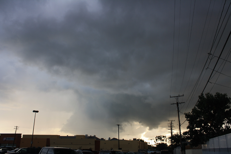
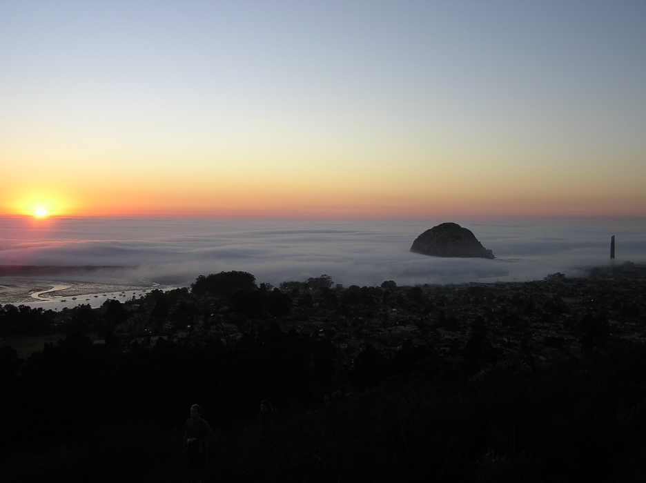
When spring progresses toward summer, we can count on two highly disparate yet occasionally connected weather patterns to develop: severe weather with violent tornadoes in the Great Plains and Midwest versus thick marine layers along the California coast. They represent completely opposite weather patterns and air masses that appear in two different places at the same time. Just as our May gray casts stable blankets of low stratus clouds and fog along the California coast, churning air masses are clashing in epic battles from the Southern U.S. through the Plains and Midwest. And though our dull misty marine layers may not inspire popular action films such as Twister and its recent sequel, they do set milder moods for millions of Californians.
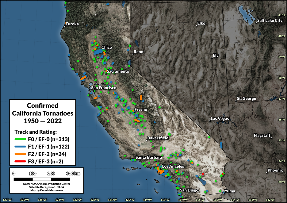
You may be surprised to learn that California’s Central Valley and the LA Basin experience more tornadoes than any U.S. region west of the Rocky Mountains. In my new book, The California Sky Watcher, I note how NOAA counted 465 tornadoes in the Golden State from 1950-2021. The majority of these twisters were the weakest, measured at EF0 and EF1 on the Enhanced Fujita Scale of 0-5, and they “only” caused about $135 million in damage. California tornadoes will never measure up to the terrifying deadly beasts that touch down in the middle of our continent each year. But why?
Severe thunderstorms and tornadoes represent the most unstable overturning of our atmosphere, defying the forces of gravity. Like all matter that has weight, gravity pulls air molecules down toward earth’s surface. But when local air masses with radically different temperatures and densities battle it out and relatively warm temperatures at the surface contrast with exceptionally cold air aloft, air becomes buoyant and is forced to rise.
The environmental lapse rate refers to how temperatures change with height in the atmosphere. The steepest lapse rates (differences between warm air at the surface and cold air aloft) will produce the most unstable air masses and the most severe storms. The average environmental lapse rate is measured at about 3.5° F/1,000 feet (6.5° C/1,000 meters) as we make our way higher through stationary air, but it is constantly changing from place to place and time to time. When environmental lapse rates increase to more than 5.5°/1000 feet (10° F/1,000 meters), the air becomes absolutely unstable, meaning that parcels (or individual bubbles) of air will continue rising whether they are saturated or not. This keeps the ascending air parcels warmer and less dense than their surroundings, which encourages them to rise further. Such instability often occurs along frontal boundaries and when air is heated near the surface (usually during afternoons), especially when very cold air moves overhead in the upper atmosphere.
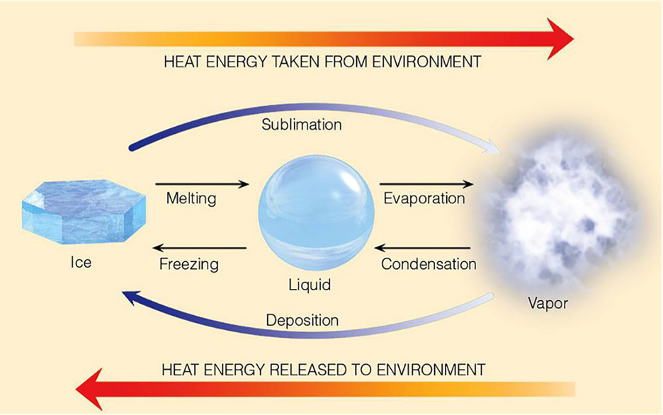
The next important player that produces unstable storminess is moisture. Though a very dry air mass may rise, expand, and cool, it may never get cold enough to reach its dew point; the result is an unstable updraft without a storm: clear air turbulence. But an unstable air parcel with a lot of water vapor will quickly rise, expand, and cool to its dew point. When condensation occurs, forming the base of the cloud, tremendous amounts of latent heat are released within the cloud as high-energy water vapor changes to lower-energy water drops. This latent heat of condensation encourages warmer boiling updrafts and fuels all severe storms on Earth, such as thunderstorms, tornadoes, and tropical storms. Those white cauliflower towering cumulus clouds you’ve seen bubbling vertically into the upper atmosphere are energized by latent heat of condensation. Very dry air masses just don’t have enough latent heat energy to fuel such storminess.
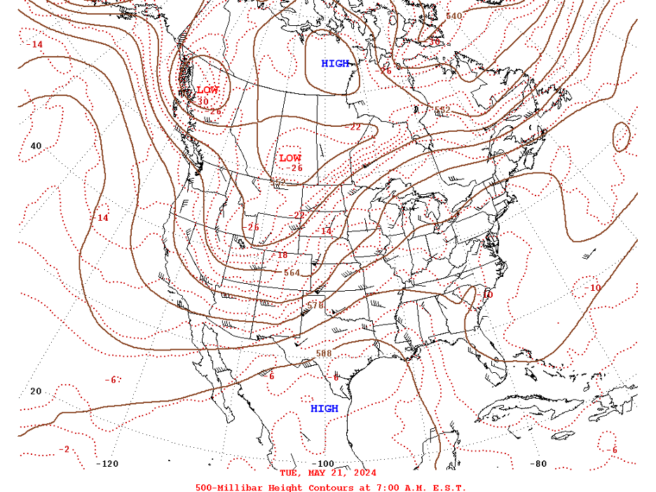
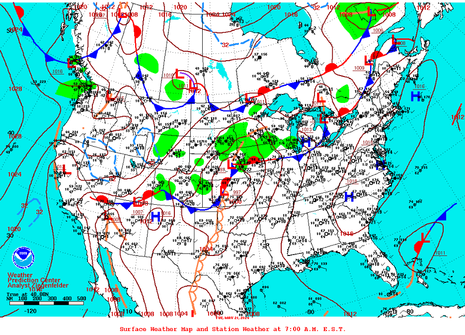
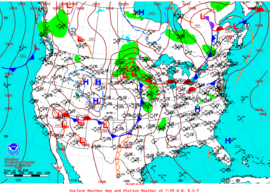
The middle of our continent is the perfect stage where we can witness the most severe thunderstorms and violent tornadoes on Earth. Such tempests often build just below and to the east of deep upper-level troughs of low pressure that encourage updrafts and cyclogenesis (the development and strengthening of middle latitude wave cyclones). Extremely warm, moist air masses that flow up from the Gulf of Mexico may encounter extremely cold air masses moving down from Canada, especially during spring. The differences are often most extreme along frontal boundaries that mark abrupt battle grounds as the final invasions of winter from the north clash with encroaching sultry summertime air spreading up from the south. Add some vertical wind shear and a few other geographic and atmospheric oddities that make the middle of our country unique (such as “dry lines”, boundaries where dry air invading from the west pushes into moist air to the east) and you have the ideal formula for the most violent severe weather outbreaks on our planet. Once tornadoes form, extensive flat surfaces encourage touch downs and keep them on the surface for longer periods. This is what happened from May 19-27, 2024, when one of the most violent, destructive, and deadly tornado outbreaks in history swept across the middle of our country. Up to 222 tornadoes killed 21 people and injured at least 240 others during this sequence. Casualties would have been astronomical without stellar forecasting and warnings from the National Weather Service.
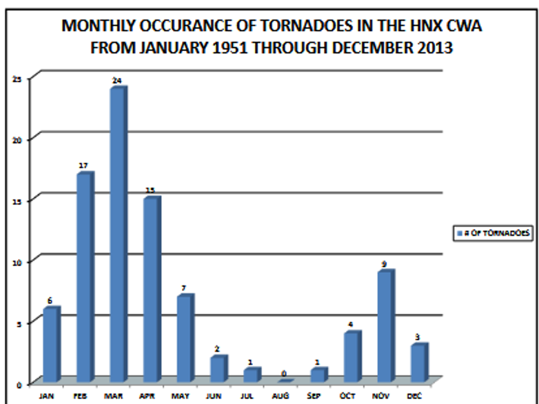
Not so in California. Our severe thunderstorm and tornado events are few and far between. Thanks to our cold California Current, protective mountain barriers. geographic situation, and other factors, we just don’t have a reliable source of juicy tropical air from the south, bitter cold air masses from the north, or dry lines to power such atmospheric upheavals. Even when our cumulonimbus clouds and thunderstorms build up to 30,000 feet high, they are no match for the monsters that can grow over 50,000 feet tall in the Plains and Midwest. Nevertheless, our relatively paltry tornadoes are most common as the winter season’s last cold storms sweep unstable air across coastal and inland valley surfaces that have been heated by more intense radiation as seasonal sun angles increase each day. Just enough instability is created during these late winter/spring clashes to produce waterspouts and “landspouts” along the coast and relatively weak twisters into our inland valleys. (Unusual weather patterns are capable of producing such storms at other times of year. For instance, there is also a slight July-September uptick in these very rare events in our deserts when the late summer Southwest (or North American) “Monsoon” infrequently slops into California from the south and east.)
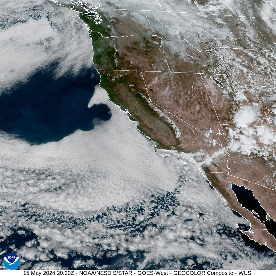
And just when the tornado season is reaching its annual peak in May in our country’s midsection, winter’s storms and turbulence have usually been pushed and blocked out of California by our great stabilizer, the North Pacific Subtropical High. As this massive heavy, dense high pressure asserts itself and then anchors off our coast, it produces some of the most stable air masses observed anywhere on our planet. How does that work?
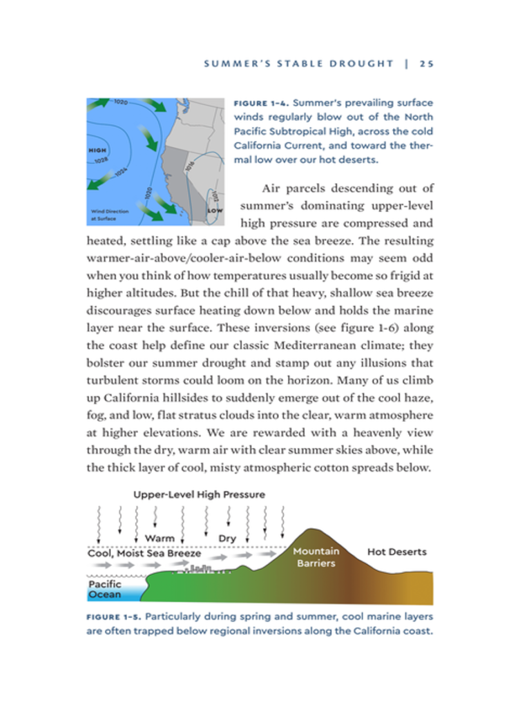
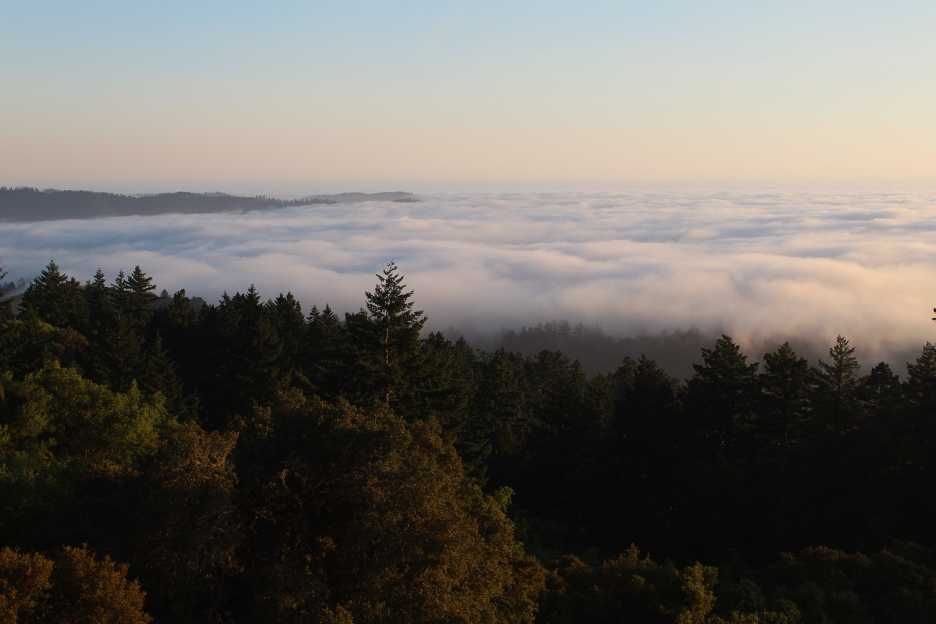
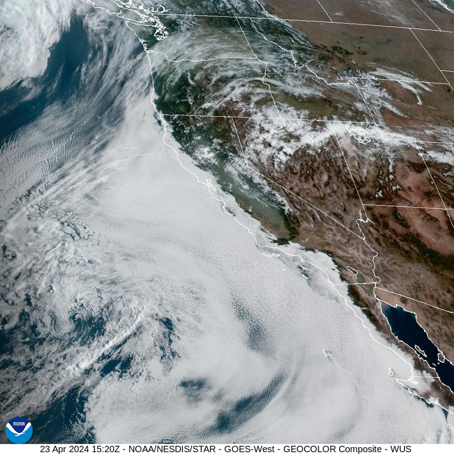
As winds spin clockwise out of the North Pacific High, they push cold ocean currents from north to south along our coastline. The cold, dense, heavy air masses in contact with the cold ocean surface form what we call our marine layer. Meanwhile, air descending out of the season’s building high pressure is being heated by compression. This keeps a layer of warm, dry air sinking on top of our cool marine layer. That barrier between the warm air above capping the cool, dense air trapped below is what we call a temperature inversion; this weather pattern is a perfect and dramatic reversal from what we consider average or normal global conditions, since air usually becomes cooler as we ascend higher in our atmosphere. When the high pressure strengthens, inverted vertical temperature differences become extreme in what could be considered a temperature inversion on steroids. For instance, if the descending air caps the inversion and marine layer at 1,000 feet altitude, temperatures can soar to more than 100° F just above the inversion yet remain in the 60s just below 1,000 feet down to sea level. Folks stuck under the cool, misty marine layer might never know that it is hot and dry just more than 1,000 feet above them. And so, we end this spring-to-summer story with some of the most stable air masses in the world, right along the California coast. They represent the antithesis of the turbulent weather patterns that terrorize folks living near the middle our continent during the same time of year. Do you prefer our dreaded monotonous May gray or their dreaded spring storm terror that can spawn twister sequels? So, the next time you coastal Californians complain about the boring gray blanket above, be thankful that you’re not being battered by softball-sized hail or flying cars and cows and objects of all kinds being driven through solid walls. Skip to the end of this story for links to more of that drama.
Here are some links if you are still interested in the twister terror of May, 2024:
First, some tornado facts and safety tips from the National Weather Service
Monster Hail and Tornadoes from the National Weather Service