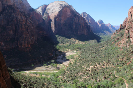
During the last ten years, many regions in California have experienced record-breaking extremes that have included some of the wettest and driest years on record. The 2019-2020 rainy season marked another extraordinary chapter in the increasingly strange weather patterns that have puzzled and often plagued Californians in recent years. We will first lead you toward National Weather Service Lead Forecaster David Gomberg’s slides that summarized our state’s situation at the end of the season. We will follow with a series of images and maps that tell a more detailed story about our latest abnormal Golden State rainy season, 2019-2020. We occasionally separate these presentations with colorful scenes on the ground (from spring to late June) that show how the state’s ecosystems and landscapes responded to these odd weather patterns.
Ending Another Bizarre “Wet” Season. High in the Trinity Alps Wilderness of northern California, Emerald Lake shines, but without the usual snow and ice that often decorates its shores and covers surrounding slopes and peaks during late spring. In 2020, trails were already dry by June.Celebrating a Wet Spring. California goldfields (Lasthenia californica) and some tidytips (Layia platyglossa) are found among the many wildflowers painting Garner Valley after spring rains soaked southern California’s San Jacinto Mountains and adjacent valleys and deserts.
For now, we can learn from the images prepared by David Gomberg as the rainy season ended in May. David is Lead Forecaster/Fire Program Manager at the L.A./Oxnard National Weather Service office and he shared his work during a workshop organized for college educators by Senior Meteorologist Todd Hall, with contributions from other meteorologists there. We are reminded again that all U.S. weather information and forecasts originate from the National Weather Service. These dedicated scientists use their knowledge of the complex physical laws that rule our atmosphere to prepare each day’s forecast. Without their technologies and expertise, weather forecasting would be unreliable guesswork. NWS original forecasts are then distributed to the public where commercial apps and self-appointed gatekeepers filter out the substance and relay their versions that will entertain the masses and increase ratings. To bypass this media fluff, you can go directly to the source of the forecast. Just click your region and let the real learning begin: https://www.weather.gov/ Thank you National Weather Service professionals!
Driest on Record. The first image from meteorologist David Gomberg shows how record drought plagued California throughout February, 2020. Huge areas of northern and central California recorded no rainfall for the first time during what is usually one of the state’s wettest months. Another Way to Display the February, 2020 Record Dry Month. Precipitation totals from Feb. 1 to March 1, 2020, are shown relative to average precipitation totals for the same period between 1979 and 2015. The colors grade form dark red as the record driest, to light as the average, to dark green as the record wettest. Source: Climate Mapper as published in the New York Times.Inverted Precipitation Patterns. It is no surprise that the resilient ridges and blocking highs not only kept northern California mainly dry compared to seasonal averages, but sinking air masses also pushed temperatures above average. The big surprise is that southern California experienced an above average precipitation year, wetter than many northern locations. Two Years, Two Extremes. We are lucky that the storms of 2018-2019 and previous seasons filled reservoirs that will be drastically lowered during this year of drought in key regions. Examine the ground images in this story to contrast that red area in the north with southern locations that benefited from at or above average precipitation totals. (Source: David Gomberg) Seasonal Distributions Turn Strange. During southern California’s 2018-2019 season, fairly normal distribution resulted in above-average rainfall. But the 2019-2020 season had nearly average totals that were erratically distributed, thanks to bizarre weather patterns that also kept northern California well below average. (Source: David Gomberg) Unreliable Seasons. Southern California’s coastal region has a history of drought and flood extremes that have become more pronounced during this century. (Source: David Gomberg) Monitoring the Fire Season. Measuring the moisture content of the common chaparral plant known as chamise, helps scientists anticipate the severity of each fire season. In both years, above-average precipitation seems to be quickly lost to high evapotranspiration rates before summer even begins. (Source: David Gomberg) The 2020 Fire Forecast. Scientists measure, analyze, and try to predict several variables as they look forward to our traditional fire season that usually extends well into autumn. It is hoped that a cool, moist marine layer might help plants hold on to some moisture and moderate the fire season near the coast. Northern California is in much greater danger this year. (Source: David Gomberg)
The images that follow are presented in chronological order as the season progressed. Various NOAA satellite imagery was used along with weather maps from San Francisco State University to display and explain evolving weather patterns. These 500mb charts are used to show upper level patterns and winds that often dictate weather conditions on the ground.
Ice Fields Retreat Early. Scanty snows melted earlier this spring on the slopes of Mt. Shasta. On this day, only a few cumulus are encouraged to condense in the otherwise low humidity air that followed an erratically dry winter.Medicine Lake Levels Dropping Fast. Medicine Lake is located in far northern California at nearly 6,700 feet. But the snow was melted by late spring, the roads were opened early, and the lake level was dropping fast after the meager snows of 2020.
After a dry October, powerful autumn storms began to form in the north Pacific and aim at the Golden State. Atmospheric rivers seemed to be setting up ahead of these incoming low pressure systems until the lowest sea level pressure ever observed in California was recorded at Crescent City in late November. By December, we seemed well on our way toward what would be another banner water year.
November 21, 2020: An Early Start? By November, a series of storms from the north Pacific swept toward California. This 500mb chart shows an upper level trough that cut off and finally drifted over southern California, perhaps signalling an odd pattern that would repeatedly reappear in the spring. (Source: San Francisco State University) November 26, 2020 Monster Storm. A powerful storm drifted out of the Gulf of Alaska and then exploded, moving toward northern California. Crescent City eventually recorded the lowest sea level atmospheric pressure in California history and it seemed that an impressive rainy season might follow. November 27, 2020: Deep Trough Plows Across the State. As this impressive trough drifted across the state and others formed in the north Pacific, record low pressure and storminess brought expectations for a robust rainy season. However, notice the large blocking high pressure system looming far to the west and the little partially cutoff low to our south that would better define weather patterns in future months. (Source: San Francisco State University)More Promises by December 1, 2020: This evening satellite image displays a strong low pressure system off the northern California coast spinning deep moist air masses up from the southwest in a classic atmospheric river, an event that was once also named the Hawaiian or Pineapple Express. December Starts with Heavy Precipitation. Meteorologists use different bands of the spectrum (Band 10 here) to differentiate between relatively drier (yellows) and wetter (blues, whites, and greens) air masses. You can see the atmospheric river being driven over California by one low off the north coast and another following it farther out at sea. Still on the Wet Side: December 5, 2020. Another strong low pressure system far off the north coast spins more atmospheric river moisture over California. We are again situated on the wet east side of the trough where upper level winds accelerate, destabilizing the air and encouraging positive vorticity advection, especially if the mother low moves closer. Late December Oddity? This low pressure system slipped farther south, bypassing northern California and delivering precipitation to southern California. Who could predict that this pattern would disappear and then begin repeating itself in March? Double-barreled Trouble? December 26, 2020. This dumbbell-shaped upper-level low began to cut off from the general circulation as it drifted over the state, an unusual pattern that would reappear nearly three months later. You can see it leaving northern California mostly dry. (Source: San Francisco State University) Focusing on the South. The late-December storm drenched southern California, leaving some northern Californians properly wondering if their rainy season might be in jeopardy.
By January, upper level patterns were shifting dramatically toward drought and by February, those ridiculously resilient ridges were locking in place over us, right in the middle of what should have been our wettest months of the year. Huge swaths of California from the coast to the Sierra Nevada received no measurable precipitation in February for the first time since recording began, following an unusually dry January. And for most stations in central and northern California, March was also disappointing. Stations around and beyond the San Francisco Bay Area into the Central Valley and along the central Coast received no precipitation in February. These included San Francisco, Oakland, San Jose, Sacramento, Salinas, Big Sur State Park, and Paso Robles. Southern California stations also recorded well below average precipitation in February (L.A. experienced its 10th driest on record) and most of the state was left at less than 5% of its average for the normally wettest months of January and February combined.
Big Pattern Changes. By February, the storms had backed off (note the swirling low far out at sea) and a blocking high was asserting itself upstream and over the state. Notice upper level winds streaming from the north and northwest over California, where they slow down and descend on the east side of the ridge, encouraging negative vorticity advection and fair, dry weather in the middle of the rainy season. (NOAA/NESDIS/STAR GOES ABI BAND 09)February Drought. This 500mb chart in the middle of February shows an enormous high pressure ridge anchored west of the state over the east Pacific. It will block any incoming storms as if it were summer, encouraging fair weather and record high temperatures. But notice that little loop of an upper-level trough attempting to form off northern Baja. (Source: San Francisco State University)Massive Surface High Pressure, February 15, 2020. An enormous high pressure system anchors itself at the surface just off our coast in the descending stable air just east of the upper level ridge, creating record summer-like drought in the middle of our traditional rainy season. (Source: San Francisco State University) Cutoff Lows become Familiar by February 22. A classic cutoff low impacts southern California, but leaves northern California dry again. (Source: San Francisco State University)
Just when it seemed too late to salvage this rainy season, nature delivered some March and April miracles to southern California that would miss many locations to the north. They arrived as a series of odd upper level lows that became cut off from general circulation patterns. Some of them drifted inland to the north as dry inside sliders and then retrograded southwest back over the ocean to pick up moisture off of southern California. Others spun right down the coast, mostly missing the north and then wandering and wobbling, again, southwest of southern California. As they finally drifted inland from northern Baja or across the southern California bight, these relatively small systems delivered soaking rains throughout southern California and well into the Desert Southwest.
California Inverted. By March 2, this intense cutoff low wandered just off the border between Mexico and California. Upper level patterns seemed to remain stuck with that big high pressure ridge still blocking major storms from sweeping in from the north Pacific as northern California dehydrated. (Source: San Francisco State University) March Starts Dry. By March 3, high pressure continued its dominance over us. Sinking air and offshore winds even drove the marine layer out to sea. You might also notice little reflection from the disappointing snow packs that should be much thicker this time of year. More Inverted California. By March 9, patterns with cutoff lows that brought storms to southern California and left northern California dry had become too familiar. More March Weirdness. As this cutoff low spins more moisture into southern California, an omega high blocks the north from badly-needed storms. Blocking High, Cutoff Low. The March 12 500mb chart from San Francisco State University clearly shows the omega high blocking major storms from approaching the state and the pesky cutoff low that had become so familiar to southern Californians during this season. (Source: San Francisco State University)Another Double-barrelled Cutoff, March 16, 2020. In a bizarre repeat performance from December 26, another dumbbell-shaped double-barrel upper-level cutoff low is rotating over the state. (Source: San Francisco State University) March 22 Teaser. This low pressure system spun around and threatened a little farther north off the central coast, compared to previous cutoffs.
During April, southern California caught up to its average or surpassed the seasonal precipitation totals, while northern California was left stranded in a serious drought year. As an example, Los Angeles accumulated 140% of its average precipitation for November and December, only 8% for January and February, and then 130% for March and April, while central and northern California missed most of those spring downpours. These cutoff lows became much more than the typical weather forecasters’ woes in the spring of 2020.
Too Late to Save the Season. By April 6, a promising low pressure system impacted locations farther north, but it was too little, too late for them. NOAA/NESDIS/STAR GOES ABI BAND 09 Look Familiar? By April 8, this cutoff low had wandered off the California coast, soon to become what might have been the most bizarre chapter in this unusual rainy season. (Source: San Francisco State University)A True Weather forecaster’s Woe. As if challenging us with forecast-me-if-you-can, the low wobbled around and drifted toward Las Vegas, only to retrograde back off the SoCal coast for another spin at us. (Source: San Francisco State University)Haunting the North, Delivering to the South. Nearly a day later, the trouble-maker that had long ago cut off, drifted, and wobbled around was delivering even more precipitation to a southern California that was at or above average for the season.
Though the late rains brought spring wildflower displays to the deserts and tempered what would have been a horrendous early fire season in southern California, they kept northern and central California on the dry side. As if the state had become meteorologically inverted, many southern California coastal stations ended up with twice as much rainfall as San Francisco and other stations around the Bay Area. The state’s northern and central snow packs and runoff into reservoirs (sources for most of California’s water projects) resembled some of the record lows experienced during our recent severe droughts that were finally doused by more recent record wet years.
What Could Have Been. This May 18 low pressure trough seemed to mimic the storms that started the season way back in fall. And though some precipitation was welcomed in the north, it was too late in the season to hope for a series of storms that might quench the extreme drought. (Source: San Francisco State University) More Strange Seasonal Patterns. By May 30, the blocking omega high formed to the east of California, allowing the latest cutoff low to wander off the coast and then move in to deliver some moisture to the state. But it’s almost summer and this year’s official rainy season is history. (Source: San Francisco State University)
And so, as this is written in mid July, our spring has turned to summer as a series of high amplitude high pressure ridges and low pressure troughs have been migrating over us, bringing periods of extreme heat, followed by refreshing cool spells, punctuated by high winds . These erratic weather patterns leave us all wondering what is next, knowing that another fire season looms ominous. Will some summer monsoon moisture sneak in from Arizona and Mexico to briefly quench inland southern California and the southern Sierra Nevada? Will Pacific Northwest troughs be strong enough to usher in cool air masses over our state? How long will we have to wait into autumn before the next rainy season returns to snuff out this year’s fire season? If you are reading this several months later, you may already know the answers to these annual scientific guessing games that have become more challenging with our changing climates.
Stranded by Drought. Dehydrating conifer forests look down on fingers of Trinity Lake that are already left dry as lake levels drop prematurely, following a disappointing 2019-2020 rainy season in northern California.Following the Spring Rains. A series of late season 2020 storms surprised southern California deserts, resulting in this colorful array of spring wildflowers (including two species of prickly poppy, Argemone corymbosa and Argemone munita) that decorated Mojave Desert washes.
After reviewing this story, you might be interested in comparing this year’s weather events to the average trends during the last century or so. Go to our next story about climate trends in southern California that was inspired by National Weather Service Senior Meteorologist Todd Hall.
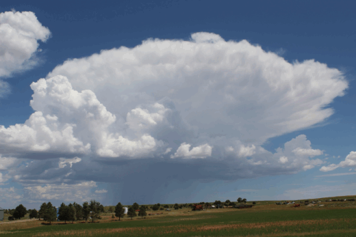
Fire, Water, or Ice? A layer of ice crystal cirrostratus and a few altostratus color the sunset high above 6,000-foot Manzanita Lake in northern California. During autumn, these clouds might announce the season’s first troughs approaching from the north Pacific, storms that could soon quench the annual dry season. In this case, it’s around 9pm at the beginning of summer, and the clouds stream ahead of another weak, dry trough and front that will only decorate the sky for a day.