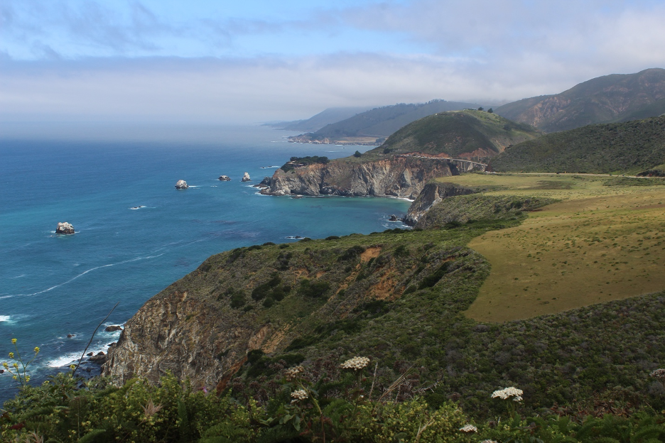
Central California’s mystical Big Sur juts out of the Pacific Ocean in stark contrast to Crystal Cove (our previous story) and other SoCal coastlines and their sun worshipping crowds. Here is where dynamic natural forces and processes have conspired to assemble some of the most spectacular and breathtaking landscapes on Earth. Join us on this natural history and field science excursion to such an enchanted land.
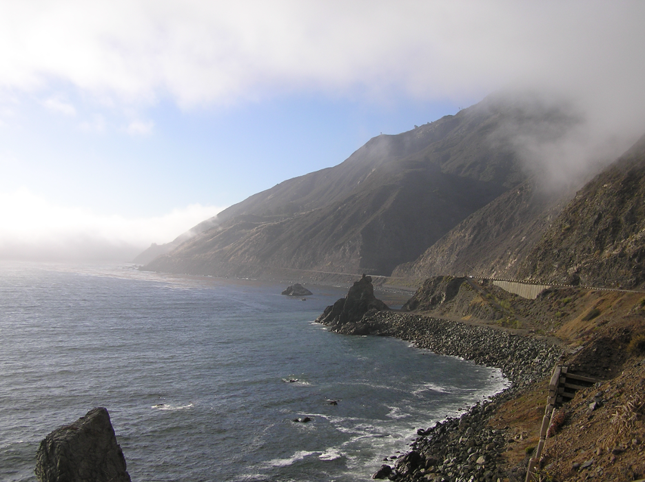
Big Sur’s precipitous escarpments emerge out of the mist as if to convince us that we have entered another world, far beyond the more accessible beaches and paradisical mild climates far to the south. Such dynamic, awe-inspiring natural environments resemble the remote coastlines farther north and into Oregon, where countless visitors find personal rejuvenation and spiritual renewal. An impressive list of superlatives has been exhausted by scientists, authors, artists, and poets attempting to describe the stunning formidable magnificence that seems to loom around each Big Sur bend. And just when we are convinced that this is a perfect opportunity to display dramatic contrasts between two seemingly polar opposite California coastlines in these two adjacent website stories, hidden connections begin to peak out of the brume—the captivating science stories behind the scenes remind us how the natural systems and cycles that dominate these landscapes are so similar.
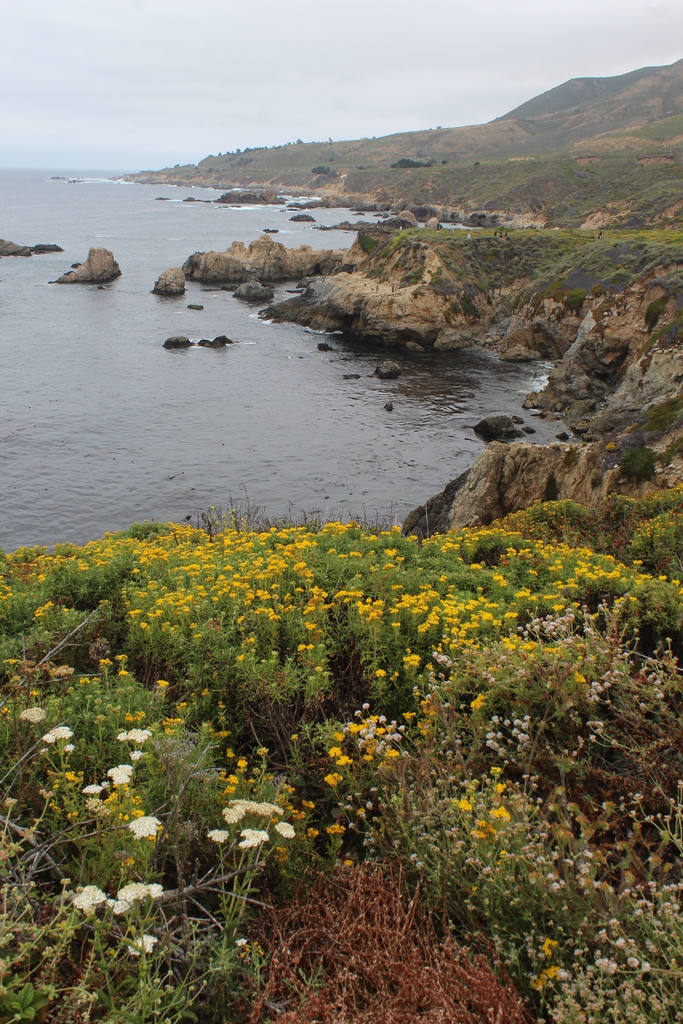
In contrast to our previous story, we will keep the general concept discussions shorter here since most of the basic scientific principles were explored there and in other stories on our website. To get the most out of this colorful field experience, you can shift back and forth, comparing and contrasting Big Sur with our Crystal Cove paradise story, remembering that everything in our state, on our planet, and in our universe is interconnected.
Seemingly Divided, Naturally United
We should start by acknowledging how parts of Big Sur’s natural landscapes (as with Crystal Cove) have been protected within some of our most cherished state parks and other public lands. We can thank countless individuals who volunteered, donated, and struggled over many decades to ensure that these natural treasures were preserved so we and future generations could appreciate and learn from them.
In the spirit of distance and location matter, you will find Big Sur at about 36.3° N, 121.9° W, or nearly 3° N and about 4° W of Crystal Cove. That’s just less than 300 straight-shot miles and roughly 360 driving miles apart (or about a 7-hour drive with light traffic). That distance north and extension west into the cold Pacific helps to expose Big Sur slopes to more frequent incursions of high energy from above, and what some might consider harsher conditions, compared to Crystal Cove. Likewise, dynamic tectonic forces from below are lifting much more lofty and astonishingly rugged landscapes along the Big Sur coast. We quickly appreciate how nature’s powerful forces, dueling from above and below, have created these dramatic other-worldly landscapes and experiences that we call Big Sur. You could spend a lifetime searching through images and stories that are being shared and made available on social media, so let’s focus on a few examples that reveal the natural history behind the stunning scenes.
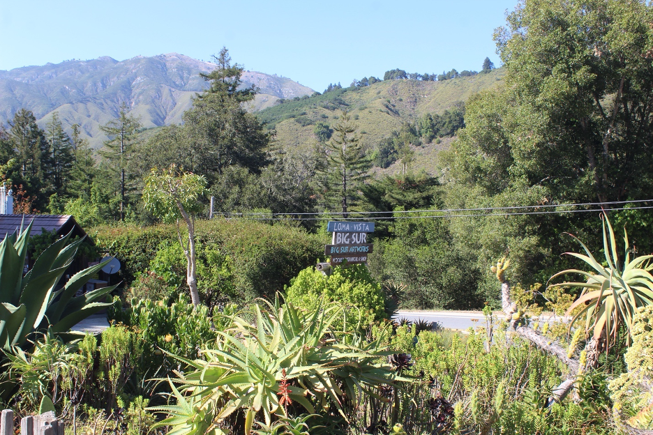
Heavy Lifting: Millions of Years of Earth History
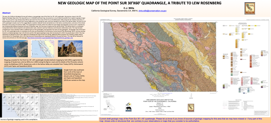
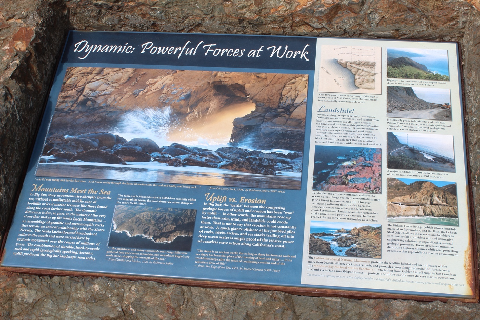
It should not surprise us that the jagged Big Sur coast runs roughly parallel to the San Andreas Fault Zone, which lines up less than 50 miles to the east, where the Pacific Plate is sliding northwest past the North American Plate at about the rate that your fingernails grow. Similar to the region around Crystal Cove, some of this motion between the plates occurs along a series of parallel right-lateral strike-slip faults that slice through rock formations along Big Sur. The infamous roughly 250-mile-long San Gregorio-Hogsri Fault stretches mostly just offshore from the Bay Area, past Big Sur, and to the southeast. This is a very active fault zone, which has produced historic earthquakes more than 6 magnitude and is capable of generating temblors more than 7.0 magnitude. It takes a slight bend along the Big Sur coast for about 65 miles. Vertical displacement and compressional forces along and inland of this Big Sur Bend have been lifting the Santa Lucia Mountains (which also trend northwest-southeast with the faults.)
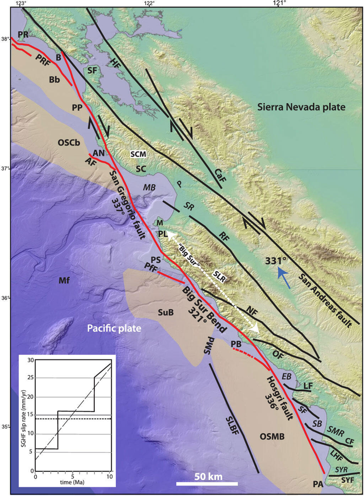
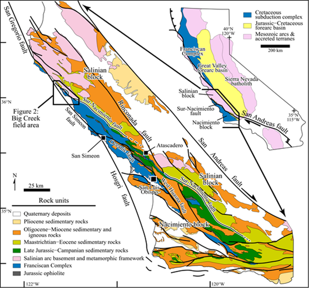
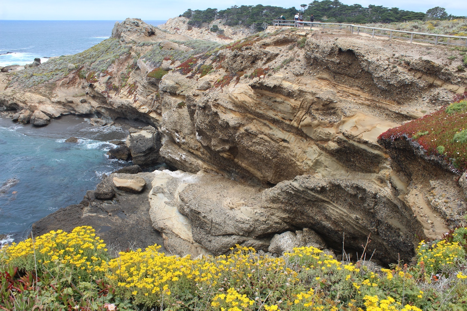
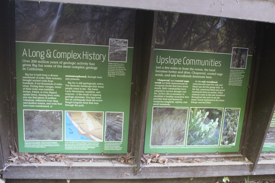
Numerous other active and ancient faults have sliced and diced this region’s hodgepodge of juxtaposed rock formations over millions of years. The ancient Sur-Nacimiento Fault is one of the most mysterious of these structures that have stretched, compressed, and sheared Earth’s crust into a complicated chaotic mess that helps define crustal deformation. As example, it may have taken millions of years, but the Salinian Block’s granitic and metamorphic rock basement has been progressively dragged all the way up here from Mexico and Southern California. On the other side of this steeply-dipping fault, you might notice Franciscan Complex (or Mélange) rocks. They are a jumble of rock formations that formed as the ocean plate once crashed into the continental plate during the Mesozoic Era when subduction ruled in this region. Franciscan Complex rocks were smashed, contorted, and finally squeezed up like toothpaste along this ancient tectonic plate convergence zone and they are now found along parts of the California coast and in our coastal ranges. Colorful varieties of jade and serpentine have been weathered out of these outcrops and deposited in protected coves. Such a potpourri of rock formations remains to form a geologist’s playground (or nightmare) from Big Sur beaches on up and over the slopes of the Santa Lucia Mountains. But let’s return to terrain basics before we become mired in geologic history details.
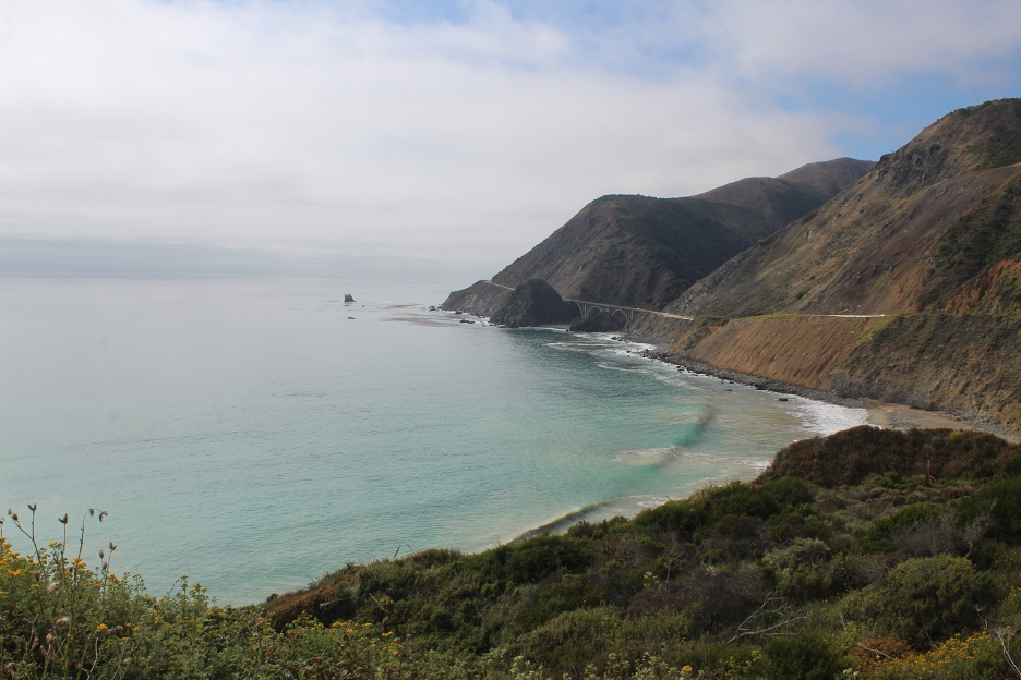
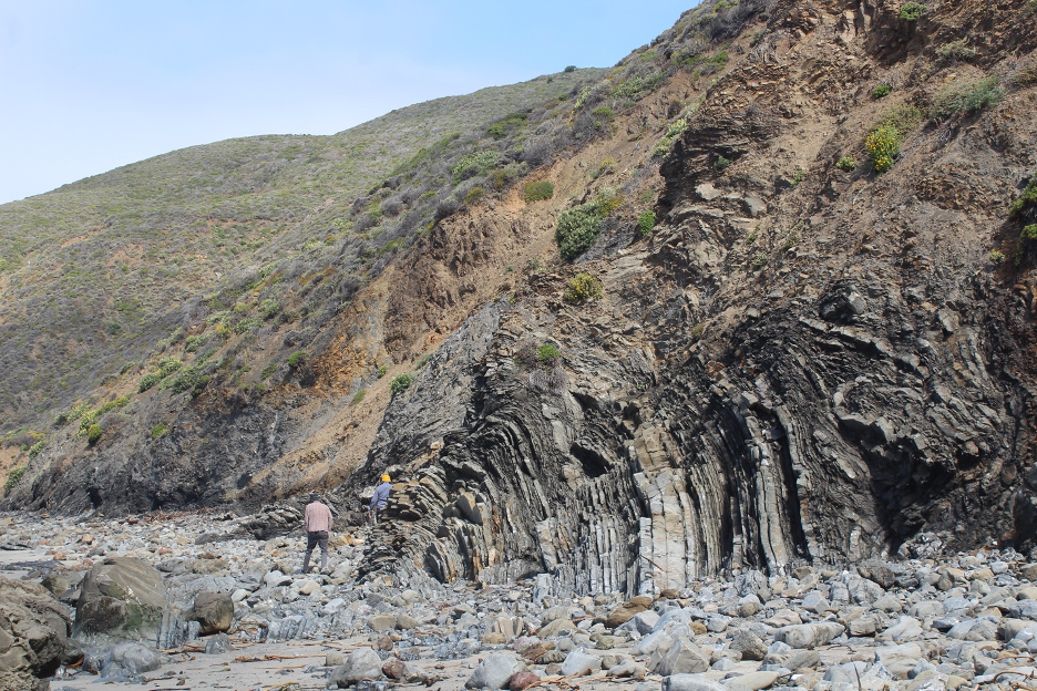
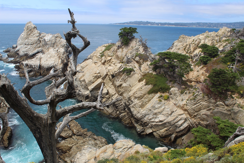
Extraordinarily steep, rugged topography common to very youthful, high-energy landscapes is the rule here. Elevations rise to 4,000 feet just two miles from the beach and the highest Santa Lucia peaks abruptly soar to more than 5,000 feet. These are the steepest coastal gradients in the continental US. Geologists estimate (see my links at the end of this story) that bedrocks are being lifted nearly 1mm/yr in some places and have been elevated nearly 3,000 feet during the last million years. But when we also consider the accelerated erosional rates, mountain elevations may “only” be rising at about ¼ that rate. Regardless, stick around for another million years and it’s likely that the Santa Lucia Mountains will be lifted even higher and this unforgiving coastline will become even more rugged, if that’s possible.
Sliding and Tumbling to the Sea over a Geomorphological Fun Zone
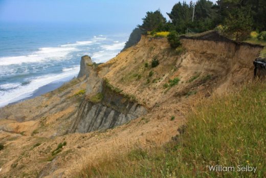
Corroborating what goes up must come down, gravity is always on center stage at Big Sur. Everything and everyone seems to be waiting to fall down. Loose weathered material sits precariously on the steepest of slopes as if to defy gravity one day, only to demonstrate the perfect mass wasting event the next. Where there are gentler slopes and more fertile soils, you might find denser plant communities of forests and woodlands that can provide some stability as they protect and desperately hang on. But few species can adapt and survive in more toxic and unstable soils (such as those with serpentine basements), destined to be ripped downhill before they can get anchored.
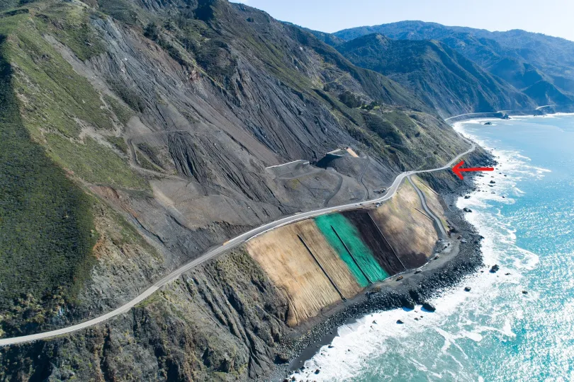
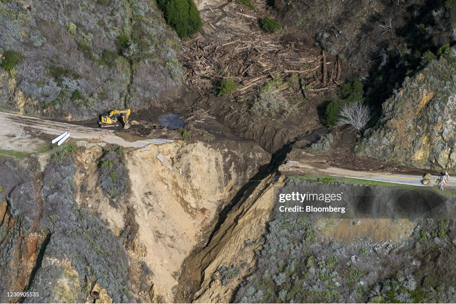
Highway 1, Big Sur’s human vehicle artery, is often the first victim to go down for the count. When it’s not tumbling into the sea, it’s buried under debris trying to get there. The big events that can close access for months usually slide during heavy rain (lubrication) years, but anytime can be landslide time along the Big Sur coast. During my decades of adventures, I’ve maneuvered around countless errant rocks and crept along narrow one-lane roads controlled by one-way traffic signals. During other years, I’ve had to postpone my visits, waiting until Caltrans spent millions more dollars to scrape up the latest slide barriers, fortify threatening cliff faces, and repave the road. For several decades, every big slide has fueled the latest controversial debate about how much it’s all worth and which slides might be so massive and devastating to render Big Sur nearly inaccessible for good. (As I write this, officials have just reponed Hwy. 1 after a two-day November, 2026 closure and the evacuation of those who needed to leave in a hurry. You can blame atmospheric river rains on top of large scars left by two wildfires that were burning just weeks earlier.) And just to prove that humans can emulate nature among such steepness, multiple drivers and passengers plunge over the edge to their terrifying (and occasionally planned) deaths each year. Still, most locals hope that Big Sur Coast Highway will remain open to welcome its next carsick victims while threats of irreversible devastation will at least wait for the next rainy season.
Liquid Artisans
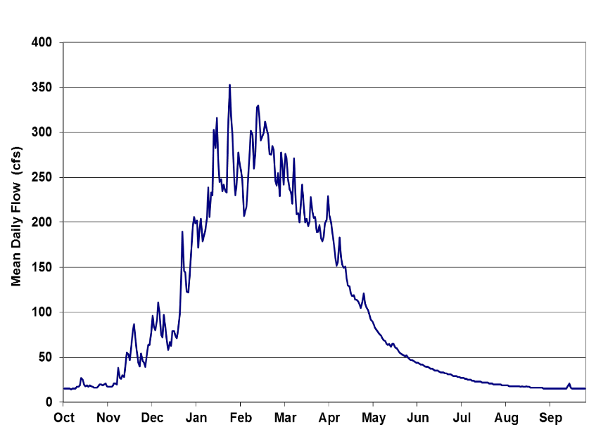
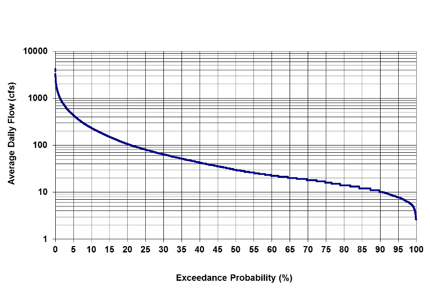
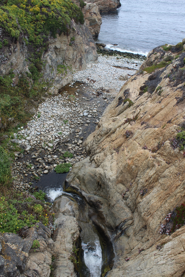
Where dramatic slides are less frequent, running water rules (as in most California landscapes) as the dominant external attack agent and sculptor. Glaring differences with Crystal Cove hydrology (recalling our previous story) are related to greater scales and energies and far more winter rainfall (our next subject in this story). During and after rain events, powerful rivers and streams race out of the Santa Lucia Mountains down to the Big Sur coast along steep gradients, out of headwaters that eventually extend up toward 5,000 feet above sea level.
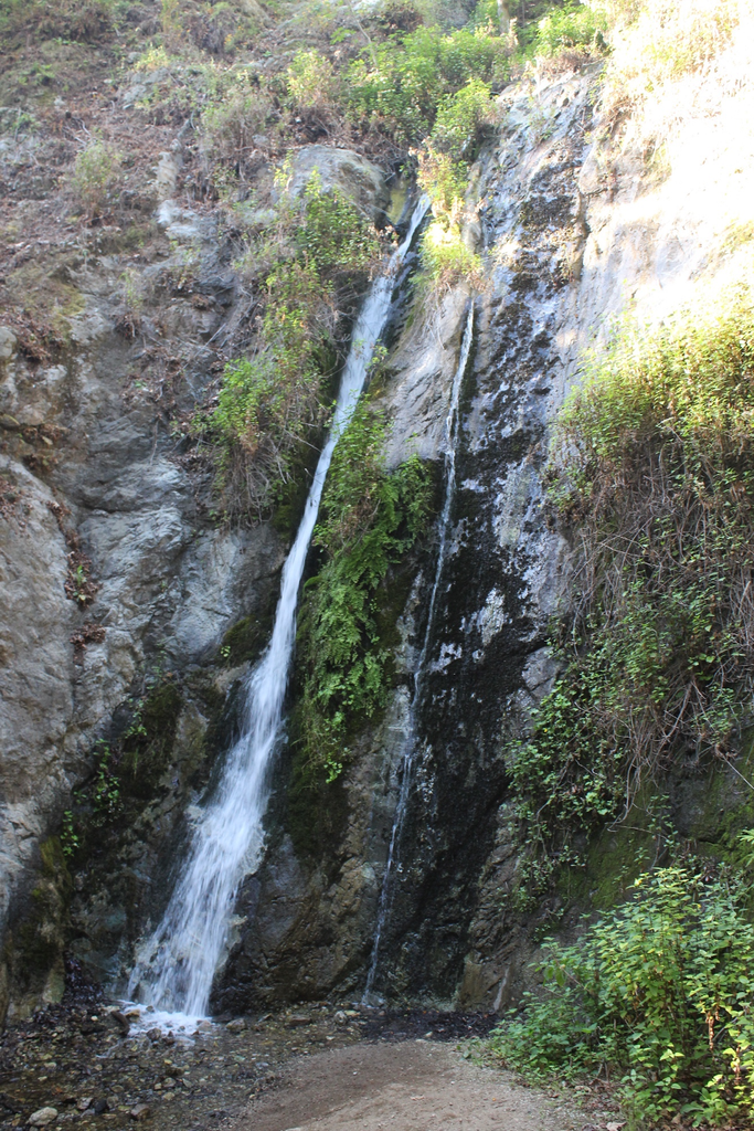
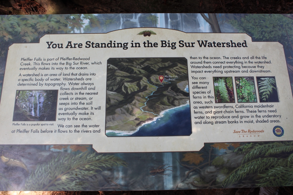
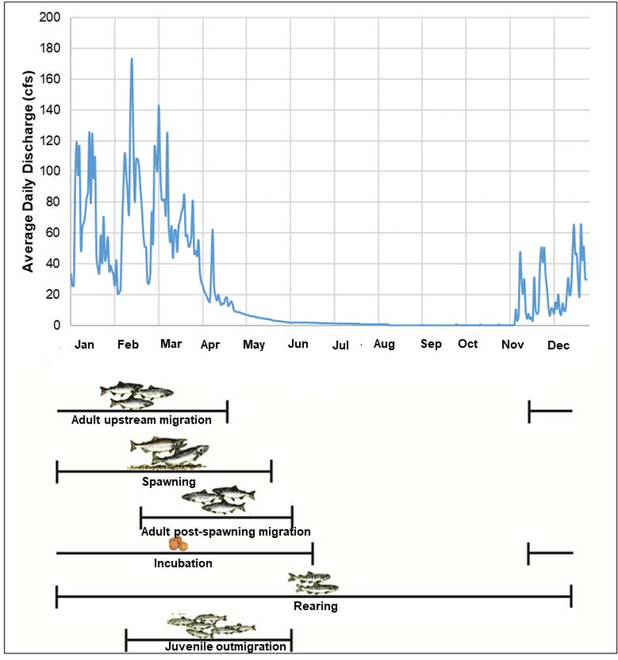
The largest of these is the wild and scenic Big Sur River that stretches nearly 16 miles inland. It and its numerous tributaries drain a watershed of about 60 square miles. It flows out of the Ventana Wilderness, through Pfeiffer Big Sur State Park, finally spilling into the sea at Andrew Molera State Park. Just to the north, the wild and pristine Little Sur River and drainage basin is just a bit smaller. During the rainy season, tributaries coalesce to send cascading torrents that carve even deeper through their V-shaped canyons. The flows gradually dwindle during summer drought to become tranquil picturesque babbling brooks, nurturing rich riparian plant communities that include coast redwoods. They even support rare populations of South-Central California Coast steelhead trout. Smaller streams and their drainage basins often dry up during the summer, leaving precious water to percolate below the surface of canyon bottoms and contribute to groundwater tables.
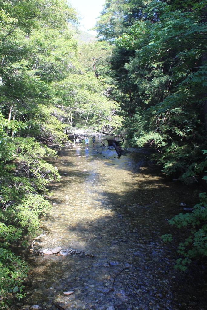
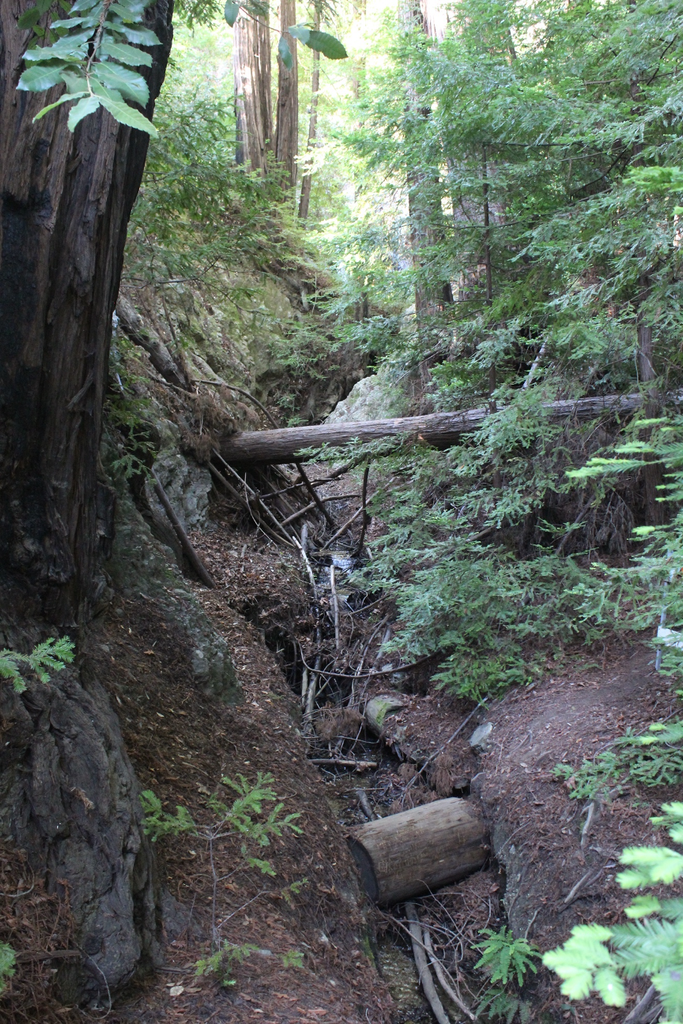
As at Crystal Cove, wildfires throughout Los Padres National Forest and the Ventana Wilderness above Big Sur strip off protective vegetation covers and leave soils vulnerable to accelerated erosion. And thanks to mild temperatures, heavy winter rains, and summer fog and drought, there is plenty of biomass to incinerate, leaving dramatic changes within ecosystems burned to the ground. Stream channels and riparian environments that were lush shady sponges suddenly morph into exposed flash flood environments. Peak discharges can promptly spike during and immediately following downpours and then quickly drop to insignificant dribbles. Sediment yields from scorched watersheds and sediment loads in impacted streams may multiply by hundreds of times during and immediately after rain events that follow wildfires. Nature weathers, erodes, carves, transports, and deposits with unbridled fury until plants gradually grow back to recast their protective coatings that will wait until the next burnoff. We can sense and scientists can measure how succession and fire cycles play key roles in shaping these landscapes, punctuating dramatic and traumatic changes into otherwise gradually evolving terrains.
Lesser Geomorphological Change Agents
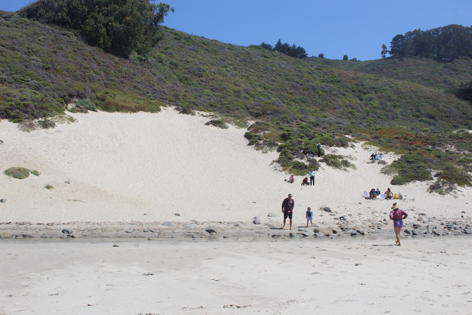
Wind has been a very local external agent along the Big Sur coast, shaping limited coastal dunes wherever the sand isn’t anchored by vegetation. Most beach sand crumbled off coastal cliffs or was transported and coughed out on to beaches by rivers and streams. It was then transported along the shore by waves as beach drift; such rivers of sand in the surf were eventually trapped in quieter coves and blown upslope above the highest tides. Look for ripples and dunes of sand that are gentle on the windward sides and steeper on their leeward faces.
High Energy Coastal Processes
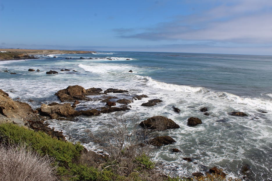
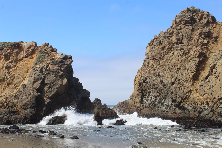
Littoral processes shaping this ragged coastline are similar to those summarized in our previous Crystal Cove story (and other stories on this website), with some big differences. Big Sur’s waves are often pounding onto much more massive, steep, solid bedrocks that seem to jut out into the sea at every hairpin turn. The rocky points and promontories represent extremely high-energy erosional environments. As waves refract and wrap around, such terrestrial protrusions become high-energy focus and attack zones. As mentioned earlier, the crumbing cliffs add more debris to the swash and backwash so that waves have plenty to work with. As the waves later refract and spread out into embayments and lose some of their power, the material that is not lost into submarine canyons may eventually be deposited on the beaches by gentler waves and then stranded in sandy coves.
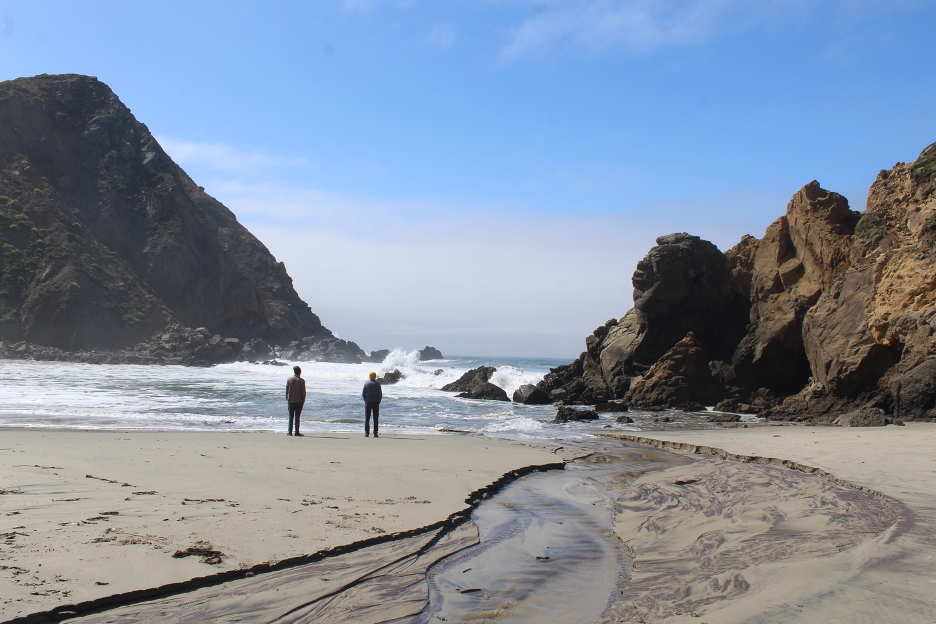
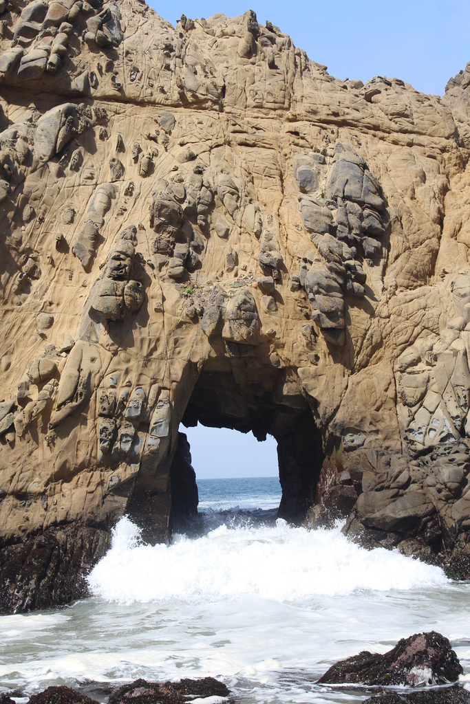
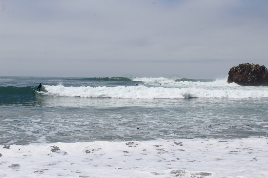
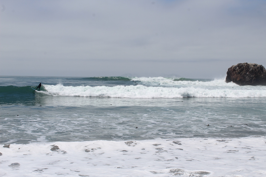
Compared to many California coastlines, you will find a larger proportion of course Big Sur beach sand, gravel, and cobbles that has been eroded off of local cliffs. You will also notice larger and more powerful waves throughout much of the year, but especially in winter and spring, when compared to Southern California. Contrary to SoCal, Big Sur is often closer to the Aleutian Low, polar jet stream, and massive middle latitude cyclones that churn up the North Pacific Ocean, particularly during the winter rainy season. Whether they peak as storms surge ashore or finally arrive from storms thousands of miles distant, relentless winter waves can top 30 feet. Big Sur’s largest swells usually refract in from the west and northwest; summer’s southern swells that impact the southern California Bight can propagate this far, but are usually not as common or powerful here.
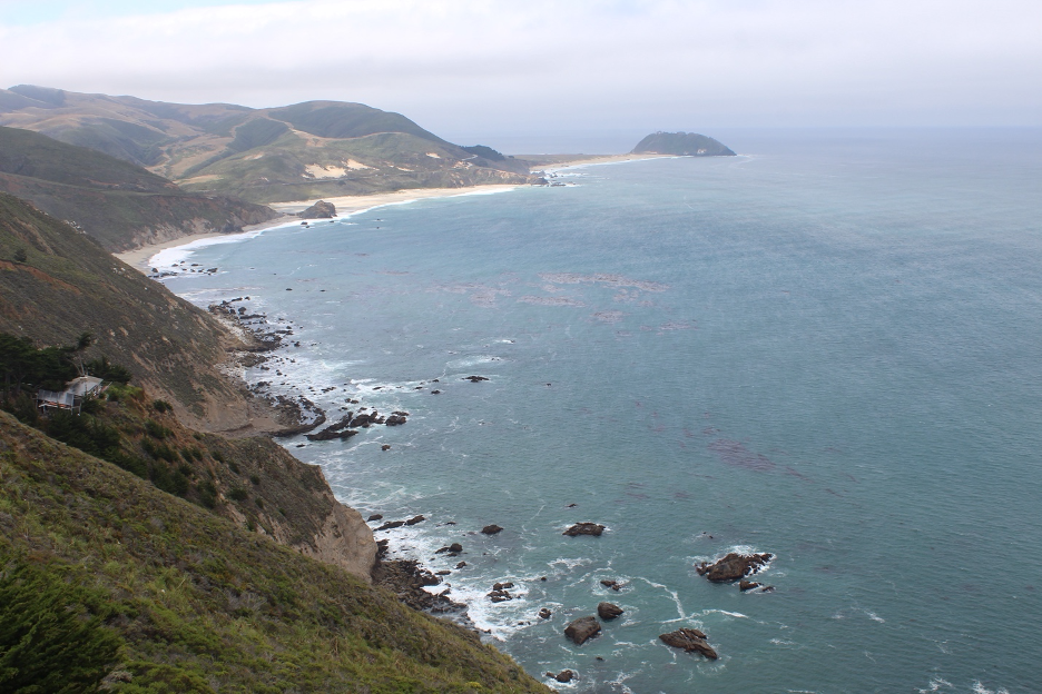
You might have noticed how this discussion has gradually turned toward the sky, our weather patterns, and changing climates. So, let’s fly there.
Drifting Fog and Blustery Rainstorms
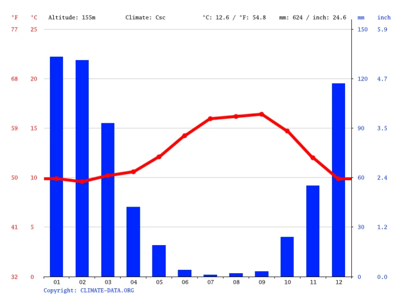
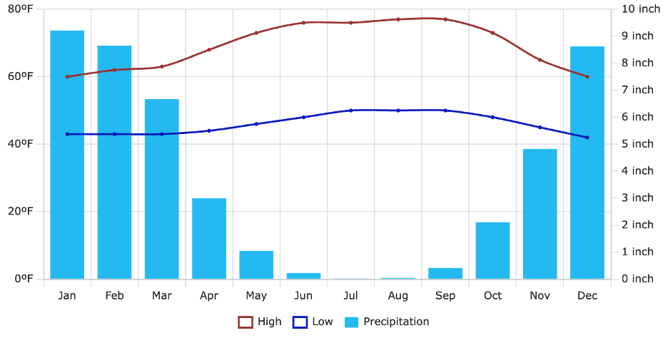
You quickly sense how we left the warmer SoCal Crystal Cove beach paradise climates (our last website story) far behind so that we could experience this different kind of paradise. Summer’s incessant fog, winter’s cool rains, and occasional blustery winds create damp, moody atmospheres that are cherished by Big Sur locals and have been celebrated in literature, art, and film. Some climatologists might argue that both locations are classified as Mediterranean climates with warm summers (Csb), but we also acknowledge how Crystal Cove leans toward much drier and hotter while parts of the Big Sur coast begin to resemble Csc (with cool summers). Either way, the atmosphere is often to blame when Big Sur casts its spell on the latest sojourners or escapees and rebels who dare try to settle there.
Cool and Cooler
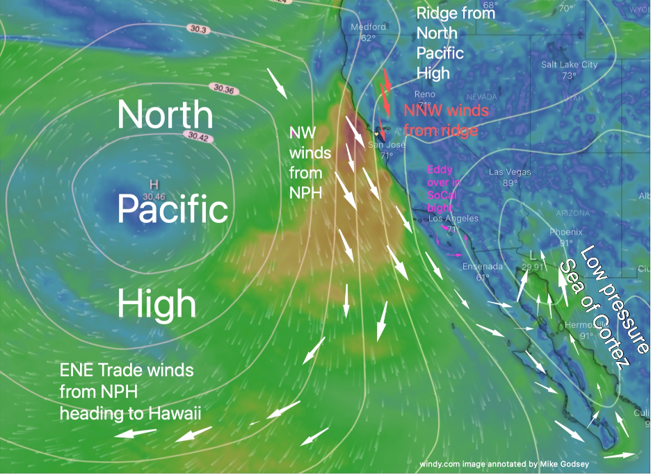
One reason for such ambiance is that average ocean water temperatures along this Central Coast remain in the 50s throughout most of the year, peaking at only about 59° F during the warmest month (September). As prevailing northwest winds push the cold California Current farther south, local upwelling delivers even colder (dipping into the 40s F), nutrient-rich water to the surface. If you survive the initial enveloping shock of cold surf, you will need a good wetsuit should you stay in for more than a few minutes. Local marine mammals have adapted with their natural wetsuits of fat layers and/or thick fur. As example, sea otters are famous for growing up to one million hairs/square inch, often advertised as the densest fur in the animal kingdom, and they eat about ¼ of their body weight in food each day. You will find more of them in Alaska, but they are just as much at home here in what might feel like Alaskan waters.
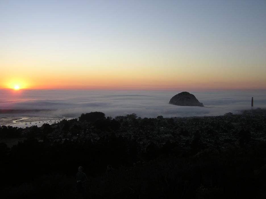
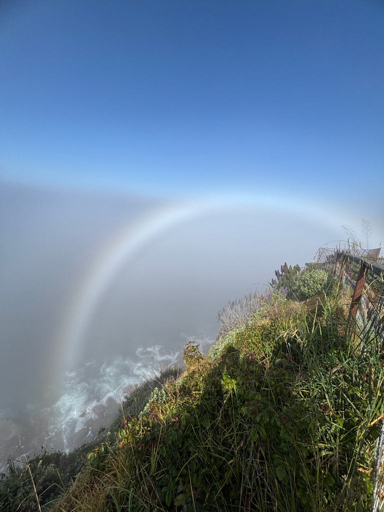
When ocean breezes pass over these cold coastal currents (particularly in spring and summer), the air frequently cools to its dewpoint. And so, the fog and low clouds are far more common here than in SoCal. The cool misty wisps of fog hang, loom, and drift around each bend like haunting ghosts searching for homes, casting their eerie spells for some and creating calming introspective atmospheres for others. Now you know why the average high air temperature for the warmest month (also September) is only 69° along Big Sur beaches. All of this cool marine layer mist sneaks in below the inversion that is most common during summer. We’ve explored these weather patterns in previous website stories (and in my California Sky Watcher book).
Finding the Heat
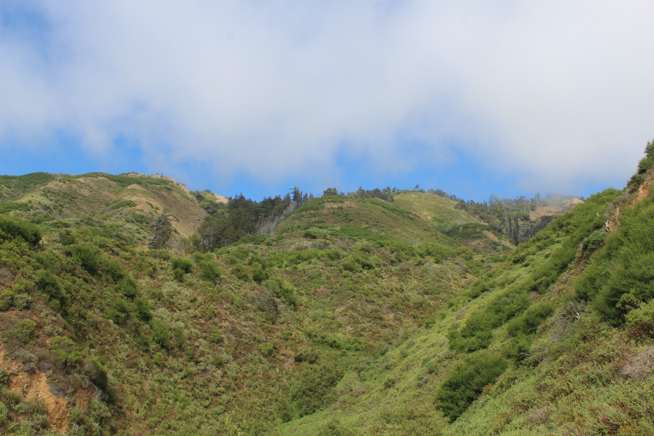
But then go inland and observe how the Santa Lucia Mountains often poke up above it all. When the inversions and cool marine layers near the beaches are shallow, summer temperatures in the dry air surrounding the slopes above often soar over 90° F. Severe water pressure deficits and low relative humidities cook and dehydrate Santa Lucia Mountain plant communities. Ecosystems looking down on the marine layer are quickly primed for the fire season that peaks in late summer and fall, before the first rains of the season. When the marine layer is more dominant and thicker, low clouds may jam up against the same slopes at more than 2,000-3,000 feet elevation, offering welcome moist relief and fog drip to plant communities during drought months. Regardless, travel east and over the rock barriers and into the inland (opposite) side of the mountains (toward the upper Salinas Valley) to find searing summer heat that would suggest you were hundreds of miles from Big Sur.
An interesting and briefly impactful weather pattern, which is similar to Santa Ana winds to the south and Diablo winds to the north, erupts during fall and winter. As high pressure builds inland, winds will reverse and blow TOWARD the coast. Here, such dry offshore gusts are known as Santa Lucia winds. As they cascade down the Santa Lucias to lower elevations, they are heated by compression, causing this usually cool and moist coastline to briefly resemble a warm, dry desert. The good news? Warm, crystal-clear days shine bright before the approaching blustery winter weather. The bad news? If the rainy season hasn’t started, wildfires can explode and are free to spread on the slopes. All of this must seem familiar if you’ve explored some of our other coastal California stories.
Unsettled Winter Wetness
Our final attempt to compare and contrast weather patterns with Crystal Cove brings us into the winter rainy season. As with SoCal, as the dominant North Pacific High Pressure weakens and shifts south, the storm door from the north begins to open. Because Big Sur is farther north and closer to the migrating polar jet stream and storm tracks out of the North Pacific, winter season rains typically start earlier, end later, and deliver much more water. Here we have another piece of the puzzle demonstrating why this is a cooler and wetter Mediterranean climate compared to the warmer and drier Southern California Bight. The first rogue middle latitude cyclones might sneak in during October, followed by a series of more frequent and wetter storms that usually peak in January and February. During average years, the rains will taper off during April and May, making way for summer’s drought and fog, all which help to define these Mediterranean climates.
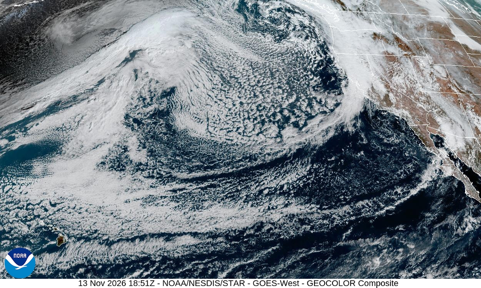
These winter tempests deliver an average of more than 16 inches of rain/year to the immediate coast. But rainfall totals increase dramatically each mile inland and upslope, as orographic effects lift winter’s turbulent air masses faster when they race off the Pacific. For instance, Big Sur Station, just a couple of miles inland, averages about 45 inches of rain/yr. Well over 50 inches of rain is common on higher windward slopes (facing the ocean) until nearly 90 inches might accumulate near the top of the Santa Lucias. And when a series of atmospheric rivers (another one of our website stories) aim at this coastline, mountain slopes above Big Sur can receive more than 10 inches of rain during one major storm and well over 100 inches of rain in one season. By contrast, the hills directly behind SoCal’s Crystal Cove aren’t tall or massive enough to encourage such dramatic orographic lifting, even after mostly weakened winter storms make it that far south.
Big Changes in the Air
time in and around Big Sur, changes we have examined on this website and in my book. While most of California continues to warm, there are indications that Big Sur’s immediate coastal strip has experienced slight cooling. This is likely a result of hotter inland valley temperatures (and more extreme thermal gradients) that encourage predominant thermal lows (and greater pressure gradients) to pull in more consistent and stronger cooling sea breezes off the ocean. Though these trends have softened warming along the immediate coast, most mountain slopes and valleys farther inland are warming. Such a wide diversity of microclimates is in constant flux, forcing local plant communities and entire ecosystems to adapt or perish. This sets the stage for our discussion of the mesmerizing diversity of plants and animals that call Big Sur home.
Biological Diversity Hotspot within a Hotspot
If you thought the relatively subtle variations in biogeography at Crystal Cove were interesting, you will be blown away by the stunning biodiversity around Big Sur.
zoologists are among the natural scientists who have been captivated and never disappointed. Like its landscapes and microclimates, diversity rules, challenging any interpreter to wonder where to begin. Native plant enthusiasts (as example, check out the California Native Plant Society), universities, government agencies (including the US Forest Service and local state parks), and scientific journals have produced scores of informative studies and publications highlighting Big Sur. This story ends with a brief list of those sources. So, we start by painting with a broad brush, knowing that multiple research projects have honed in on the smallest of plant and tiniest of animal details.
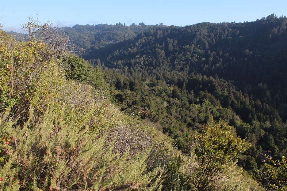
The California Native Plant Society summed it up in their In the Field blog in 2024: “The Central coast is a hotspot of biological diversity within a state that belongs to one of the world’s 36 biodiversity hotspots. This dynamic creates a host of microhabitats, which weave a unique floral tapestry of plants, both common and rare, unlike anywhere else in California.” As example, there are some prickly pear cactus (more common to Southern California) growing on exposed slopes above Big Sur and coast redwood trees (more common to the northern California coast) towering within protected canyons and north-facing slopes.
Let’s survey the more common plant communities within this hotspot of the California Floristic Province.
A Mélange of Plant Communities
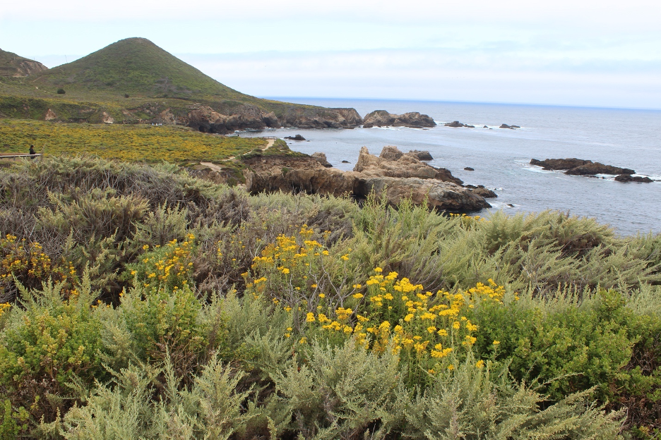
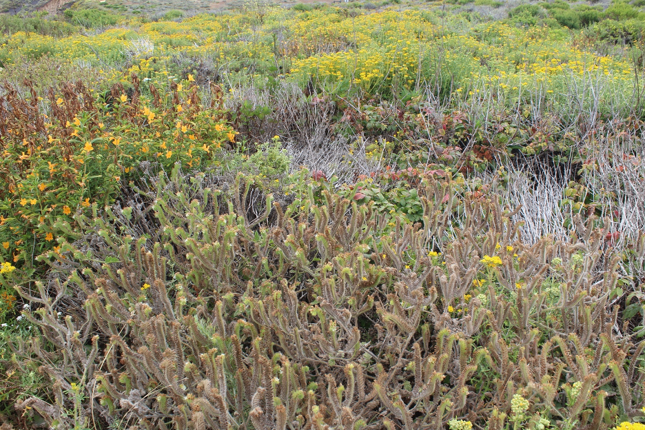
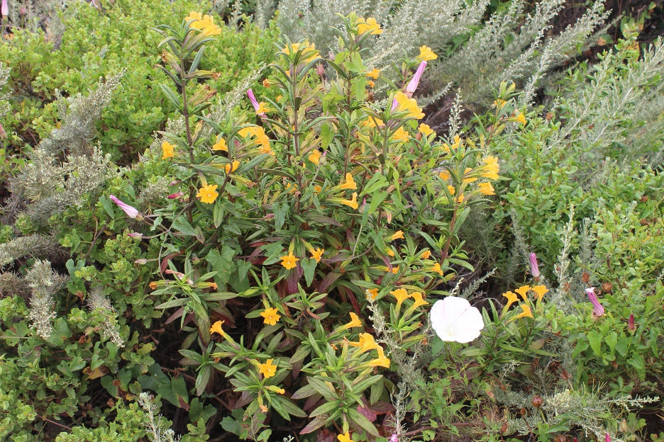
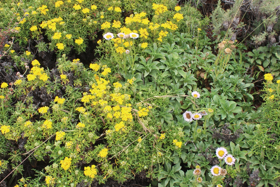
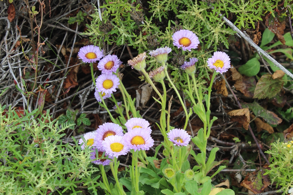
Similar to Crystal Cove, coastal sage thrives from the ocean up along coastal terraces and slopes; but it spreads a relatively greener and lusher (compared to SoCal) low scrubby canopy across these windswept terrains. In most locations, you can scan across this plant community, often with ocean views as backdrop. Though you might find wildflowers any time of year, such “soft chaparral” erupts with colors in spring and into summer, thanks to lupines, poppies, and a host of other annuals and shrubs.
Farther up the slopes, where winter rains are heavier but summer fog is less reliable, chaparral plant communities have evolved on more xeric, exposed slopes. Again, there are similarities to SoCal as leathery sclerophyll leaves minimize water loss during warm, sunny summer days and long periods of drought. Whether you call it Mediterranean scrub or elfin forest, the growth here is relatively denser, taller, and greener compared to points south. Look for tangled shrubs that can grow to resemble small trees, such as manzanita and ceanothus.
You might find patches of grasslands on poor and/or clay soils. Look for open spaces that were once part of rolling prairielands supporting native bunchgrasses but have been invaded by today’s nonnative grasses that dehydrate and die into summer’s gray and golden browns. The first winter-season rains will encourage fresh green sprouts that progress to eruptions of colorful wildflowers lasting into early summer.
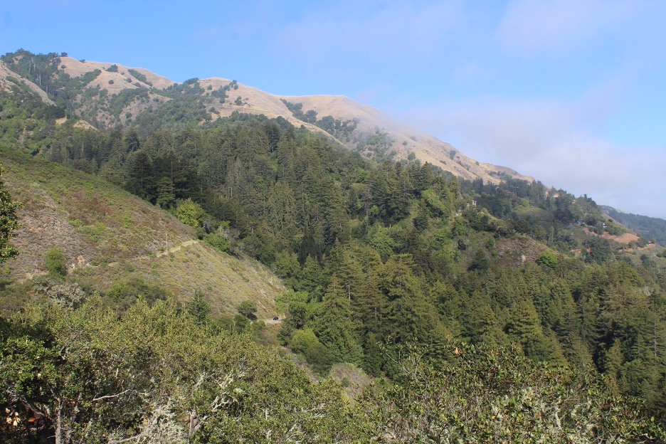
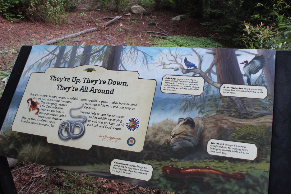
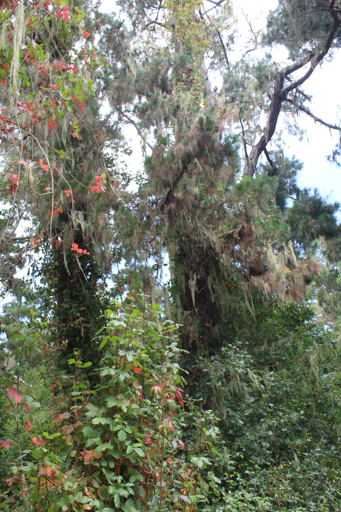
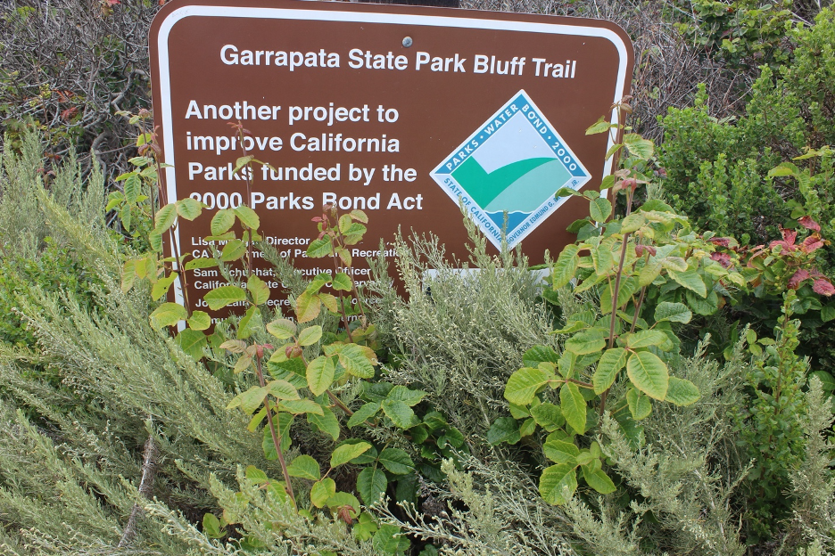
When oak trees scatter into the mix, these landscapes resemble savannas, framing the iconic bucolic landscapes that are frequently associated with Central California’s coast ranges. On cooler and wetter slopes, they become oak woodlands that grow lusher and denser, such as on north-facing slopes. Coast live oak may give way to more drought-tolerant canyon live oak on drier slopes. Rub the sclerophyll leaves typically found in Mediterranean climates. But, as is true in Crystal Cove and throughout coastal California, beware of attractive poison oak, which also spreads into the shadier canyon bottoms. Its leaves of three often dry into bright colors such as yellow and red during summer droughts. It might first resemble wild berries, but poison oak has smooth stems without the thorns. Numerous animals, large and small, immune to its toxic oil, eat poison oak; more than 50 bird species eat its berries.
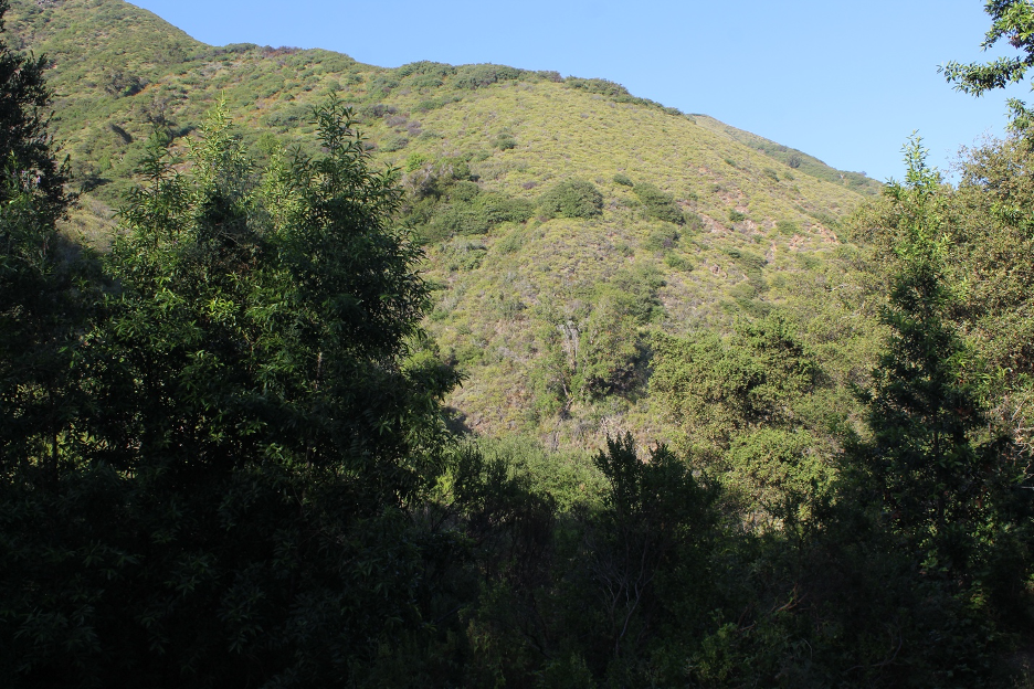
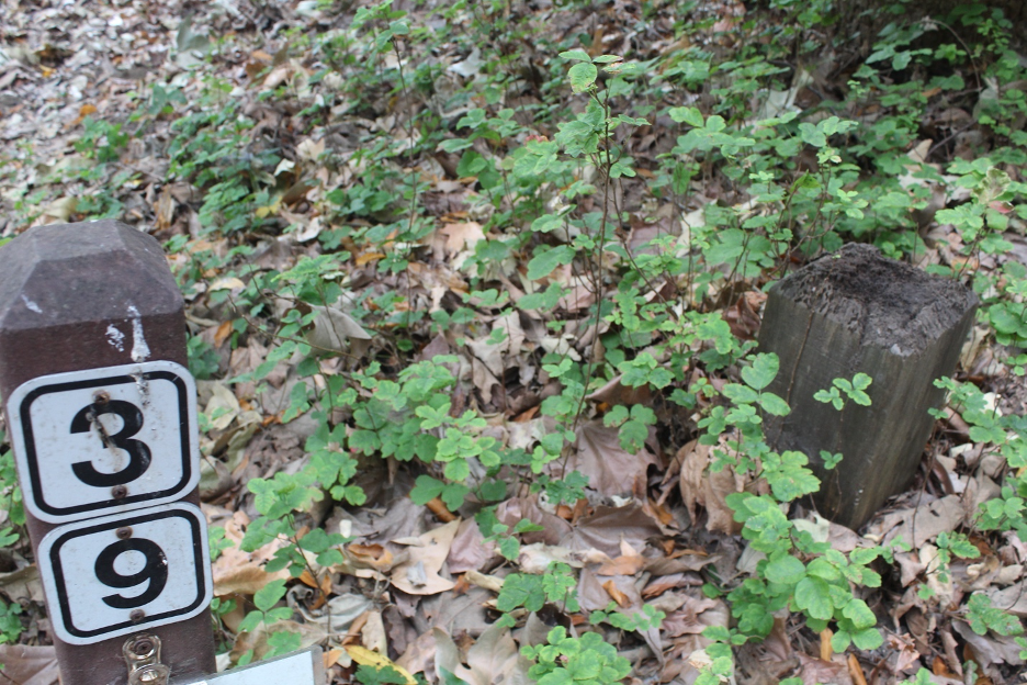
Trending toward shadier and wetter are the mixed evergreen forests, hosting the most diverse assemblage of tree species in the region. Several species of oaks grow with California bay and Pacific madrone. Dissimilar trees such as bigleaf maple and Coulter pine (hosting the largest pine cones in the world) might join the party within microclimates on the slopes of the Santa Lucia Mountains. Add a dizzying array of rich understory species and you have a botanist’s paradise.
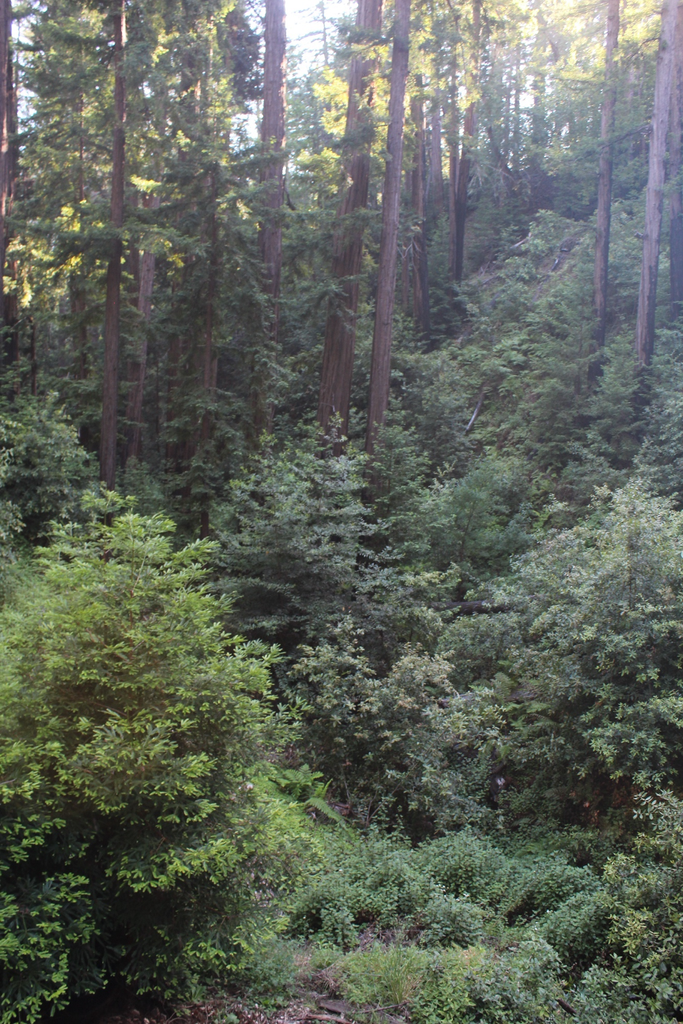
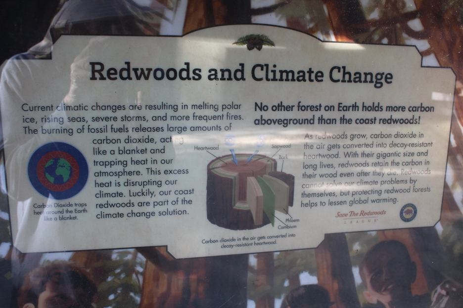
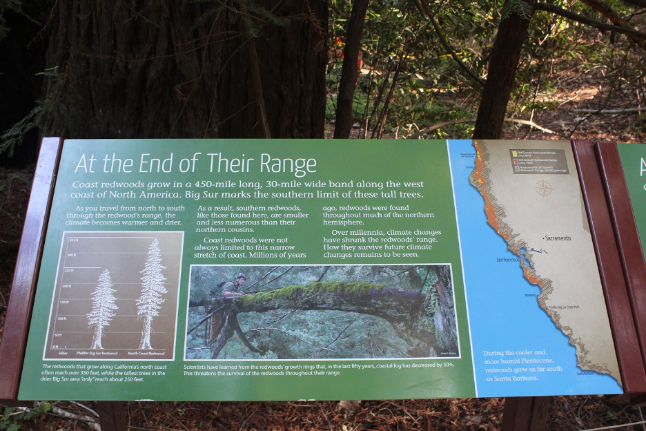
On the dampest, coolest, and shadiest lower north-facing slopes and deepest canyons, we find the southernmost natural range of majestic coast redwoods. These darker forests may also be populated with statuesque bigleaf maple, alder, and sycamore and an understory of fern and other shade- and water-loving species. Such tall forests become seductive cathedrals harboring noticeably cooler temperatures and higher humidities under protective shade, even on the warmest summer days. But remember the mantra, Where the fog goes, the redwoods grow, repeated in other stories on our website, because you won’t find them father inland or on exposed slopes. The coastal fog we discussed earlier drips up to 1/3 of all the water into soils of these forests and much of it is delivered during long summer droughts that would otherwise kill these ancient treasures. Farther north, they grow to become the tallest trees on Earth. Farther south, it’s just too dry. Coast redwoods often mix with evergreen forests to remind us that this is not southern California. You can learn more about these giants and the groves just to the north in our earlier website story, Fire in the Redwoods.
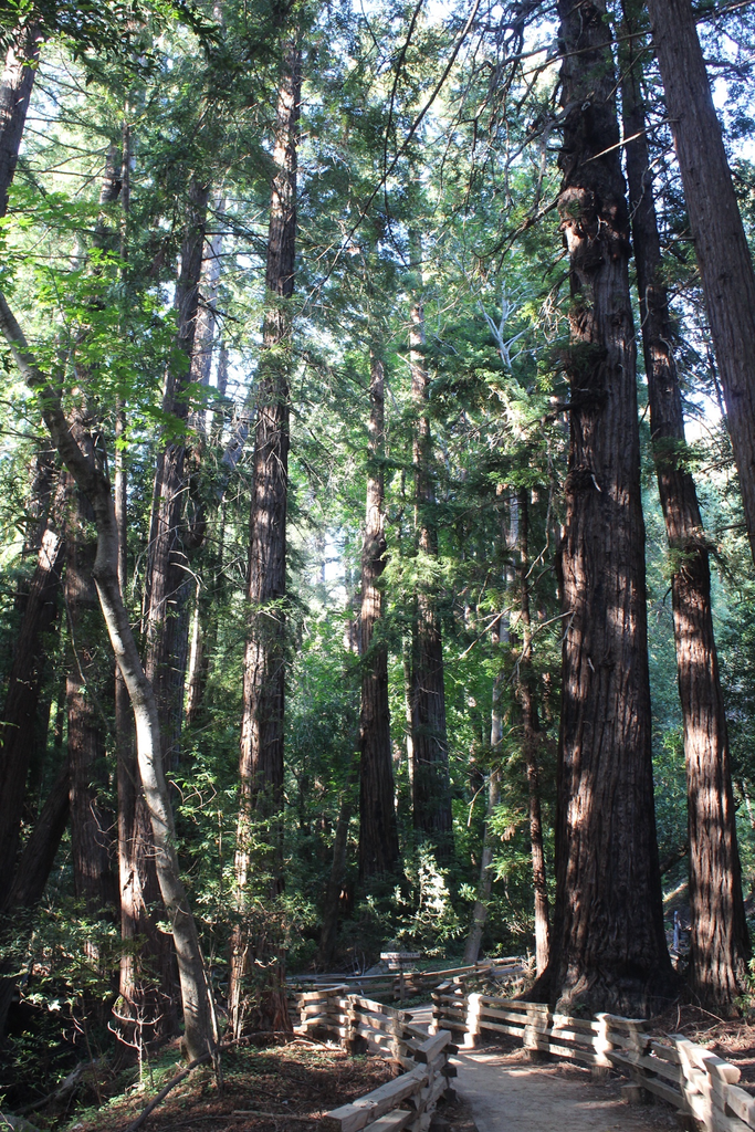
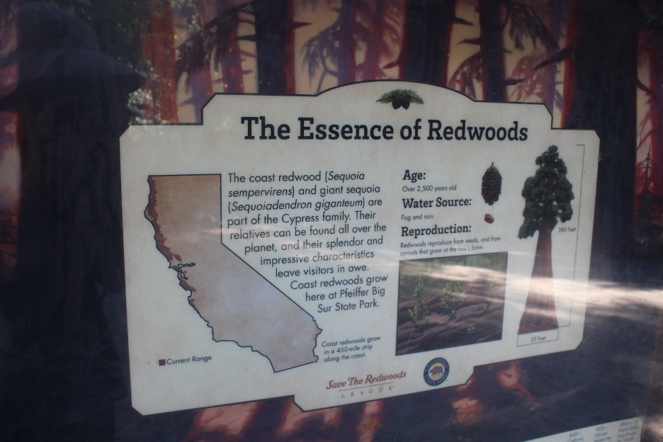
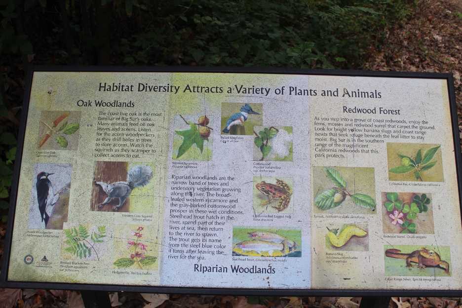
Now that we have ventured into the lushest plant communities with the greatest terrestrial biomass, note how these same trees and their associated species grow in ribbons along water courses. Strips of riparian communities, where plant roots have access to surface or groundwater, remain as shady and luxuriant shelters throughout the year, where plants and animals can thrive with fewer limiting stresses and environmental constraints.
Rare endemic and relict conifer forests and woodlands that grow on more remote and exposed slopes of the Santa Lucias have attracted researchers from around the world. These unique plant communities have earned complicated labels such as the Santa Lucia mixed conifer woodland and the Santa Lucia fir-pine-oak woodland-rock land. Conifers that include Coulter, ponderosa, and sugar pines might mix with oak species and slow-growing tanoak (which is not a true oak, but is in the beech family). According to the California Native Plant Society, “The Bristlecone Fir or Santa Lucia Fir (Abies bracteata) is a rare fir, confined to slopes and the bottoms of rocky canyons in the Santa Lucia Mountains on the central coast of California, USA. It is a tree 20-35 meter tall, with a slender, spire-like form…”
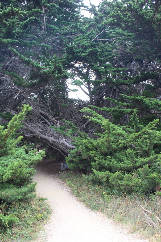
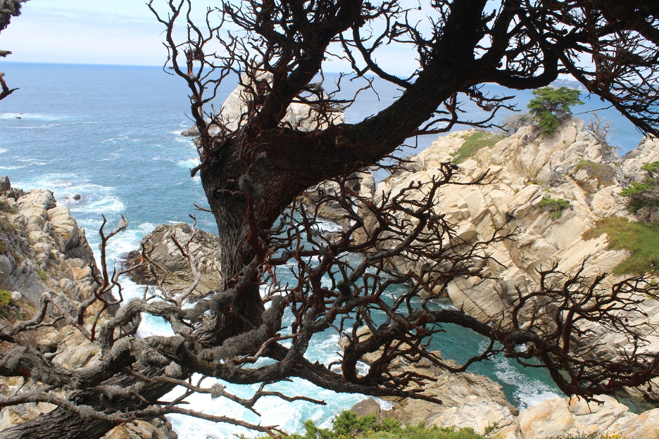
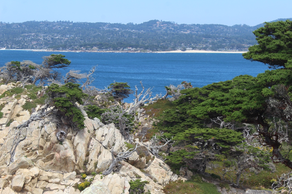
Monterey Cypress (Hesperocyparis macrocarpa) has become emblematic of this coast but its story is complicated. You can’t miss these handsome trees, often sculpted by wind and featured in countless images of Big Sur and the Monterey Peninsula. Surprisingly, there are only two small protected populations of native Monterey cypress in the wild within the region. But they have been planted as ornamentals all along this coast (particularly along the Big Sur Coast Highway) and they now stand out, some growing to over 80 feet tall. From The California Native Plant Society, “…one of the few native plants that the California Invasive Plant Council has determined is invasive in regions outside its natural range. It has invaded coastal prairie, desert scrub, and riparian areas.”
Uninvited Guests
It often surprises visitors to learn that those picturesque, innocent-looking stalks of what some call pampas grass have earned scorn as insidious invaders as they crowd out natives on steep, unstable slopes and other disturbed sites now stretching far beyond Hwy 1. Also known as Jubata Grass, they spread fast and are extremely difficult to control once established. This Cortaderia jubata is now recognized as a high-impact invasive non-native by the California Native Plant Society and the California Invasive Plant Council. French broom (Genista monspessulana) is another attractive but aggressive invader that competes with natives for water and nutrients. You will see these troublemakers doing damage across the state, often along roads, but particularly along the Big Sur coast. One plant can drop thousands of seeds that can hide out for many years. Thickets of French broom burn hot and serve as “ladder fuels” during wildfires. The Big Sur Land Trust and Keep Big Sur Wild work with our state parks and other scientists and organizations to clear such menacing threats out of our plant communities. You can volunteer to help with this sometimes-painstaking work at various popular events around Big Sur.
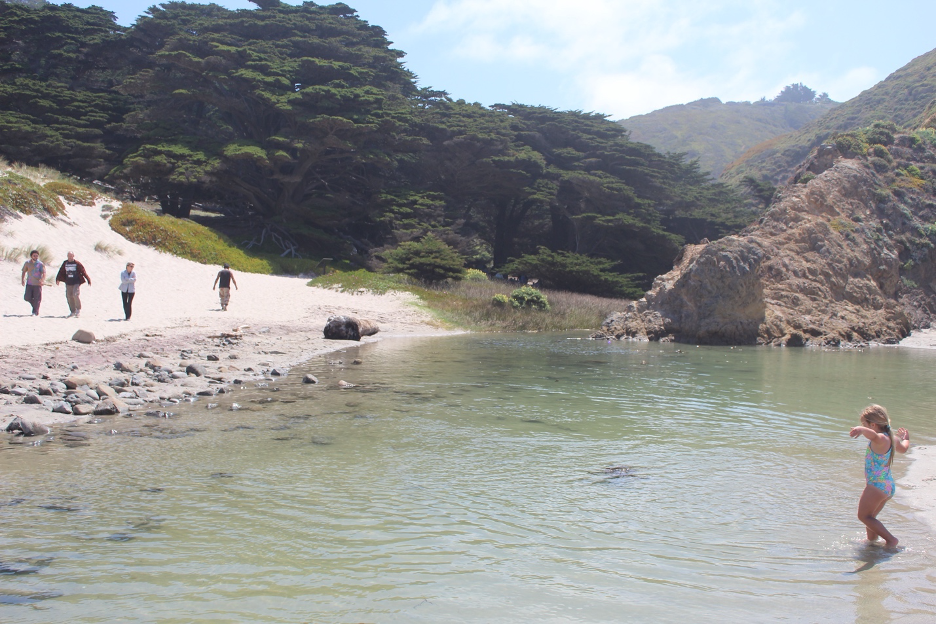
The famous calla lilies that bloom each year in Calla Lily Valley at Garrapata State Park have attracted guides and visitors from around the world who are willing to make the short hike. Many are surprised to learn that calla lilies aren’t even classified as lilies. After being introduced here, they spread during the 1900s as nonnative invaders. But they are aggressive as they crowd out native vegetation along this isolated riparian environment and they often draw crowds more interested in their perfect selfies. You can smell the controversy. In early March, 2026, a large number were cut, likely by one or more of their more adamant critics. (Such behavior is illegal in our state parks, by the way.)
And those are just a few examples of colorful attractive backdrop flowers in your selfies that could actually be noxious weeds hogging the scenes among such picturesque landscapes.
Wildfire Rules
The Big Sur region has experienced several large wildfires during this century alone. They include the massive 2008 Basin Complex Fire (more than 160,000 acres), the destructive Soberanes Fire of 2016, and the Dolan and River Fires of 2020. Those 2020 fires were part of the larger catastrophic CZU Lightning Complex fires that burned from August into fall. I examined the impacts of these fires in an earlier website story, Fire in the Redwoods. More recently, the Timber Fire started on August 9, 2026 and, though nearly contained, was still creeping and smoldering through mostly dry grass hillsides just northeast of Big Sur Village into mid-November, after roasting over 25,000 acres and costing more than $185 million to contain. The Plaskett Fire started farther south of Big Sur Village in late August, 2026 and eventually burned more than 30,000 acres.
As those 2026 late-summer fires expanded, beloved tourist destinations, local haunts, and state parks were evacuated and tourists were advised to stay out of the region for days. It was a close call. As fire threatened, KQED quoted Meredith Gafill, of Nepenthe Restaurant fame, about life on the edge in Big Sur: “I’ve gone to bed and looked off my back deck and thought, ‘How do you go to sleep when there’s a fire behind your house? When you can see the flames?’ so many times now,” and how living in Big Sur … “comes with a huge price tag. When we have disaster, it’s abundant.”
Too Many Species, too Little Time
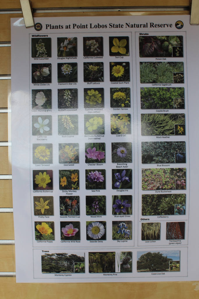
The Big Sur region is home to more than 700 plant species, including at least 57 strict endemics and this rough overview has already become a bit lengthy. So, I’ll have to trust you to check out the list of links and other sources that suit your botanical interests and needs.
Eat or be Eaten in Eden
We have reached a turning point in this story as we evolve our discussion to focus on the rich wildlife of Big Sur. Here is where I’m not going to make a long list of animals (large and small), that include herbivores (primary consumers), carnivores (secondary and tertiary consumers), omnivores, and decomposers. Whether you view them through food (trophic or ecological) pyramids or food webs or chains, they have been connected, researched, and illustrated in numerous research projects and educational resources, some of them listed in links at the end of this story and highlighted on our website.
The Power of Comparing and Contrasting
You can start by going back to our previous story on Crystal Cove, where you will find many animal species and critter details that are just as relevant to Big Sur. I won’t waste previous time and space by repeating them here. The powerful comparisons and contrasts between these two regions will bring enough rewards, partly because thousands of years of migrations across California have distributed so many similar species now separated by great distances and natural and human barriers. So, let’s focus on a few key and interesting differences between the two locations.
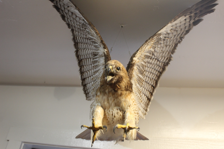
We’ve already shown how Big Sur is cooler and wetter than the SoCal coast year-round. Because climate is king and water is the most important limiting factor throughout almost all California ecosystems, this is a big deal. It helps us understand why we will find more biodiversity and much greater biomass (lusher and greener) around Big Sur and that includes more animals that have adapted to thrive in their relatively mild Mediterranean homes. It also means that you will usually find more diverse and numerous predator and prey thriving in these rich habitats. So, the following are just a few examples that highlight these differences and to demonstrate how Big Sur is so much bigger, wetter, and wilder.
Here’s an excerpt from our discussion of bear history at Crystal Cove: “Grizzly bears once had the run of this place and their way with anything that got in the way. Growing Spanish and Mexican settlements eliminated most of them by the 1800s and American settlers finished them off by the early 1900s.” Same goes for Big Sur. But unlike Crystal Cove, Big Sur is home to an expanding population of black bears. Population estimates for the Central Coast range from about 1,000-1,600 and growing. Why? The Big Sur region is far more remote and less accessible with no large cites nearby. It is also surrounded by the rugged Santa Lucia Mountains, the northern extent of Los Padres National Forest, and expansive wilderness (such as the Ventana Wilderness). This is why Big Sur’s wildlife corridors not only support most of the animals you might find at Crystal Cove, but with higher populations and a greater range of species. Hikers experience more frequent encounters with larger animals in these lusher plant communities. (So far, my numerous personal encounters with bears in California have not included Big Sur.)
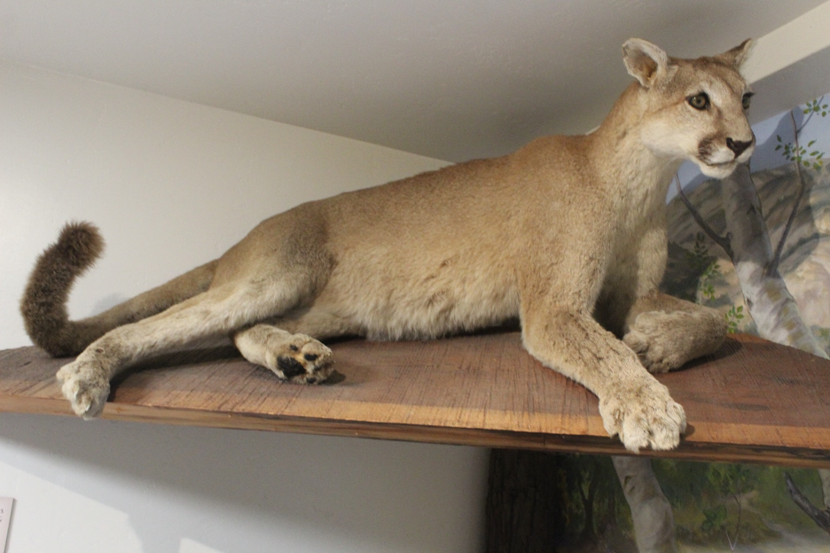
There have been only very rare sightings of transient mountain lions at Crystal Cove State Park. But the reclusive cats are common to Big Sur and the Central Coast. As apex predators, they play vital roles in local food (ecological) pyramids or webs. Their primary kills and the majority of their diets consist of deer, which helps to keep deer populations under control. They also dine on wild hogs that would otherwise root through the soil and destroy native vegetation. (Monterey County has some of the largest populations of destructive feral pigs and wild boars in the nation.) If Big Sur cougars are hungry enough or presented with the opportunity, they have been known to prey on raccoons, rabbits, skunks, squirrels, coyote, bobcats, foxes, birds, and just about any vulnerable animal, Including occasional unfortunate pets and livestock. (I was lucky to hear a cougar vocalizing late one night when I was walking at Pfeiffer Big Sur Campground last June. Such an extraordinary and eerie sound is difficult to forget.)
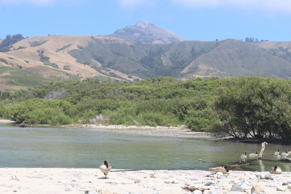
Taking to the Sky
Just as all the animals are too numerous to cover in a story such as this, let’s focus on just two very special birds that can turn birding in Big Sur into a spectacular and unforgettable experience. Following extensive habitat loss, poisoning, and poaching, both were successfully saved from near extinction just a few decades ago (check out our previous website stories).
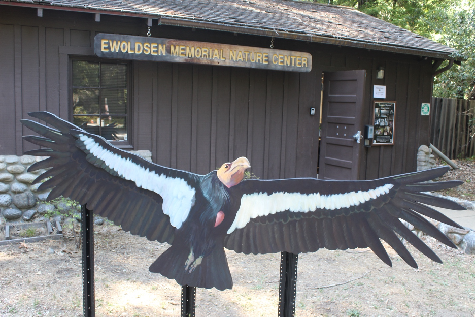
California condors commonly danced in the skies over Big Sur until they became extinct in the wild during the 1980s. After dwindling to just more than 20 individuals in captivity, breeding programs brought them back. And after being reintroduced to the wild, Central Coast populations have “soared” past 100. They are considered obligate scavengers since they only eat the flesh of dead animals. Their bald heads guarantee cleanliness and sanitation as they dine on carryon and clean up the decaying messes. Our condors are the largest flying birds on the continent with the widest wing spans (up to 9.5 feet). Spotting these winged giants soaring overhead is quite a natural history treat, so keep your eyes to the sky when sauntering around Big Sur.
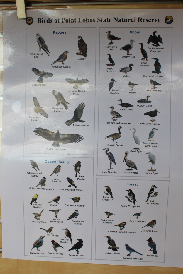
Bald eagles also once thrived in Big Sur but habitat destruction and poisons (particularly DDT) cut their numbers until the “last” Central Coast nest was observed in 1933. Thanks to heroic efforts by biologists and conservationists (such as at the Ventana Wildlife Society), they were successfully reintroduced after a roughly 60-year absence. With dozens of nesting pairs in the region, Central Coast bald eagle populations are currently considered to be self-sustaining.
Chasing More Fauna
A dizzying array of additional animals have adapted to the montage of Big Sur plant communities. Again, rather than repeating past discussions, check out my recent California Sky Watcher book, other stories on our website (remember to compare and contrast with the previous Crystal Cove Paradise story), and the list of links at the end of this story.
Diving In
You will also find most of the marine plant and animal species we recognized at Crystal Cove within Big Sur coastal waters and tide pools but with some substantial differences that refer back to our story title and previous discussions here. The Big Sur coast is far more rugged and its waters are colder, vaster, and wilder. And though nature lovers may line Hwy 1 and concentrate along the more popular trails (particularly during summer months), you won’t find the hordes of beach culture sun worshipers at Big Sur coves.
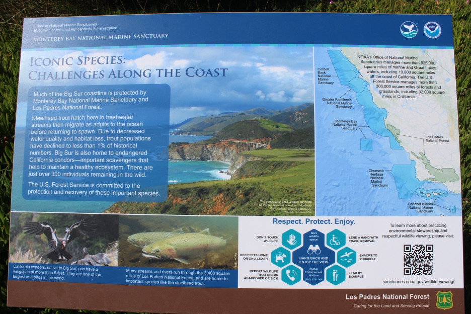
Big Sur’s swaying kelp forests represent some of the most productive ecosystems on our planet. Colder upwelling currents (averaging in the 50s F, but occasionally dropping into the 40s), bring nutrients from the depths toward the surface and dissolve more oxygen and carbon dioxide to nurture these giant oscillating marine algae sanctuaries that can grow faster than a foot/day. Think Southern California Bight coastal waters on steroids. Look down on the sea and surf from the bluffs or peer from a strip of sand across the patches of deep blue waters and the expansive brown kelp nurseries floating with the swells. You quickly understand why the 276-mile-long Monterey Bay National Marine Sanctuary and the nearby Monterey Bay Aquarium are world famous, attracting cutting-edge marine biologists and other researchers and millions of curious visitors each year.
We can start by listing some of the familiar marine stars on this Big Sur stage that we surveyed in our Crystal Cove story, such as California sea lions, harbor seals, great white sharks, and California gray whales. Humpbacks and blue whales are also spotted off both coastlines. Scan the skies for western gulls, common murres, and cormorants. You might be lucky to spot a peregrine falcon. This apex predator is the fastest bird on Earth, capable of diving at speeds of more than 200 mph. it is another bird that was miraculously saved from extinction decades ago after DDT decimated their numbers. California brown pelicans are frequently seen roosting on the cliffs or dive-bombing into the water to gulp down the latest unsuspecting fish caught off guard. How is it possible that these huge prehistoric-looking creatures can skim within a few centimeters of such turbulent waters at such great speeds without crashing?
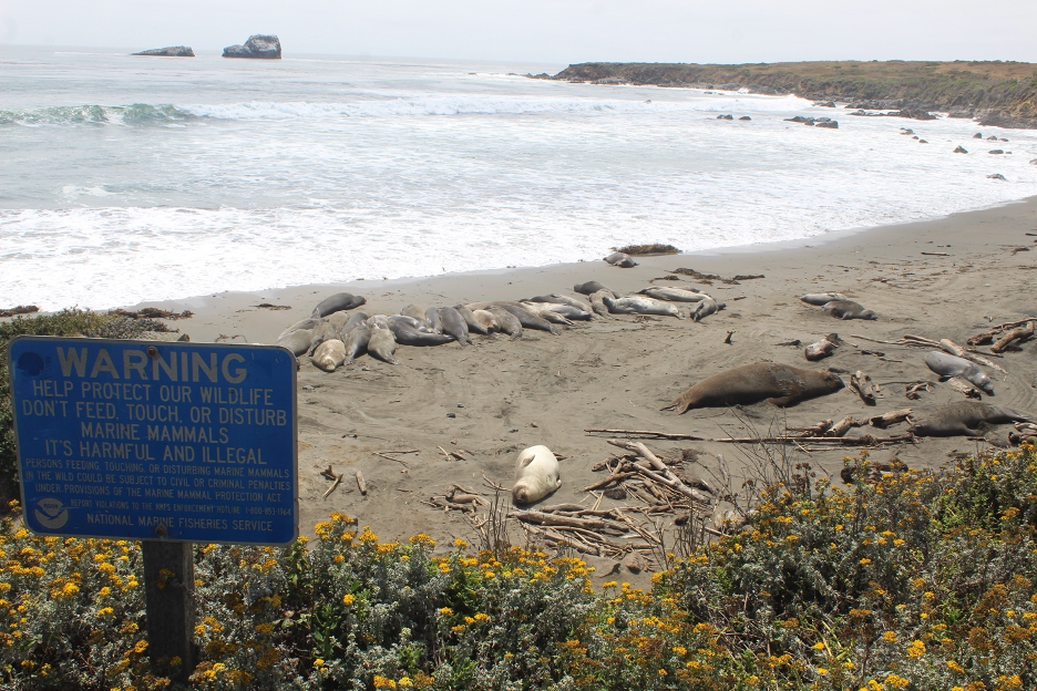
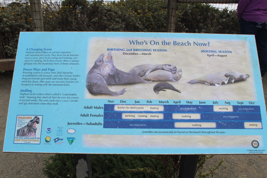
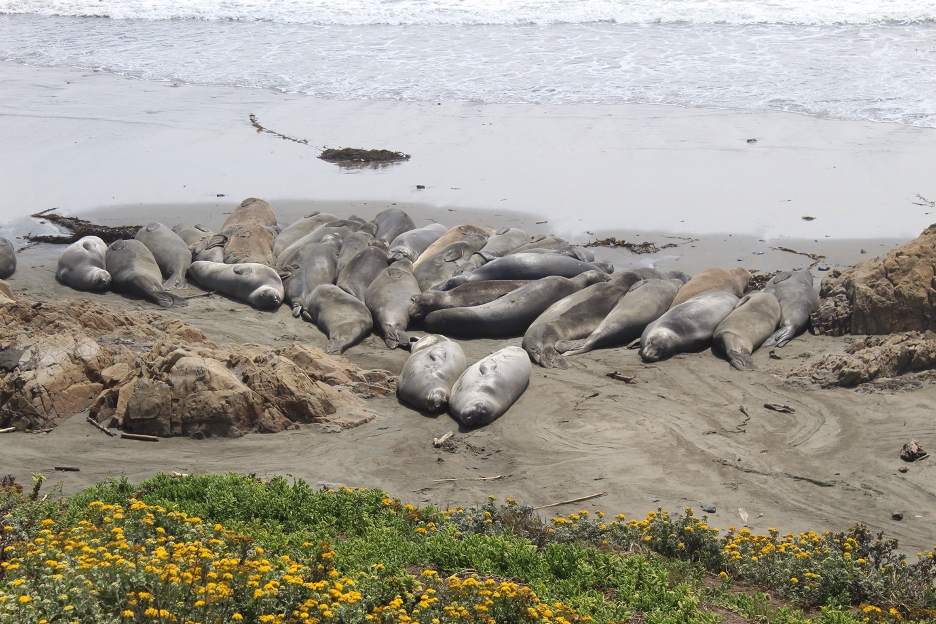
Though northern elephant seals haul out on several beaches around Big Sur, you can’t miss them at the Piedras Blancas Elephant Seal Rookery road stops, just to the south near San Simeon. I first saw these remarkable pinniped mammoths land at Año Nuevo (to the north of Big Sur) when they first returned to mainland beaches decades ago, after nearly going extinct. Years later (since the 1990s), we witnessed the populations grow by the thousands during our annual educational expeditions with our marine biology and earth science faculty and students to the Central Coast. They can dive deeper than 5,000 feet and males can grow to more than 4,000 pounds. Don’t be surprised to find them resting on Big Sur beaches.
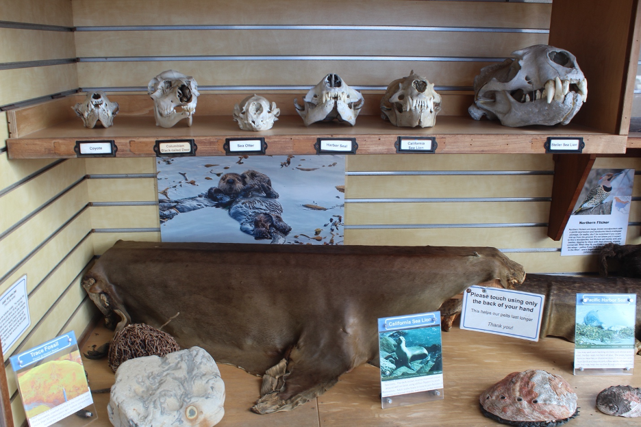
If there’s anything that can steal the show within the grandeur of Big Sur, it’s our beloved sea otters. We already mentioned how they stay warm in such frigid waters. They are often seen floating with other sea otters in groups to form “rafts”. They frequently wrap around the kelp beds they use as floating devices. (Don’t be fooled: most observers have mistaken bobbing kelp for sea otters.) But these important apex predators also spend much of their time diving down to the sea bottom, emerging with morsels to satisfy their voracious appetites. They use rocks as hammers and the chest anvil method (banging clams or oysters on rocks) until the shells break open. Last June, while looking down into a cove from the terraces at Garrapata State Park, we heard an onlooker exclaim, “A sea lion is clapping!”. The tapping sound came from a sea otter floating on its stomach, pounding its future meal on a rock to break open its shell.
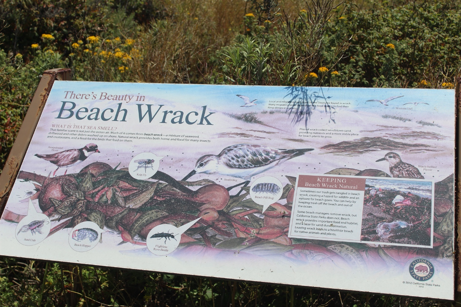
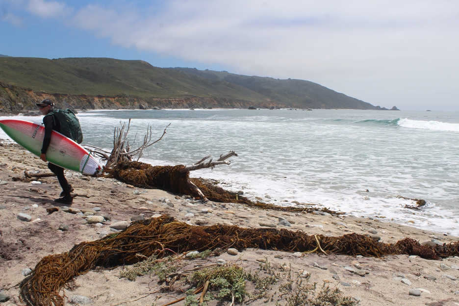
Hiding Out in the Tidepools
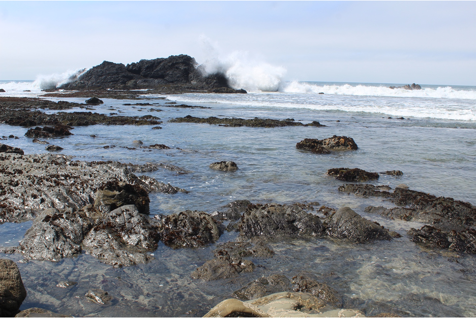
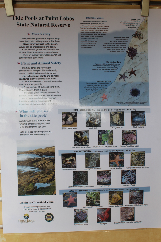
And don’t forget to survey Big Sur tidepools at low tide. You can start with some of the creatures from our Crystal Cove story (such as the recovering populations of ochre sea stars) and add several species better adapted to colder currents farther to the north. Abundant producers include those giant floating gas balls or bladders (called pneumatocysts); they are attached to brown fast-growing Bull Kelp (Nereocystis luetkeana). Watch for Sea Palm (Postelsia palmaeformis), which resembles an upright palm tree growing on the rocks and flopping around in the surf.
If you think those grazing chitons resemble creatures from another planet, at least two Big Sur species could star in your imaginary science fiction drama-turned-reality show. Growing more than a foot long, Gumboot Chiton (Cryptochiton stelleri) is the largest chiton in the world. It’s difficult to miss this reddish-brown rock roamer that has been called the wandering meatloaf as it scrapes algae off the rocks. The lucky ones live for more than 20 years. Black Leather Chitons (Katharina tunicata) resemble their common names, AKA Black Katy Chitons. Various cold-water crab species also thrive in these frigid high-oxygen waters, such as tasty Red Rock Crabs (Cancer productus). OK, that’s a start.
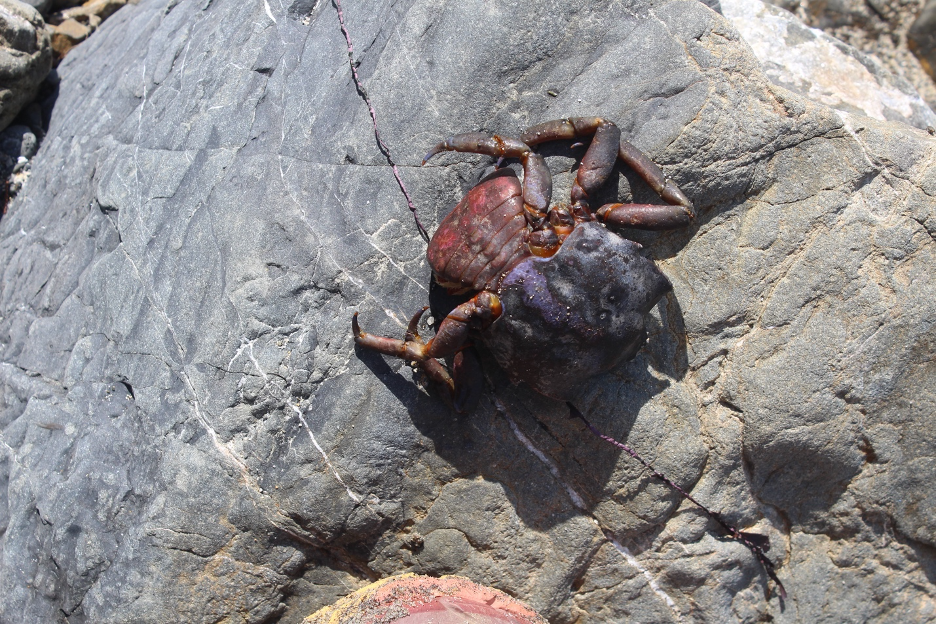
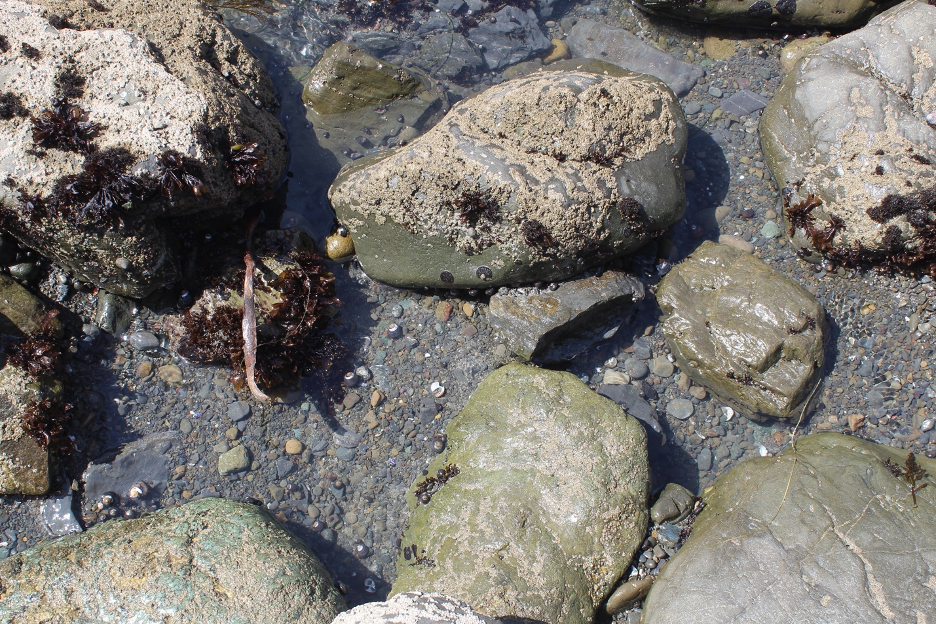
Please don’t harass or squash these otherwise resilient organisms while stumbling over intertidal rocks and never turn your back on the ocean. The Monterey Bay Aquarium is also still waiting for you.
Humans as Nature
The First Hunters and Gatherers Thrive
For thousands of years before Europeans arrived, the Big Sur region was home to Native Americans that included the Esselen, Ohlone (Costanoan) toward the north, and Salinan people toward the south. Their cultural heritage and traditions may seem familiar to those who have studied California’s Native American history. The Spanish began efforts to wipe out these cultures, tragedies that continued during the Mexican Period and long after the Americans ceased control of these landscapes. But today’s Esselen people are reemerging with efforts to reclaim and restore ancestral lands and to share thousands of years of Big Sur nature knowledge and traditions that can serve as lessons for all of us.
he Esselen people shaped and managed natural resources in these landscapes so that they didn’t just survive, they thrived. Every available resource was used but not wasted for food, shelter, clothing, basketry, medicine, and other essentials. As example, they even used redwood trees for construction material and canoes.
Across Central California, acorns and buckeyes (horse chestnuts) were harvested, shelled, ground into flower, leached to remove toxic tannic acids and cooked into cakes as nutritious meals. Berries added vitamins and antioxidants and bay leaves were used as medicine and to flavor food. Many of the animals mentioned earlier, large and small, were hunted. As example, lizards were caught with snares and then roasted. Esselen diets included a variety of fish and shellfish (abalone and mussels) and they also harvested seaweed.
They not only took advantage of nature’s buffet; the Esselen tried to manage it to their benefit. That included low-intensity cultural burning to clear out overgrown areas, thin the forest, and promote growth of more beneficial species. Scientists and officials such as those who work within California’s state and national parks, CAL FIRE, and the US Forest Service are learning from such traditional ecological knowledge that dates back thousands of years. It is hoped that rediscovered wisdom might help ease the catastrophic wildfire threats that we have examined here and in numerous other stories on this website and in my California Sky Watcher book.
Camp Counterculture
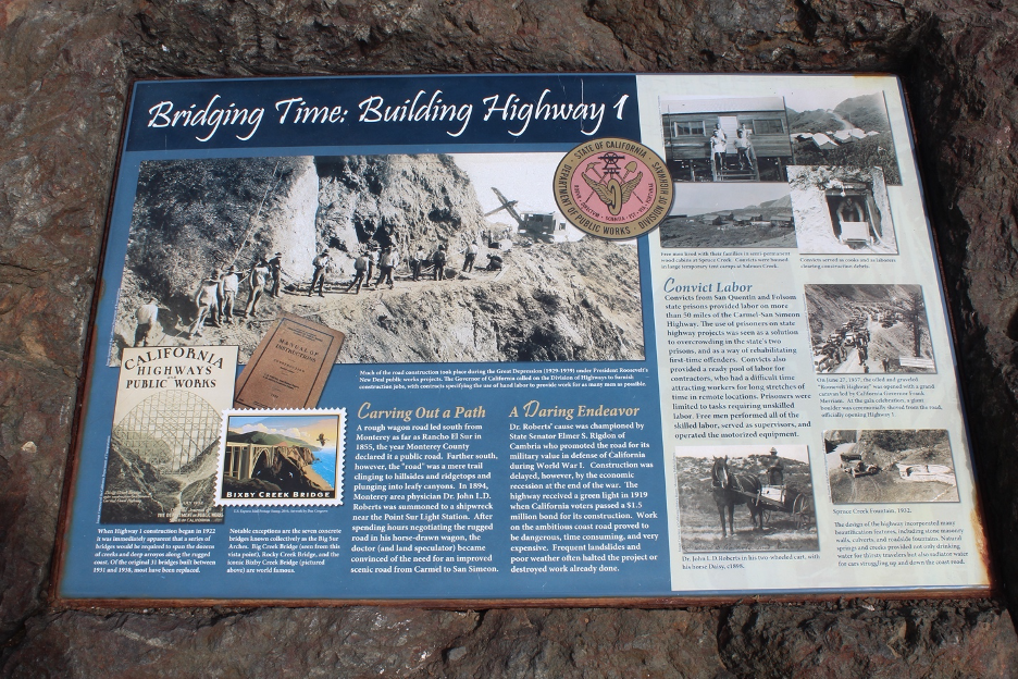
It is no surprise how mystical Big Sur has attracted counterculture free thinkers and movements during the last century. After Hwy 1 opened in 1937, it brought access to the isolation and Big Sur became known as a bohemian refuge, attracting artists and Beat writers. Henry Miller arrived in 1944. Jack Kerouac (who wrote Big Sur) and other notables followed. Big Sur Inn and Nepenthe Restaurant gained fame as informal gathering spots. By no surprise, the hippie movement invaded during the 1960s. Big Sur evolved as an epicenter of the New Age Movement and what is still known as the Human Potential Movement, which leans toward spiritual rejuvenation, environmental awareness, holistic medicine, and eastern philosophies.
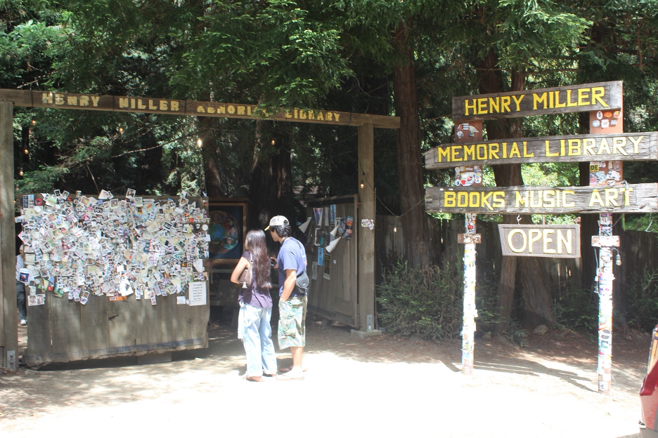
And the beat goes on. You can still visit these cultural history roots, hike through the adjacent wilderness, comb the relatively isolated beaches, and notice how they are all changing. Visitors who can’t find lodging at Big Sur often arrive from the south or north, stay for the day, and prepare for the long, car-sickening slog around the hairpin turns on Hwy 1 on the way out. Better yet, you could get lucky to reserve a family campsite at one of the beautiful state parks for about 50 bucks. (You’ll have to plan many months ahead for spots during summer and/or weekends.) At the other extreme, if cost is no barrier and you want to mingle with the intellectual elite, there’s always Esalen.
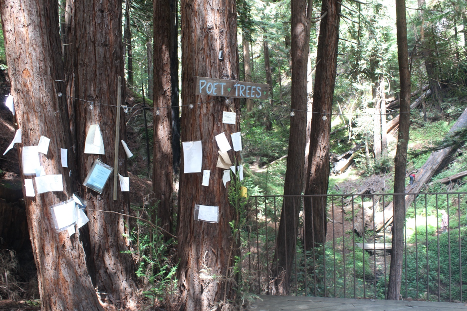
At the Esalen Institute Retreat Center (named after the Esselen people), tuition prices start at $560 for shared sleeping bag spaces during a 3 day/2 night stay but you can always upscale to a suite or house that will cost you more than $4,000. Add a massage for about $400. Maybe you qualify for one of their scholarships. “Esalen is a world-renowned holistic learning and leading global retreat center for guests and faculty to explore and realize their human potential through experience, education, and research. Public workshop and private conference programming pushes our growth edges closer toward collectively living in a more just, creative, and sustainable world.” Prepare for some high-priced Big Sur-style yoga, meditation, and body work on the cliffs overlooking the ocean.
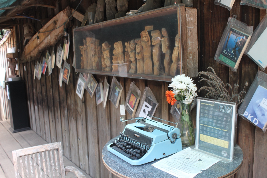
Whether you camp like me or enjoy local lodging, the Henry Miller Library is for everyone, so check it out: “The Henry Miller Memorial Library is dedicated to preserving and advancing the spirit of Henry Miller by fostering literature, art, music, and free expression. Through public programs, education, and community engagement, the Library serves as a cultural gathering place that encourages open inquiry, creative exploration, and the preservation of Big Sur’s natural and cultural heritage.” Sounds like quintessential Big Sur to me.
It’s time to finally say goodbye before our brief cultural history subset of this natural history journey turns into a travel guide.
Sailing On
This natural history story is another reminder that everything is connected to everything else, we are all part of nature, and we just wouldn’t be California without Big Sur. The end of our journey here provides an opportunity to consider this quote I found that celebrates ecocentrism and deep ecology: “If humans are nature, then harming the environment is literally damaging the organism to which we belong, moving ethics from “saving nature” to recognizing that our survival is tethered to ecological reciprocity.”
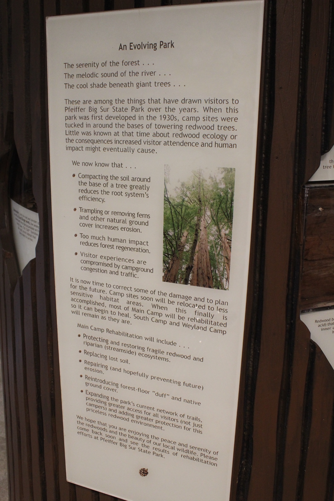
We have to stop somewhere, so enough already. How many natural history stories do you need before you dive in to the research and go out in the field to see for yourself? And how many times must I remind you that the following list of links and the wealth of other relevant stories we have delivered on this website and in my book should serve as springboards for anyone, regardless of your specific interests. You’re the captain of the ship now, so fair winds and following seas!
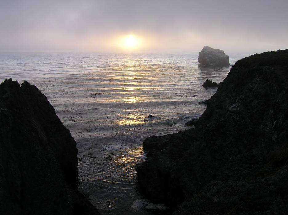
“You’ve seen the sun flatten and take strange shapes just before it sinks in the ocean. Do you have to tell yourself every time that it’s an illusion caused by atmospheric dust and light distorted by the sea, or do you simply enjoy the beauty of it?”
Links and other sources to continue your journey …
Brochures, Guides, Field Trips, Organizations, and other General Stuff:
Big Sur Discovery Center/Ventana Wildlife Society
Ecology of Big Sur Intro/Summary from the Chamber of Commerce
Nature Interview with Biologist Paul Henson
Nature Video: Living Edens: Big Sur – California’s Wild Coast (2002)
One of Many Online Big Sur Travel Stories
Pt. Lobos Natural History from the Pt. Lobos Foundation
Geology
UC article and video on Hwy 1 Problems
Old Article on Sur-Nacimiento Fault Zone
Geology of Los Padres National Forest
Hydrology
More about Steelheads and Little Sur River
California Dept. of Fish and Wildlife Steelhead Study
Instream Flow Evaluation, California Department of Fish and Wildlife
Weather and Climate
Big Sur Weather from Weather Spark
Plants
From the Pacific Southwest Research Station
Keep Big Sur Wild: Eradication of Nonnative Invaders
Big Sur Botany: Most common flowers
KQED article about the recent fires
Wildlife
Be Aware in Big Sur from State Parks
Big Sur Mountain Lions by Steven Harper
Monterey Bay Aquarium and Sanctuary
Monterey Bay National Marine Sanctuary
People
THE END
BONUS PHOTO ESSAY
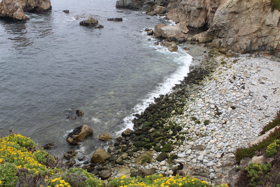
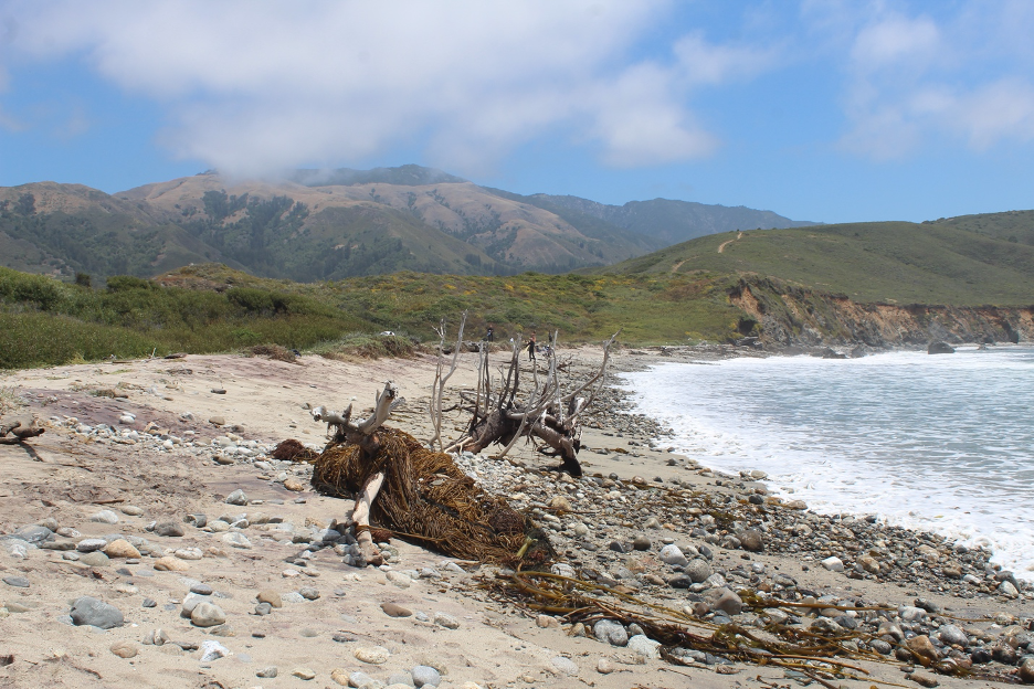
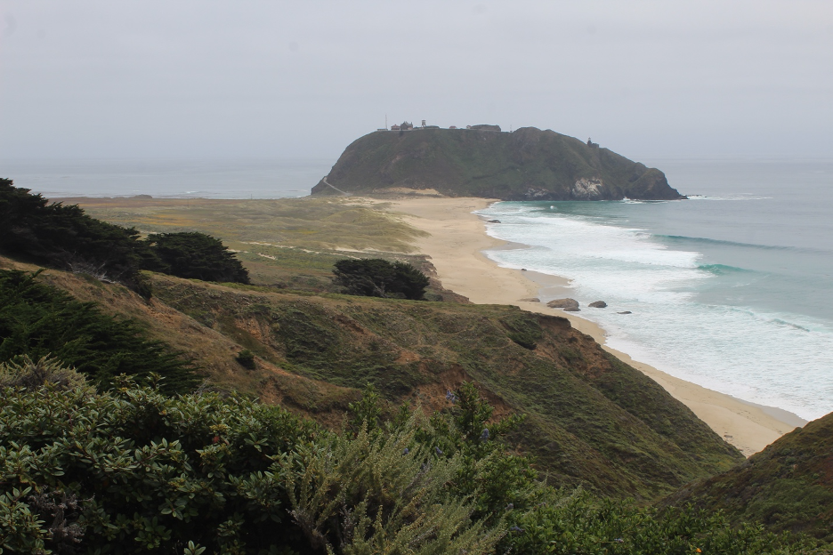
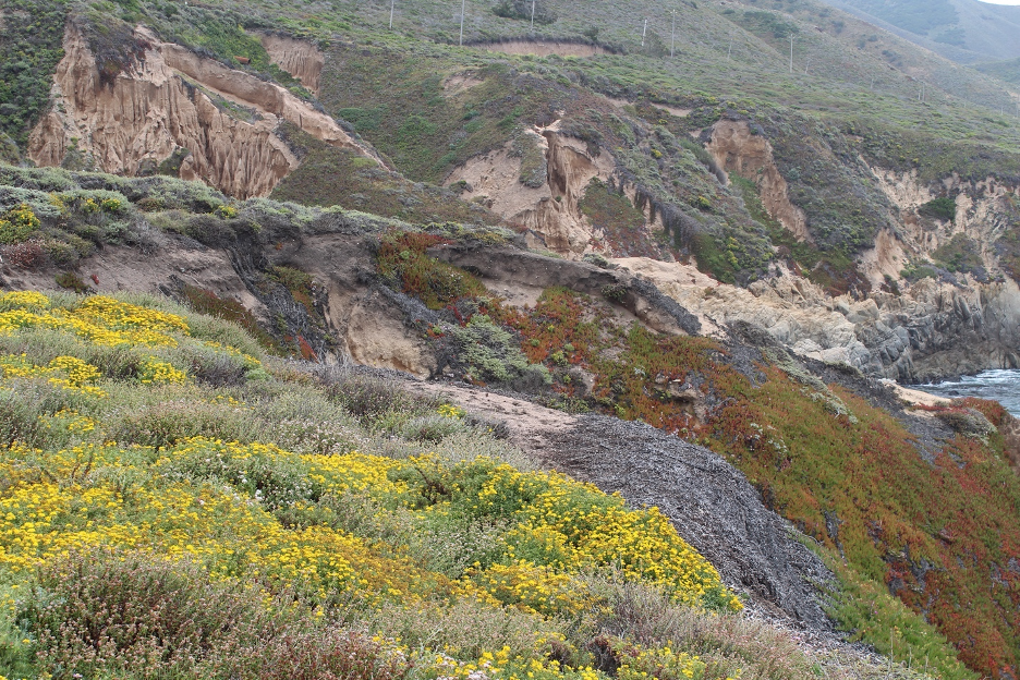
If you’d like to see even more of Big Sur, check out these images that roughly follow the organization in this story but didn’t make the first cut. …
THE FINAL END – FOR NOW