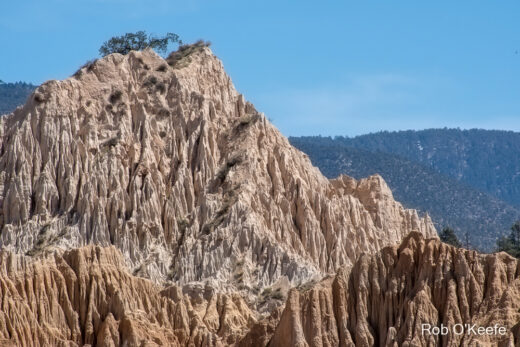
We live in exciting times, times when geospatial technologies are helping us to ponder, explore, understand, and even solve complicated, multi-faceted problems. At colleges across the Golden State, like Santa Monica College, students are learning and putting into practice GIS (Geographic Information Systems) concepts and techniques to investigate those quandaries.
One topic of concern that is familiar to Angelinos is the toll that the car culture has on the environment and quality of life in southern California. In a detailed and informative story map presentation, Amir Heibl, a GIS student at SMC, posed real-world geospatial questions while employing appropriate and innovative spatial analysis methods to address those issues.
We invite you to view his thought-provoking work entitled Gimme Shelter!

For those of you who are unfamiliar with GIS, it can be thought of broadly as the marriage of computer cartography and database management. More specifically, it is a computerized system for capturing, storing, managing, analyzing, and visualizing geospatial information. Crucially, the data in a GIS contains a locational element which allows for spatial analysis of anything plotted on the surface of the Earth.
GIS is frequently used to answer why things are where they are. In the case of many human endeavors, it also helps decide where things will go or be. Businesses increasingly use GIS for such tasks as locating their customer bases, maximizing the efficiency of delivery fleets, and finding the best location to put in a retail store. Governments use GIS for a host of applications. From knowing the location of a city’s fire hydrants, to managing critical habitat and open space, to tracking and understanding the movement of goods, services, and people though a city, state or nation, GIS helps administrators make informed and timely decisions with real-world implications for the people they serve.
But GIS, along with interactive mapping applications, can be used effectively as a tool for stimulating learning and inspiring critical thought. As we have now seen in Amir’s work above, GIS allows you to explore spatial data, ask questions about that data and display it in ways that provide insights and inspiration for others to follow up on or act upon.
If you are interested in learning GIS at Santa Monica College, please check out their offerings in Geography Program in the Earth Sciences Department.
** Rediscovering the Golden State: California Geography welcomes submissions of California-themed projects from students and faculty from any CA institution of higher education to be highlighted on our web site. This includes, but is not limited to, articles, papers, maps and presentations– GIS or otherwise).
Even if you are working/ studying outside CA, we’ll consider your contributions too provided the content has a clear and unambiguous connection to California geography.
For more information: info@rediscoveringthegoldenstate.com