Part III: On the Beach and into the Ocean
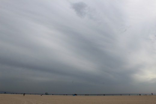
After finally arriving on the coast, caught in the wave zone, our sand grain was transported along the beach. Approaching swells are refracted as they encounter shallower water at various angles; these bending waves break and spill over at angles to the shore. Breaking at wildly varying intervals ranging more and less than every ten seconds, depending on the day and conditions, this wave action shoves tons of sand up (swash) and then pulls the particles back down (backwash) the beach with back and forth motions. This river of beach sand usually meanders from northwest to southeast, pushed along with the prevailing swell direction down the California coast.


If you go into the surf, you can often feel the power of breaking waves tossing your body around and pushing you down the beach with the longshore drift and current. Imagine these forces acting upon each sand grain in the surf zone; such rivers of sand flow much faster with the beach drift when waves are highest and most powerful. When swells originate out of the south, often during our summers, they temporarily reverse this prevailing direction and transport sand toward the northwest.
One of the first classic studies illustrating how these cycles and forces shape our beaches was done along the Santa Barbara coast in the 1960s. It was made into an informative movie called The Beach: River of Sand and it lives on to this day with its sometimes entertainingly-old-fashioned narration: http://www.youtube.com/watch?v=FqT1g2riQ30
If you would like to see some images of what Santa Barbara Harbor looks like today (with strikingly similar coastal processes and sand deposition issues), go to the end of our final photo essay at the end of this web story (Part V on Page 5).
Here is another very informative tutorial that uses several California beach examples and is much more current. It summarizes many of the concepts we cover in this story:
After weeks of turbulent tumbling and surfing, our sand grain was finally stranded during high tide, waiting at rest. This is where we examined it.

Source: A project of the Frances L. Parker Program for Outreach and Education in the Earth Sciences: Geosciences Research Division Scripps Institution of Oceanography ….. University of California, San Diego.
Sandy beaches throughout the world can be most generally classified as organic or inorganic. Organic beaches are usually composed of ground up coral and other marine shell detritus made mostly of calcium carbonate. California ocean waters are too cold to support tropical coral reefs; so, scant organic debris, mixing with the sand, comes from the remains of microscopic or larger ground up shells. Most of the inorganic beach sand more common to California reflects the chemistry of the source rocks we have examined in this story. Quartz (clear and white) may have weathered from the granites we have reviewed. Chert is also made of SiO2, which is precipitated from water solutions and then grows to form cements and fillings in rock cavities, such as in sandstones, though other cherts are biochemical deposits. Not surprisingly, like quartz, chert is also hard (7 on the Mohs scale of hardness). You might find it scattered on our beaches in the form of flint and jasper, often weathered out of sedimentary rocks. The more vulnerable chemical bonds of the peach and yellow-colored feldspars and darker minerals with less silica make them subject to faster weathering, leaving more resistant quartz to dominate the beach.

This means that our more recently exposed and weathered “less mature” beach sands, with closer sources, might still contain more feldspars and other softer or vulnerable, darker minerals. More abundant crystals of mica, amphibole, and other minerals that grade darker might also suggest a beach with younger sands that haven’t been subject to prolonged, extensive weathering. Quartz and chert can also be colored when contaminates are present. However, you can see why California is not known for the black beach sands such as those found in Hawaii and other volcanic landscapes. Hawaii’s black sand beaches are weathered from highly mafic, dark, runny lava basalts. Such basalts are loaded with heavy, dark minerals high in iron and magnesium. These display stark contrasts with the high silica granites common to most California mountain ranges. If you are wondering about a few of our beaches that can accumulate black streaks, read on to the discussion of magnetite.

Notable exceptional California beach sands are the sediments that have recently weathered out of the Franciscan Complex (mélange), which outcrops along parts of the coast and within the Coast Ranges. These rocks were formed when highly mafic exotic igneous rocks and overlying sediments were plastered against the continent within a western region of the Mesozoic subduction zone discussed earlier. Metamorphic serpentine minerals and serpentinite rocks (named for their snakelike, greasy, green appearance) are common in these complex mélanges. Colorful serpentine, jade, and a wealth of other alluring gems polished by wave action continue to weather along some California beaches. This is particularly true along Central Coast beaches, such as at Big Sur (especially Sand Dollar Beach and Jade Cove), after falling out of those local Franciscan Complex rock formations or rushing out of local streams.

E6: Go to E6 to learn about different types of metamorphic rocks.
We can see how the size, shape, and color of sand grains reveal their diverse natural histories. Large, raw, angular, and unsorted sands are usually recent deposits. Smaller, better sorted, well-rounded sand grains are usually older with longer histories of weathering and abrasion. And since beach sand chemistry reflects the source rocks, most California beaches are dominated by lighter quartz, with sprinklings of slightly darker feldspars, and even darker micas, hornblende, and magnetite.
Magnetite has also earned a quick shout out here. It may accumulate in dark streaks especially south of the Golden Gate Bridge, along Ocean Beach, Baker Beach, and Fort Funston. You may notice these deposits after inland rivers transport them away from their source regions and deliver high discharges through the Golden Gate; prevailing waves then work the conspicuously dark, heavy minerals south toward Daly City. Since magnetite is dense, it may remain stranded along high tide lines while lighter minerals are washed away. Some have confused these occasionally noticeable deposits with pollution. You might identify black magnetite with a hand lens or magnifying glass, but you can’t miss attracting it with a magnet. Regardless, it is less common than the lighter, tough minerals that dominate our beaches. While you are combing Bay Area beaches, you might find it mingling with more common clear and lighter quartz, milkier and occasionally peachy feldspars, greenish serpentines, and more rare pink garnets.

Occasional blotches of gooey tar or asphaltum (bitumen) can also be found along some California beaches. Though these sometimes (many decades ago) originated from oil industry spills, most of today’s tar deposits are natural. They are especially noticeable along beaches around Pt. Conception or on any beach that happens to be downstream of local ocean currents that carry natural seeps from the Santa Barbara Channel. There, west of Santa Barbara, you will find some of the most active petroleum seeps in the world, as light and heavy crude oil, tar, and other hydrocarbons are buoyed to the ocean surface after leaking from fractures and faults on the seafloor. Most Californians who visit these beaches have brought the sticky tar home on their feet and into their bathtubs. Long before the petroleum industry began drilling, Native Americans used this tar to seal their boats and various containers; the Chumash became famous for their seaworthy vessels, partially thanks to their applications of asphaltum sealants. Today, it can sometimes be seen gluing formerly separated beach sand grains together.


Returning to our sand grain, we can postulate its likely future based on research about the vast majority of sand on our beaches. High winds would blow some of the surrounding lighter dust and silt particles farther inland into little ripples and dunes until they were deposited on dry land, stranded far away from even the highest tides. But our larger and heavier sand grain would remain here, along with a few broken shells, until the next high tide with heavy surf could disturb it and dislodge it back into the surf zone, where it might resume its zig-zag motions down the coast. It might become temporarily trapped against points and promontories, or along groins and behind breakwaters built by humans to protect and widen the sandy beaches. Some California beaches have even been fortified and widened with imported sand.
You are also encouraged to take time out to watch this movie about how sand erosion and deposition and rising sea levels are reconfiguring the East Coast of the U.S. It has become a more recent classic, illustrating how nature will eventually reclaim control where reckless human developments creep too close to the shoreline. You will see how the same themes are so relevant on our California coast: https://shoredupmovie.com/


But our sand grain would finally navigate around various natural and human obstructions and eventually drift and settle into a deep submarine canyon. There, gravity would pull it into the quieter depths, along with tons of sand grains and other sediment. All of these migrant particles would be trapped and deposited on the deeper ocean bottom. There, they would be crunched together as new layers were deposited on top of them. Many thousands of years or more of pressure and precipitated chemicals would glue and lithify the sediments into sandstone again in another example of how the enduring rock cycle lives on. There, our sand grain might wait in dark silence for millennia and the next tectonic upheavals that could lift it, within its latest rock formation, millions of years into the future.
E7: Go to E7 to learn more about what happens to salts and other dissolved minerals that are carried away by water to eventually accumulate in inland valleys and ocean basins.
Epilogue
In our obsessions with consumerism and material wealth, our popular culture too often discounts the beauty and significance of natural products and features such as rocks and sand that inform us about the systems and cycles vital to our everyday lives. Our detachment from nature has poisoned our perceptions of our places in the world and our roles in it. Following our sand grain helps us to dispel these misconceptions and reconnect to the natural world around us. It is not surprising that Californians continue to debate about how we can best make these connections without destroying the very natural resources we cherish.
One epic example can be found at the expansive Oceano Dunes just south of Pismo Beach, where there has been forty years of growing conflict. Off-road vehicle enthusiasts have used the dunes as their weekend family playground, while biologists and naturalists and local residents concerned about restoring native species and air quality have fought to end the tradition. It was the last state beach where motorized vehicles were allowed to roam freely. By 2021, the embattled Coastal Commission’s decision to close Oceano Dunes State Vehicular Recreation Area to all vehicles was headed to the courts. This is a classic Golden State conflict between diverse special interest groups who have opposing views about how to enjoy the great outdoors while more people seek use of our limited natural resources. In this case, our cherished sand is the foundation and center stage for this battle.
California’s native people were true natural historians and ecologists, as they considered themselves part of the land, rather than separate from nature. Their perceptions of and relationships with rocks and sand reflected these connections. Many rock formations were considered sacred and were sites of legends and countless rituals. Joints and cavities were sometimes considered connections to the underworld. Many types of cobbles were used as tools and weapons by California Indians for many thousands of years.

Native Americans used hand-held stones to grind seeds and nuts into rock depressions. Manos were used to process harder seeds and nuts inside metate, while pestles were used to grind softer nuts such as buckeye (horse chestnuts) and acorns into existing depressions that were deepened into mortars. Native Americans’ teeth were often found to be ground down by the sand and other rock particles that had been incorporated into their prepared food over many years. You can see why they preferred the hardest and most resistant rocks (such as granites) for grinding and processing food. These same Native Americans drew some of the first California maps in the sand to guide them and clarify their sense of place.
They shaped rocks into tools and weapons, but they also used them as canvas for rock art that included colorful pictographs and sketchy petroglyphs. Hematite was used as a red pigment. Cinnabar was mined and used for red face paint. Their principal mine was at New Almaden near San Jose, where poisonous mercury would later be extracted and exploited during the gold rush.
Many California tribes believed that natural features, including stones and boulders, had thoughts and feelings. Since we already quoted from Heizer’s and Elsasser’s The Natural World of the California Indians as we followed our water drop in a previous story, let’s try it again. In that publication, the authors wrote what a Nomlaki Indian told an ethnographer: “Everything in this world talks, just as we are talking now—the trees, rocks, everything. But we cannot understand them, just as the white people do not understand Indians.” And there was that Wintu woman who told the ethnographer, Dorothy Demetrocopoulou in 1930, “The Indians never hurt anything, but the white people destroy all. They blast rocks and scatter them on the earth. The rock says, ‘Don’t. You are hurting me…’ ”

After following our California sand grain’s story, spanning hundreds of miles and thousands of feet elevation during more than 100 million years, the hour glass/sand clock metaphor that we started with doesn’t seem so farfetched. We begin to realize why so many historical idioms and quotes involve references to rocks and sand. Here are just a few examples:
I was sand, I was snow, written on, rewritten, smoothed over. Margaret Atwood
The whole of the world could be deduced from the smallest grain of sand, if one studied it closely enough. Christopher Paolini
A handful of sand is an anthology of the universe. David McCord
The sand murmurs that it wants to swallow everything. Gao Xingjian
All that mankind has ever learned is nothing more than a single grain of sand on a beach that reaches to infinity. H. Jackson Brown
Time is like a handful of sand – the tighter you grasp it, the faster it runs through your fingers. Henry David Thoreau
(For more of these quotes about sand, go to https://www.wisesayings.com/sand-quotes/#ixzz6quZnvID5 )
So, get out and start making your own discoveries and listen to the many stories that the rocks and sand grains have to tell. After all, you can’t leave footprints in the sands of time if you are trapped in the comfort of your four walls. We will keep you walking with a final photo essay (in Part V, Page 5) at the end of our Glossary of Explanations and Definitions section that follows.