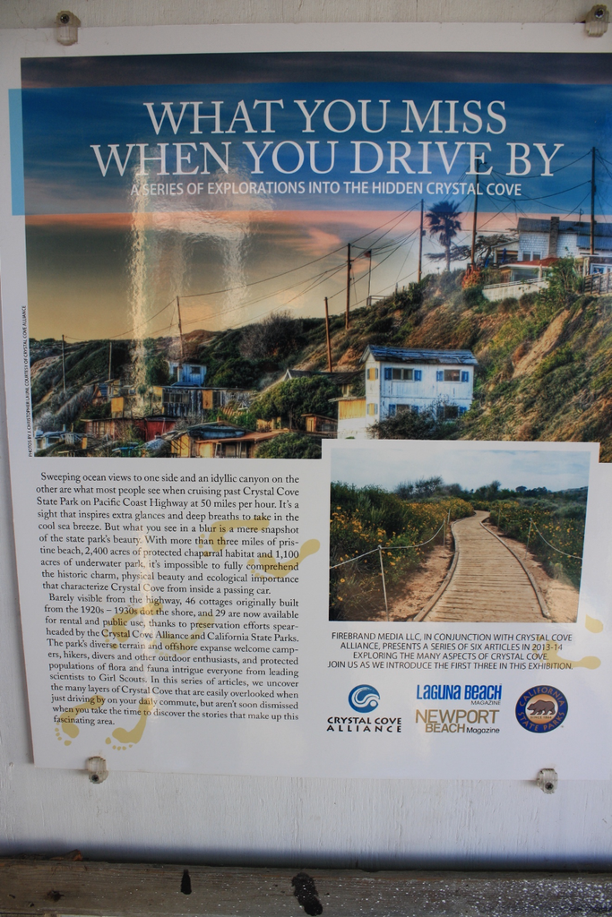
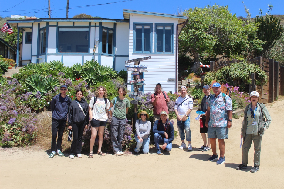
In this latest field adventure, we unveil the captivating natural science stories behind the stunning coastal scenery at Crystal Cove State Park. For centuries, its natural history and legendary human stories have attracted hunters and gatherers, explorers, tourists, scientists, anthropologists, plein air artists, Hollywood’s movie industry, beach bums, and vacationers. This Newport Coast between Laguna Beach and Corona del Mar has often been characterized as a slice of paradise for good reason. You can see why the California Geographical Society asked me to lead their field trip here this year; and now I’m inviting you to join us.
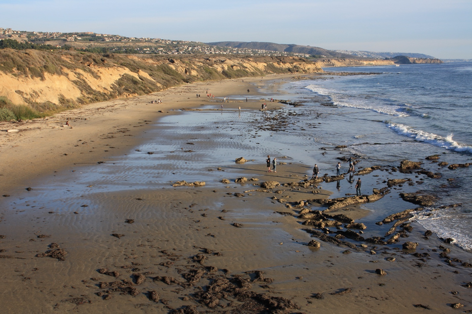
From ancient rock formations and landscapes thrust above the sea, to sculpted contours left by weathering, erosion, and waves; from unique weather patterns, to some of the mildest climate cycles on Earth; from distinctive Mediterranean plants and animals, to marine organisms that thrive in crystal blue habitats; and from the early Native Americans, to the diversity of settlers who have called this place home: we will explore the forces and processes that have shaped one of California’s iconic coastlines.
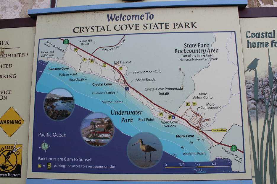
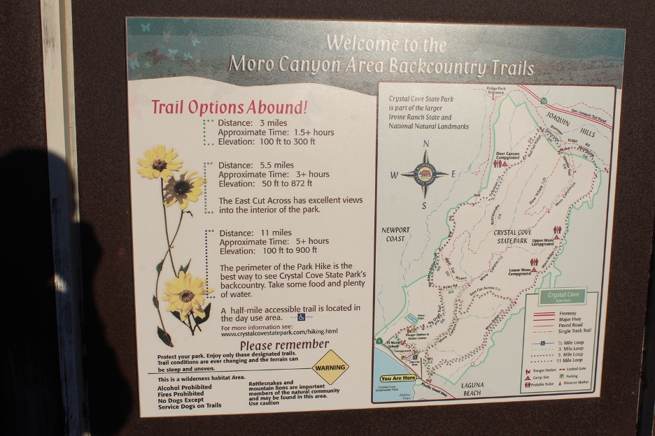
Episode I: Twisted Geologic History and Disheveled Geomorphology
Rising from the Depths
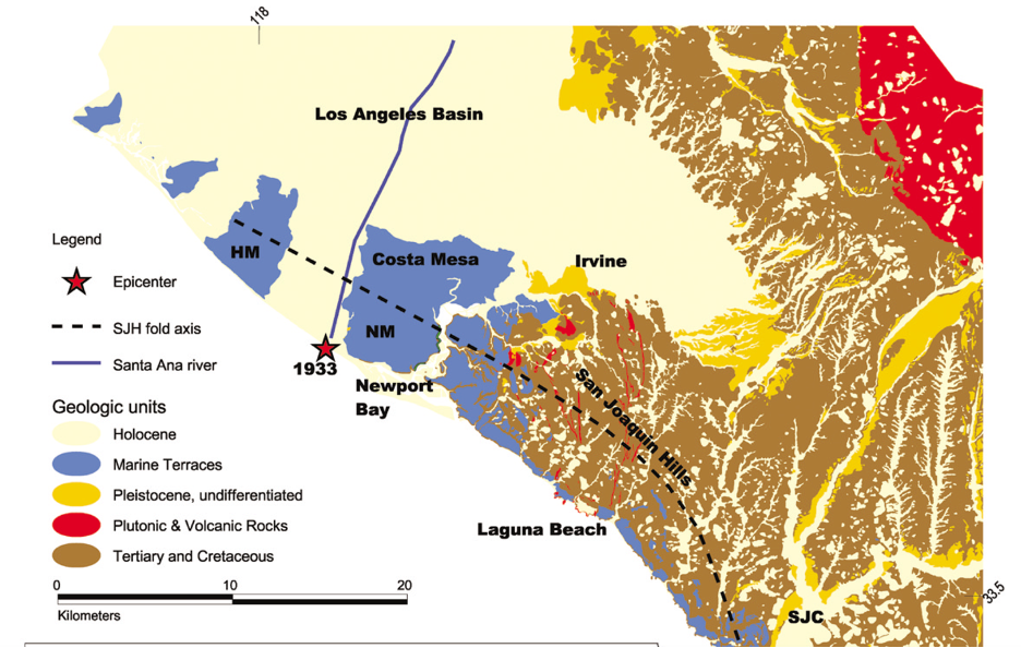
How has the surrounding landscape evolved to what we experience today? The answer, particularly in California, starts with an understanding of the internal mountain building forces (often called endogenic or tectonic processes) that are shifting rock formations and lifting them above the sea. You will find abundant examples in previous stories on this website. Such rock formations may be gradually folded under pressure into undulating anticlines (bent upward to form ridges) and synclines (bent into troughs) OR they can be broken along fault zones. Thanks to both processes, the San Joaquin Hills have been rising out of the ocean and above the beaches at Crystal Cove.
Much of the local credit goes to the San Joaquin Hills blind thrust fault. As the name implies, it is embedded and hidden below the surface, where compressed rock formations are being shoved and displaced higher on one side of the fault. It slipped around 1769 to produce a major earthquake estimated at about 7.0 magnitude. Geologists have evidence suggesting this is likely the same event experienced by the Gaspar de Portolá expedition on July 28, 1769, which would represent the first written record of an earthquake in California. (Such an earthquake today could be just as deadly and damaging or even worse than the devastating 1994 Northridge Earthquake, one of the costliest disasters in US history. However, the abundance of relatively recent construction developments adhering to earthquake-resistant building codes will help to limit casualties and devastation in the surrounding region.) Add the folding, also caused by compressional forces, and the entire San Joaquin Hills anticlinal structure is estimated to be rising at nearly one foot/1,000 years.
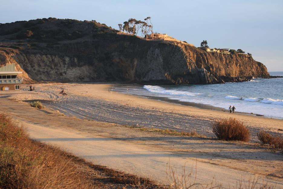
You can see evidence of this tectonic activity all around Crystal Cove. A series of ancient wavecut platforms have been lifted above the sea to form today’s marine terraces. These elevated flat surfaces have become convenient natural foundations for building roads, parking lots, trails, and other infrastructure where you can look over the cliffs and out toward the ocean. (We can thank the heroic work of countless individuals who have saved these open public spaces from what could have been exclusive housing and generic commercial developments that would otherwise block our access and views.)
In the bigger picture, all this tectonic activity is part of the grinding and crunching along the much wider and longer northwest-southeast trending Pacific and North American plate boundary that we call the San Andreas Fault Zone, a star in several other stories on this website. It is not coincidental that local mountain building is occurring parallel to a big branch of the system we know as the Newport-Inglewood Fault Zone (like the San Andreas, also a right-lateral strike-slip fault). It trends from Culver City to about 47 miles southeast and eventually into the ocean just off the Crystal Cove coast to eventually connect to the Rose Canyon Fault in San Diego. This is a particularly dangerous active fault because it stretches below or adjacent to so many major SoCal cities. This Newport-Inglewood Fault was responsible for the deadliest earthquake so far (6.4 magnitude Long Beach Quake in 1933) in SoCal history and is quite capable of outperforming that catastrophe at 7.0 or greater. Here is another reminder that all these rolling hills and scenic mountains come (or will come) with a big price tag.
Surrounding hills and mountains are mere infants in geologic time. Fossil shells dated at only 100,000 years old are falling out of the cliffsides. Scientists estimate that the terraces have been lifted more than 1,000 feet in less than 4 million years.
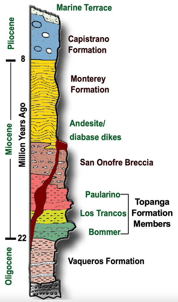
Waves have been carving away at the base of the uplifted cliffs to expose a very different geologic dynamic dating back millions of years. Exposed rock formations range from deeper layers more than 20 million years old to recent deposits only hundreds of thousands of years old (on top). Some of these ancients have earned local names, such as the San Onofre Breccia (more than 15 million years old) and the overlying Capistrano Formation (just a few million years old). The most ballyhooed of these pages of the past is the Monterey Formation. This sequence includes accumulations of microscopic skeletons thousands of feet thick deposited in deep ocean basins more than six million years ago during the Miocene Epoch. The picturesque Monterey Shale is repeatedly exposed up and down our coast and may be the most acclaimed sedimentary rock formation in the state, but for another reason.
Organic materials squeezed and cooked in the Monterey Formation are sources of petroleum today. The skeletal remains of single-cell diatoms (planktonic algae) have been fossilized to form diatomite. The highly porous layers are storing reservoirs of petroleum occasionally trapped by other layers of impermeable chert. This is often the source of that tar that seeps out of cracks and other weaknesses in the rocks, floats onto our beaches, and ends up stuck to our feet. Native Americans used the tar as a sealant for waterproofing baskets and boats.
The first oil wells were drilled in 1904 and city-owned production began during the 1950s. Today’s remaining oil wells (as of this writing), visible adjacent to PCH, have been generating about $1 million/yr. for Newport Beach, with slightly lower operational costs. These and the offshore platforms that dot the horizon take advantage of slant, AKA directional, drilling technologies to tap several reservoirs from each platform. It should be no surprise that the environmental threats and costs (that include destructive spills) related to this activity have created firestorm-style controversies. Some of the abandoned and now orphaned oil wells 100+ years old were filled with cement and have been known to occasionally leak methane into unfortunate Newport Beach homes and neighborhoods.
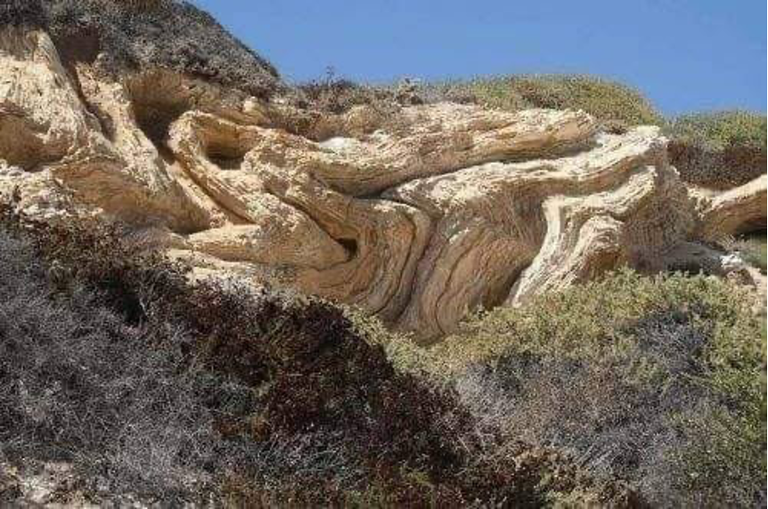
You can see that there are so many captivating stories connected to the Monterey Shale, just one rock formation that decorates landscapes along Crystal Cove and much of the California Coast. Another mysterious oddity appears on local cliffsides in the form of recumbent folds. Some layers of Monterey Shale have been deformed into what look like twisted and folded taffy. After being deposited on steep ocean bottom slopes, but before the heavy, wet sediments could be lithified into hardened stone, they were disturbed (perhaps by earthquakes). As the stacked layers slid downslope, they folded over on one another like piles of rugs. You will also find abundant light-colored thin veins cutting through the shale. As the rocks were buried deeper, fluids carried concentrations of calcite and silica, which were deposited within cracks zigzagging through the rocks.
In a few places, chunks of concretions have been eroded off the sea cliffs. These odd giant frisbee-, flying-saucer, or eye-shaped formations form after foreign objects (such as logs or other debris) were deposited and embedded within the sediment to act as irregularities. Minerals precipitated out of solution to solidify with fine sediments in hard sheets or layers surrounding the objects. Millions of years later, they are being exposed and weathered out of the cliffs to tumble on to the beach, landing at random angles.
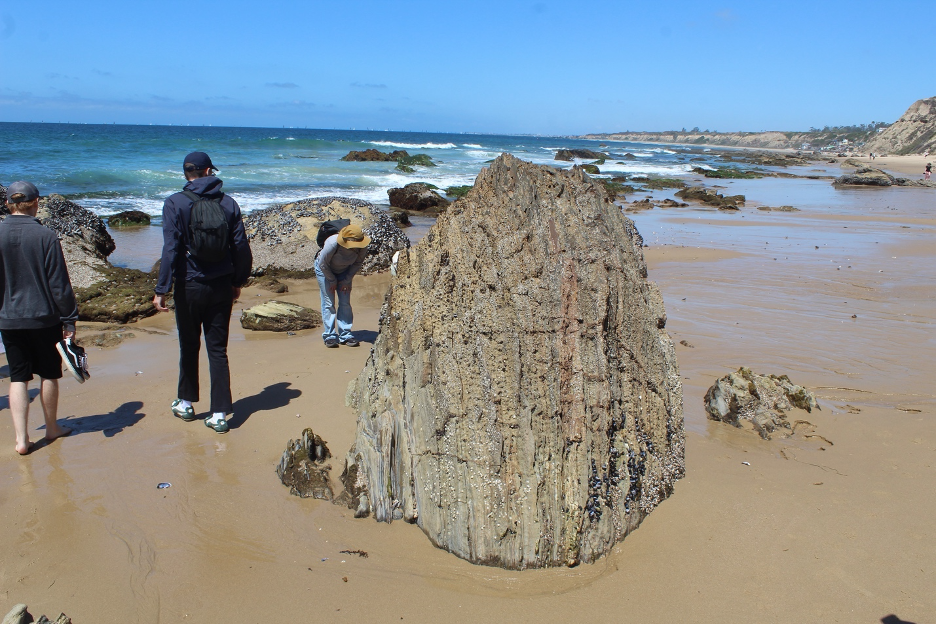
Abalone Point sticks out as another exceptional feature. Rare columnar jointed volcanic rocks tower above the waves on the south end of Crystal Cove. These relatively resistant andesites squeezed up through joints, cracks, and other weaknesses in preexisting country rocks (such as San Onofre Breccia) when they were below the sea up to 15 million years ago. As they cooled and crystalized, the rocks shrank and cracked into geometric patterns resembling giant vertical columns, accounting for a bit of Devil’s Postpile-like scenery towering over today’s beach. There are millions more years of Earth history stories waiting to be revealed in these landscapes, but we all have limits and the average naturalist might be ready to move on. Looking for more? You might check out a few of the links at the end of this story.
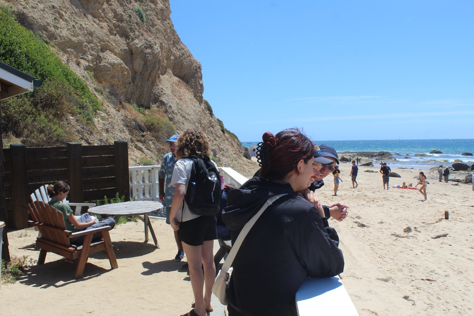
Forces Attack from Above
As soon as these rock formations emerge from the depths, they are attacked by external degradational (exogenic) forces. This is where physical and chemical weathering processes (reviewed in previous stories on this website) take over to break massive rock formations into smaller pieces so that erosion can transport their sediments down to the sea. Since the most common erosional agent on Earth’s surface and in the San Joaquin Hills above Crystal Cove is running water, you will find abundant evidence across these slopes. Every water-cut rill and gulley points toward a tributary that eventually flows into a canyon with a larger stream. And though all of these features may dry up for most of the long summer drought season, water becomes a powerful sculptor during winter rain events.
Gravity pulls the trickles that combine into torrents cascading toward the sea, enabling the water to carve V-shaped tributaries that merge into deeper canyons. More and faster flowing water = deeper canyons over the millennia. Los Trancos and Moro Creek and Canyon are just two examples. But Crystal Cove’s streams flow out of San Joaquin Hills watersheds that stretch only a few miles inland from ridges and peaks that barely rise above 1,000 feet. Such relatively small and steep drainage basins produce surface runoff that peaks and subsides within hours of most rain events. Blink and you might miss the flood. Delayed interflow gradually decreases until only meager baseflow might make us wonder how so many V-shaped notches could be carved into these hillsides.
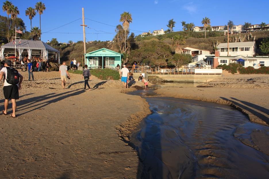
These little cascading streams that were in the denudational phase suddenly and only briefly become aggragational in nature when they reach the flatter beaches, where they lose their erosional power and deposit any sediment or debris they had picked up along the way. They drop their coarser sediment loads first, while the finer sands and silts may be carried all the way to the surf. As they meander to their ultimate base levels, look for cut banks sliced into the sand on the outside of the curves and point bars deposited in the calmer insides of the meanders. The usually paltry streams serve as miniature examples of alluvial processes common along floodplains of mighty rivers such as the Mississippi and Colorado. All of these deposits remind us that such streams and rivers are major sources of sand on our beaches. The chemistry of beach sand (containing abundant quartz and feldspars) can help us locate the source of rocks that were initially weathered, eroded, and transported from their headwaters. As you might guess, you will find more thorough discussions about these processes in previous stories on this website.
In stark contrast, the heralded Santa Ana River spills out just northwest of here between Newport and Huntington Beach. It originates from Southern California’s largest mountain ranges and highest peaks and flows for nearly 100 miles with a drainage basin of more than 2,500 square miles. Peak discharges from this river are astronomically higher (even with the upstream dams and other obstructions) with longer lag times following big storms. It also drains sprawling urban landscapes along its path. Flood control engineering has drastically changed its character over the decades to resemble a massive concrete-lined drainage ditch subject to flash flooding from the surrounding impermeable citified landscapes. Little Crystal Cove streams versus the nearby Santa Ana River: we could hardly imagine more dissimilar hydrologic settings.
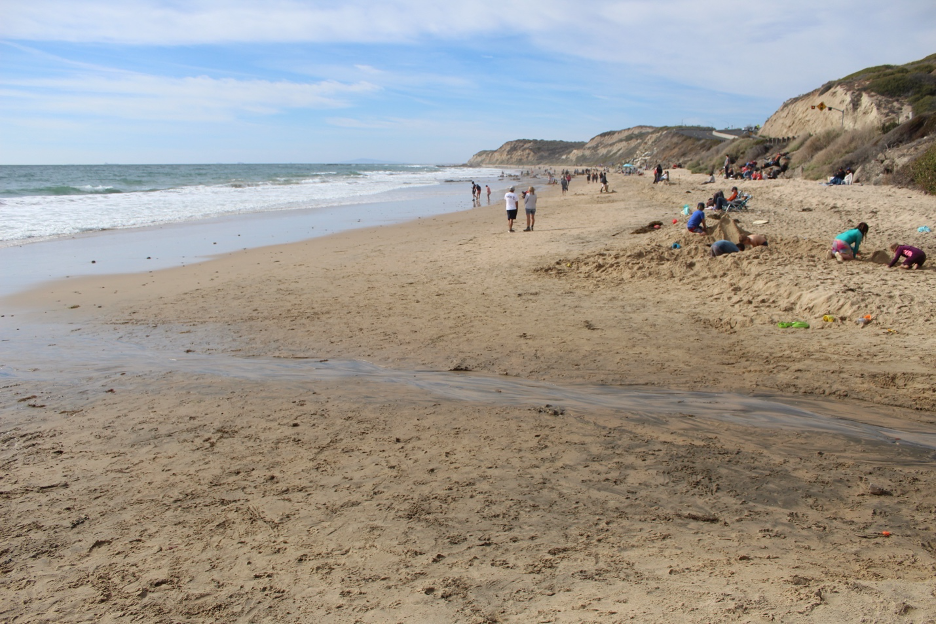
When viewing inland from Crystal Cove, you can easily be tricked into thinking that these are simply local foothills leading up to the much larger and taller Santa Ana Mountains in the distance. But they are not connected and there is a big gap between. If you’ve ever traveled between the El Toro Y (where the 405 and I 5 merge in Irvine) and Mission Viejo, you probably noticed how you were in a depression separating the San Joaquin Hills on the coast side and the far more massive Santa Ana Mountains on the inland side.
Where running water carves to steepen slopes above Crystal Cove, a host of mass wasting events are set in motion to quickly deliver tons of material into the canyons for transport. Landslides are most common along the steepest slopes where unstable rock formations have been fractured and weathered. Earthflows and debris flows become more frequent after wildfires strip off the thick coats of stabilizing vegetation that otherwise offer protection. Sediment yields from local drainage basins and sediment loads in streams increase by hundreds of times during rain events following wildfires. Noticeable changes may be evident in one day during these periods of accelerated erosion that can deliver tons of wasted mountain slopes onto the beaches within an hour. Small-scale examples of badlands topography (intricate patterns of eroded rills and gullies) may be etched on the most vulnerable and steepest slopes lacking the vegetation that might otherwise protect the loosest materials. Slower, less dramatic processes are also doing work on these landscapes. Local soil expansion and contraction can encourage soil creep that conspires with gravity to gradually drag loose, vulnerable weathered material downhill. We can thank winter’s soaking rains followed by summer’s dehydrating droughts for the swelling and cracking.
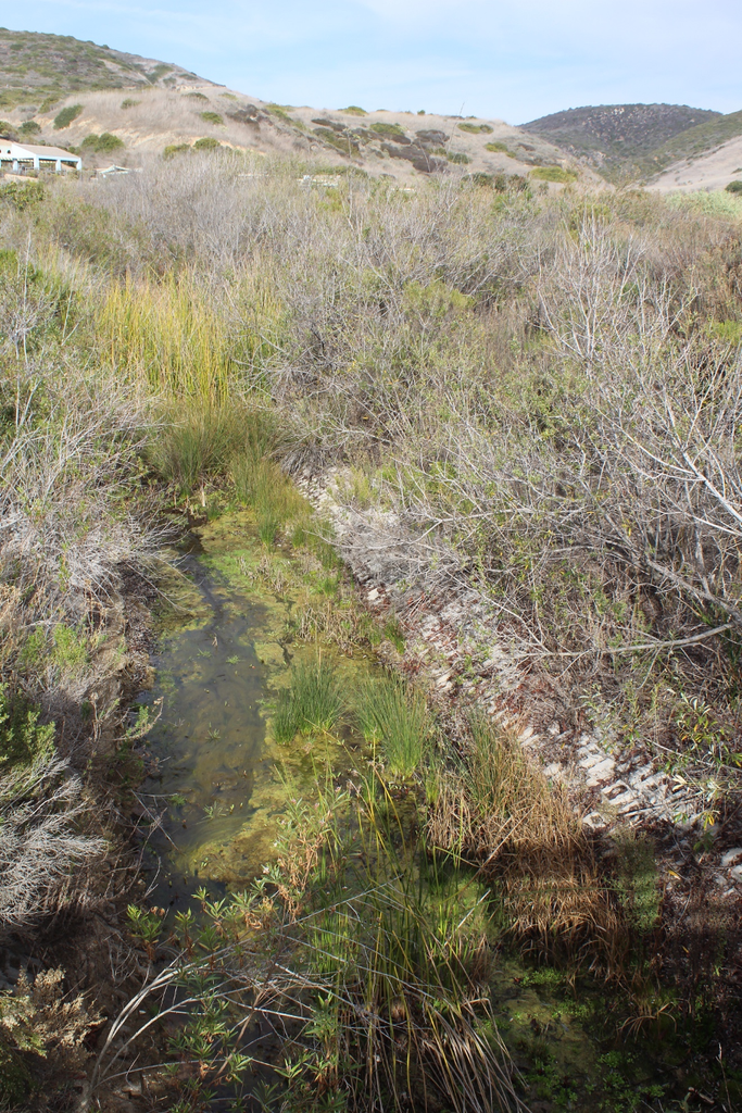
By now, you might notice why a survey of the region’s weather and climate might have necessarily preceded this section covering the external forces that shape Crystal Cove’s geomorphology. But you can also sense why deciding on that sequence is always a tossup: six of one and half a dozen of the other. Before we sail into those changing weather patterns and climates, let’s dive into the waves and coastal currents that are shaping these beaches.
On the Beach: Dynamic Coastal Processes
More than 10,000 years ago, melting glaciers and warming oceans were contributing to rising sea levels, eventually boosting water levels at least 400 feet higher since the most recent glacial maximum. As wave action ate away at this uplifted (and still uplifting) land, the shoreline gradually migrated inland until sea levels became relatively stable a few thousand years ago. More recently, during high tides and heavy storms, the waves have been cutting the sea cliffs that we see today, freshly exposing those millions of years of Earth history summarized in the earlier discussion. And now that sea levels are rising again, we can expect more frequent and severe erosional events, hoping that our thin strip of beach will somehow survive. These processes that shape our coastlines have earned extensive attention in numerous stories on this website, so we’ll keep this discussion focused on a few local examples that help explain the science behind shoreline scenes.
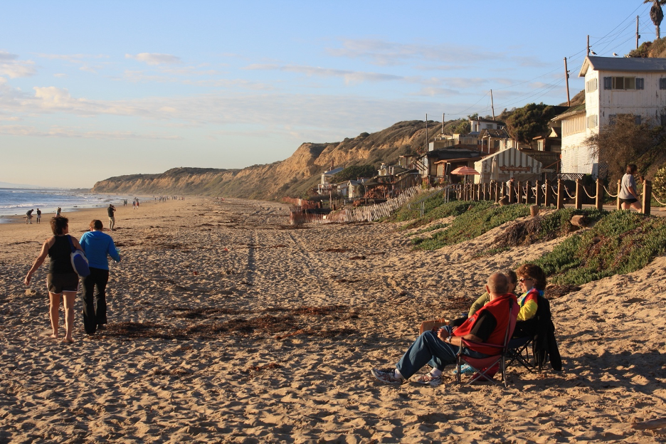
Crystal Cove (and SoCal) beaches don’t always experience the more predictable seasonal oscillations common along the Northern California coast. It is true that winter storms may generate large waves that erode beach sand and deposit it on to sandbars just offshore. Sand is eventually pushed back up and deposited on to wider beaches by summer’s normally calmer, less erosive surf. But Northern California’s powerful winter storms and waves often lose their punches after wrapping around Pt. Conception and down into what we call the Southern California Bight. So, when NorCal’s beaches are being stripped of sand by monster winter waves, the more distant and protected Southern California beaches might be spared. And since our strip of Crystal Cove coastline faces southwest, it is more vulnerable to summer’s south swells that originate from Southern Hemisphere storms or tropical storms off the Mexican coast. During these events, long period summer swells can become crashing sand erosion and transport machines. Such memorable waves recently stripped sand off the beaches until they ate all the way up to the cottages at Crystal Cove during June, 2026.
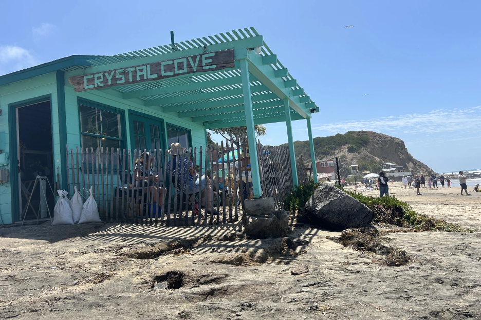
Watch the incoming waves first crash and concentrate their erosive energies on the rocks that jut out into the sea (such as at Abalone Point or Reef Point). Then, watch the same swells curve into our coastal crescents, stretching out and losing some power as they finally break into the coves. As they refract and spill over at angles to the shoreline, rivers of sand will be transported and deposited down the beach, pushed in the same direction as the breaking waves. When surf is big, the back-and-forth swash and backwash pushes tons of sand (AKA longshore drift) along the beach within hours. Powerful longshore currents are capable of carrying you and anything else that gets in the water parallel to the shore at remarkable speeds.
Maine life here has also adapted to warmer water currents compared to NorCal beaches. We will soon explore some examples.
Episode II: Changing Weather Patterns in a Paradise Climate
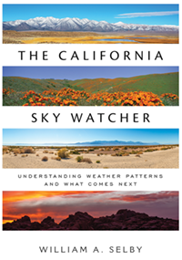
Official weather records confirm why coastal climates from Crystal Cove to the Mexican Border are considered to be some of the mildest on Earth. (If you prefer wild weather events and harsh seasonal extremes, this place is not for you.) Welcome to the heart of America’s plein air skyscapes and landscapes. The wealth of stories and images on this website and in my recent California Sky Watcher book describe and illustrate the general science and more specific details behind such a paradisical atmosphere. I’ll start by summarizing a few larger-scale regional factors that orchestrate our Mediterranean utopia.
Crystal Cove is located at about 33 ½ degrees north latitude. The average location of the North Pacific Subtropical High is around 30° N and out at sea to the west, so it is no surprise that this high-pressure system dominates the weather here. This is especially true during summer, when the tall stacks of dense high pressure shift and expand farther north, protecting the California coast from storminess. Stable weather is the rule as air descends out of these fair-weather drought makers. Some high sun seasons (from May-October) may pass without any measurable precipitation and most summers experience no major rainmakers.
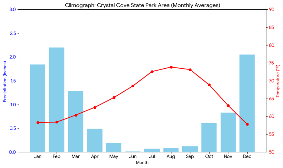
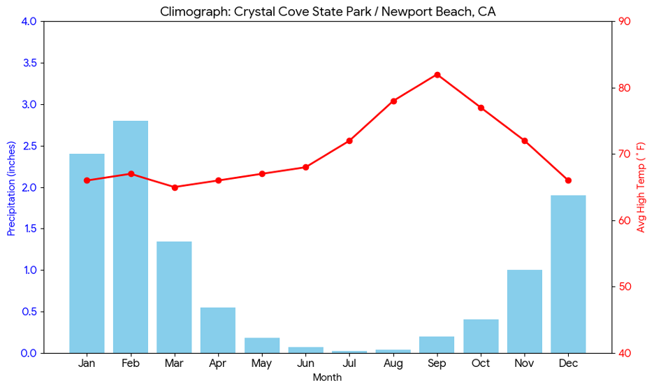
Surface winds spin clockwise out of this massive Pacific High as it anchors just to the west, pushing a giant ocean circulation known as the North Pacific Gyre. Our side of the gyre is known as the California Current, which flows north-south along the coast, carrying cold water into this latitude. Upwelling along the immediate coast pulls even cooler, nutrient-rich water up from the depths to the surface. Cool, dense air masses that form over this current are further stabilized, inhibiting storminess and compounding the drought. Crystal Cove water temperatures may only (normally) make it into the low 70s F during the warmest months of July-September, after dipping into the mid-50s by late winter. What a contrast to similar latitudes in steamy, stormy Asia and the Southeast US, where warm water currents with temperatures well into the 80s F flow from south to north along those coastlines during summer, destabilizing their air masses and fueling tropical storms.
This is also why tropical storms don’t build off the California coast. The few tropical systems that might drift north from warmer southern Mexico waters from July into October always weaken. By the time they reach this shoreline, only remnant clouds and a few showers usually remain. The fewer exceptions are when powerful hurricanes race north and land ashore as tropical depressions or even fewer tropical storms. You will find entire stories on our website and in my California Sky Watcher book covering these rogue tropical cyclones that may become more common as ocean water temperatures rise.
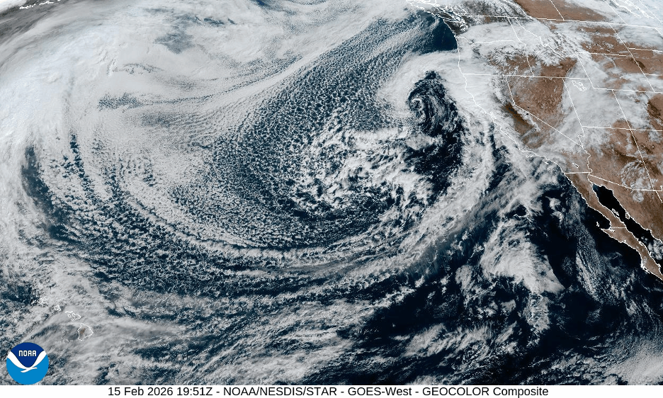
Crystal Cove’s cool marine layer and sea breezes are often trapped below inversions capped by descending air out of the high pressure. Low stratus clouds and fog commonly drift ashore, keeping spring and summer days mild and moist near the surface. When a shallow marine layer is trapped on the coastal side of the San Joaquin Hills, locations on the inland side can warm up to 20° F higher in the summer sun. When the marine layer is squashed down below 1,000 feet, you can hike to the top of the hills and look down on the cotton-like misty chill from the clear, warmer, drier air above.
When pressures ease, allowing the marine layer to strengthen, stratus thicken to stratocumulus clouds that cover all of the coastal plains far inland, occasionally dropping some morning drizzle. During these cooler days, gray ceilings barely break open to let some sun through during the afternoons. Such marine air surges can become more common in late spring, leading to the May Gray and June Gloom descriptors. These damp conditions are especially common when winds from the northwest are forced to curve around Pt. Conception and then swirl counterclockwise into the SoCal Bight. Such infamous Catalina Eddies will pump the low clouds and fog from south to north over Crystal Cove and into Orange County. Local plant communities then enjoy a cooler reprieve from the Mediterranean drought.
When the vertical rays of sun retreat into the Southern Hemisphere, the subtropical high shield sporadically shifts south and weakens from November into spring, occasionally opening the door to a sagging jet stream and powerful storms off the North Pacific. While Northern California gets hammered with winter storms that can dump more than 100 inches of rain in a season, a few will sneak into Southern California so that Crystal Cove may resemble a NorCal beach, if only for a day or two. When deeper upper-level troughs of low pressure steer these massive middle latitude wave cyclones south, you’d never know that this coast only averages about 11-12 inches of rain/year.
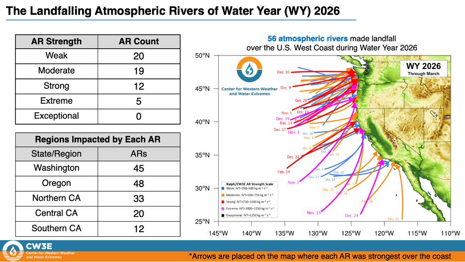
As winter’s massive low-pressure tempests spin counterclockwise, circulating their warm and cold fronts, southerly winds draw in the energy and moisture, followed by colder winds from the northwest to scoop up the air masses and wring them out. When bigger storms direct atmospheric rivers (also earning an entire story on this website) from thousands of miles offshore, they can resemble giant firehoses against these hills, dumping half a year’s, or more, average rainfall within a couple of days. Plant communities that have struggled through months of drought are suddenly deluged in buckets of rain that become impressive overland flow to be directed into flooding stream channels. Our dehydrated Mediterranean drought world is temporarily transformed into a soaked water world. Plants and animals must take advantage of the instant overabundance of moisture that will be short lived. During the big rain events, tons of sediment are transported out of these hills, on to the beaches and into the sea. Watch for the rust-colored surf at the mouths of streams and where sediments are carried farther out by rip currents.
Fire Changes Everything
And here is where we can emphasize the importance of fire cycles that have gained so much attention on this website and elsewhere. Nature has written the perfect script for wildfire dramas here. Months of summer drought are followed by the annual race to determine what will come first as autumn sets in: Santa Ana winds or the first winter-season rains. If the rains come first, the fire season is squelched. But if the offshore winds come first to these stressed plant communities loaded with dry fuels, you have the perfect firestorm conditions. Dehydrated plants bake under autumn’s strong offshore winds that can be heated by compression up to 100° F, driving relative humidity below 10%. If there is an ignition, get out of the way.
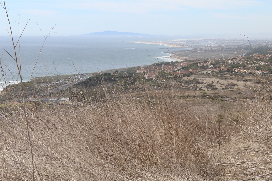
Recent local conflagrations include the devastating Laguna Fire in late October, 1993 that burned through Crystal Cove, 441 structures, and destroyed $1 billion of property, adjusted for inflation. Part of Crystal Cove was burned again during the smaller and less destructive Emerald Fire of 2022. (Such fire frequency is pretty typical in these Mediterranean plant communities.) In this last case, the NWS had issued their typical heat and wind advisories and the dry winds blew as expected, with one big irregularity: The Emerald Fire started on February 10, in the middle of our average rainy season, but during the driest consecutive January and February in state history! It was another exclamation point to emphasize how climate change has interrupted seasonal cycles and expectations that we once took for granted. Regardless, the big fires are almost always followed by big rains on these steep slopes with loose materials stripped of protective vegetation. As suggested earlier in the geomorphology section, welcome to some of the most celebrated mud and debris flow habitats in the world, where disturbance ecology becomes a big deal.
It’s the Topography, Stupid (My Memetic Snowclone)
Just as the local San Joaquin Hills (and more massive mountains in the distance) often block summer’s shallow, cool, moist sea breezes from encroaching farther inland, so do they play key roles in funneling Santa Ana winds. During autumn and winter, when wind directions sometimes reverse to offshore (land breezes), giant mountain walls farther to the north and east will block the coldest air masses from freezing Orange County and this coastline. Instead, these Santa Ana winds are funneled and squeezed through canyons and passes down toward the coastal plain. By this time, such offshore gales are compressed to become hot and dry blow torches that can extend out to sea, all the way past Catalina Island during stronger Santa Ana events. This is when the true desert comes to visit Crystal Cove. Temperatures can soar well into the 80s and relative humidity can dive into single digits even in the middle of winter.
By contrast, when winter’s low-pressure storms charge out of the Pacific toward this land, their turbulent air masses get an extra bump as they are forced to rise over hills and mountains. Catalina Island (often upwind during these storms) gives the moist tempests their first bumps with what is sometimes called the Island Effect. From there, enhanced clouds and showers may stream toward the San Joaquin Hills, where they will get another big lift. When the already unstable moist air masses flow over Crystal Cove, they must glide over those local hills. As the air columns are forced to rise higher and cool to their condensation levels, towering clouds and showers are more likely to dump precipitation on the hilltops. This accounts for higher annual rainfall totals at higher elevations, even across relatively small distances.
Consequently, though local mountaintops may not always experience such reliable soothing shallow fog banks during summer, they will accumulate more rainfall during the winter. These winter storms get even bigger boosts as they continue farther inland and up toward the Santa Ana Mountains, where annual precipitation averages up to 30 inches above 5,000 feet, more than double the average at Crystal Cove. It is no surprise that such a diversity of plants and animals has adapted to these changing conditons.
We have finally set the stage for the green leaves, colorful flowers, and furry critters that populate these habitats.
Episode III: Biogeography Within a Unique Floristic Province
Our California Floristic Province is a world-renowned biological hotspot that stretches in length from southwestern Oregon to northern Baja California and in width from the coast inland to the mountain crests. It includes thousands of unique Mediterranean species (more than a third are endemic); many of them are threatened or endangered and some have already gone extinct. You will find a wealth of information about our astounding diversity of ecosystems in other stories on this website. Crystal Cove State Park is located within the southern coastal extension of this province that boasts remarkable species diversity. There are no massive mountain barriers or radically different climates within or adjacent to this relatively small park as compared to the rest of California. And so, you won’t find redwood forests or true deserts.
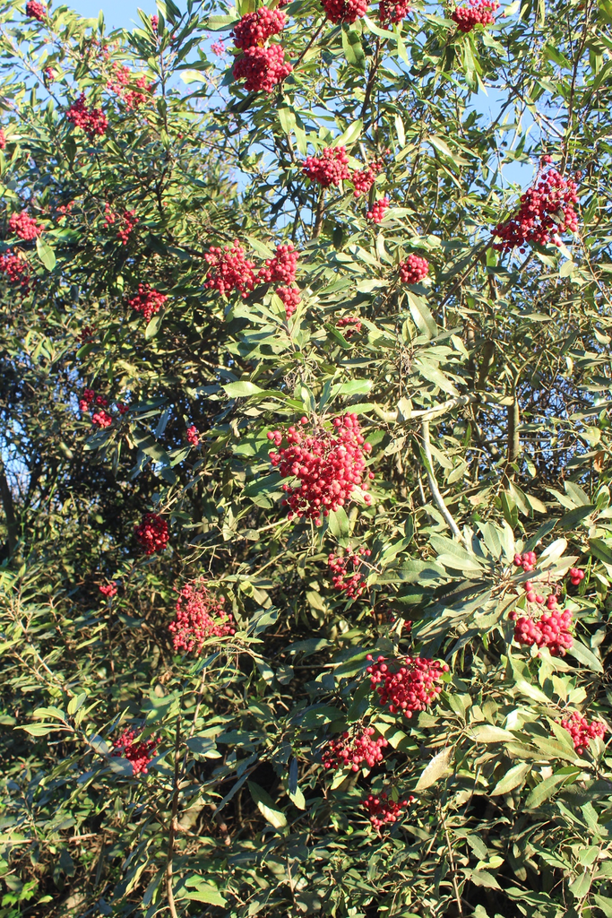
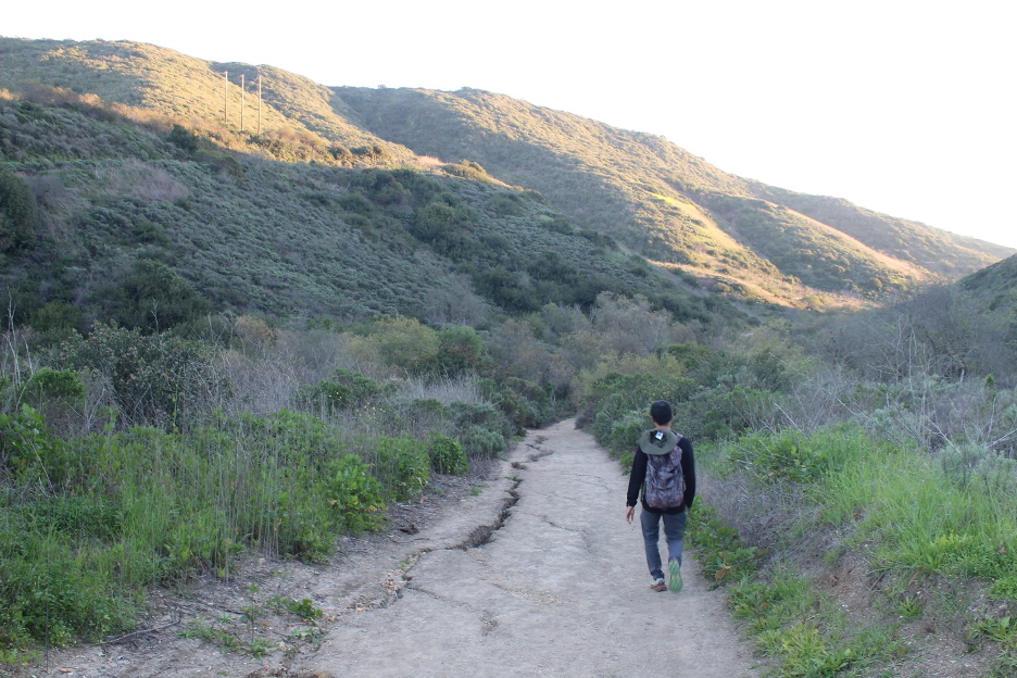
These rolling landscapes, sliced by streams into steepened canyons, are dominated by shrublands with plants and animals that have adapted to seasonal extremes: warm, dry summers and cool, relatively wet winters common to Mediterranean climates that we examined in the previous section. Plants and animals must cope with water scarcity most of the year, punctuated by short spurts of drenching winter rains. Freezing temperatures are rare along this mild coastline, eliminating one limiting factor that could otherwise challenge life at Crystal Cove. Chaparral is often the dominating descriptor, though we recognize a few other common and more specific related plant communities: coastal sage scrub, grasslands, and riparian woodlands. Small leaves with hard, waxy coatings are the rule; such sclerophyll leaves minimize transpiration rates during drought but are ready to quickly sprout and grow after a soaking rain. Give them a rub to feel their leathery textures, but watch out for thorns, irritable hairs, and the dreaded poison oak.
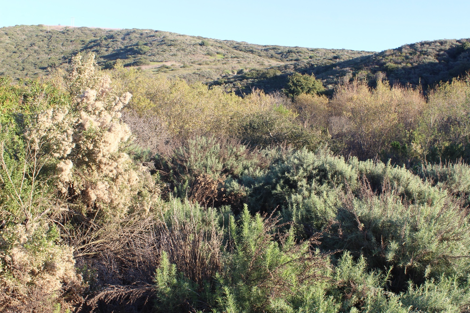
Here, as in other SoCal coastal locations, you will notice some plants with relatively softer leaves (coastal sage sometimes called soft chaparral) closer to the shoreline, where relative humidity remains a bit higher and coastal fog more commonly cools summer days. As you work your way farther inland, higher slopes often experience warmer summer days with lower relative humidity; harder chaparral endures as summer water vapor deficits increase. When the marine layer thickens, cool low clouds skim over the entire region, bringing brief but welcome moist relief to all the plant communities.
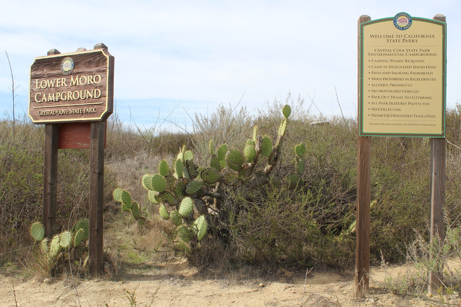
On drier and/or more disturbed slopes, including historically overgrazed areas, more xeric grasslands have evolved. Grasses are particularly abundant where coastal California’s shrink-swell clay soils become brick hard during summer and fall. Patchy grasslands here display radical seasonal fluctuations; winter and spring explosions of colorful wildflowers and green nonnative grasses quickly dehydrate into wilted and parched fuels during summer and into autumn, the harsh season when animals struggle to find water and food. Only the strongest will survive in what becomes a brutal land of scarcity and desolation until the first rains revisit.
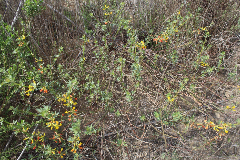
By contrast, riparian strips grow lusher along Crystal Cove canyons and stream channels. Oak, sycamore, and willow are taller trees that grow their roots near groundwater long after surface flows have disappeared and percolated deeper. Examine the sycamores in particular: their large, soft, lobate leaves with high transpiration rates signal that there is water at least near the surface. Such trees might line up together along streambeds harboring Crystal Cove State Park’s greatest terrestrial biomass density and diversity/area. These cooler, shadier microclimates become habitats for a host of predators and prey.
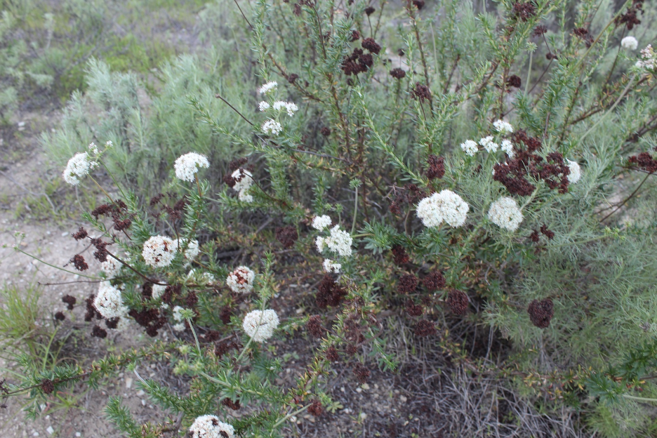
On the grand scale, as the long droughts progress, you will notice green giving way to grayer and browner shades on the slopes (most conspicuous from July-September), while many drought- or semi-drought-deciduous shrubs drop some or all of their leaves until beneficial rains return. On most of these slopes, the sprawling woody thickets have been described as dwarf, elfin, or pygmy forests since they barely grow taller than the average human adult, as observed in and around Crystal Cove during our 2026 field explorations. As they grow a bit higher and mature, the plants may drop their lower leaves, providing open spaces and cover for small animals scampering on the ground below the stunted canopy.
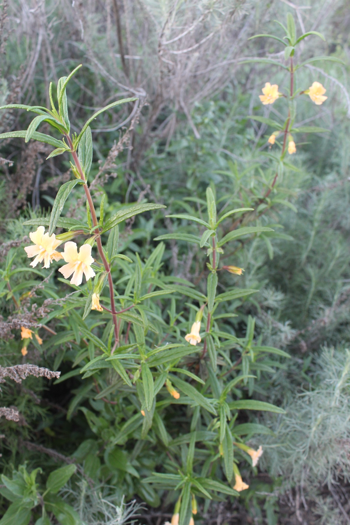
Wildfires have returned every few decades to burn all of this to the ground, so that the growing and maturing process can start all over again, reminding us that these ecosystems are in constant states of succession, always responding and adapting to stresses and other changes. Such fires leave scorched nutrients in the soil and eliminate the dwarf canopy so that sunlight can reach the surface. When the rains return, an explosion of wildflowers and other pyrophytes (fire followers) will decorate the slopes for a few years after the fires. Some wildflower seeds wait many years for these opportunities to sprout, while burned shrubs may simply grow back from their root crowns. Changing fire frequencies are impacting Crystal Cove landscapes, as they are throughout the state, as examined in previous stories on this website.
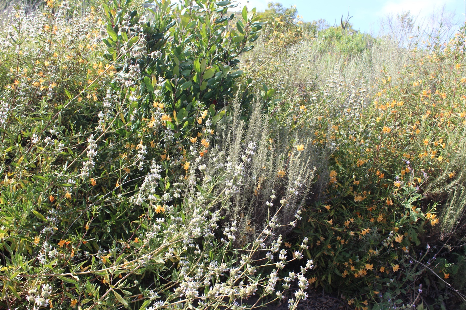
Though we necessarily focused on king climate, there are many other limiting factors that determine the nature of Crystal Cove’s mélange of plant communities. As in most of California, slope aspect and exposure are most conspicuous. The steepest slopes shed water faster and inhibit the formation of nutrient-rich soils. More xeric slopes facing south into the direct rays of sun also dry out faster and get hotter during the afternoons. By contrast, slopes facing north experience lower sun angles and stay shadier and cooler, cradling more water for longer periods. Hike on opposite sides of the slopes on a sunny afternoon to sense the dramatic difference in temperature and humidity and plant cover in these ecosystems where water is the most important limiting factor. Because soils weather from parent rocks, the weathering bedrock also plays an important role, helping to determine the texture and chemistry of soils. Add up all these supporting characters and limiting factors, and you can better understand the medley of plant communities decorating these hills. At the end of this story, you will find a partial list of species that I have noticed and chose to highlight, and some relevant links.
As expected, the producers make up the base and greatest biomass of the food pyramids at Crystal Cove. But the often-inconspicuous decomposers are responsible for processing plant and animal waste materials into essential chemical nutrients that can be utilized and recycled into these ecosystems. Soil bacteria, fungi, earthworms, and a host of other organisms might seem hidden at first, but life as we know it here wouldn’t exist without them.
Common Critters
Grizzly bears once had the run of this place and their way with anything that got in the way. Growing Spanish and Mexican settlements eliminated most of them by the 1800s and American settlers finished them off by the early 1900s. (Some of California’s last wild grizzlies were spotted not far from here at the base of the Santa Ana Mountains.) Many other animal species remain or have moved in as humans impacted these ecosystems. Unlike some more expansive California coastal and mountain wildlands, black bears have not replaced the grizzlies at Crystal Cove State Park.
Now that I have your attention, some of the smallest crawling and flying critters determine whether these ecosystems will thrive or perish. The great diversity of insects such as ants, butterflies, bees, and beetles do the heavy lifting that includes pollination. Whether they are classified as arthropods, arachnids, or myriapods, creepy-crawly critters must be found everywhere, or there would be no here left to explore. This is why there is so much concern about pollution and other anthropogenic changes that continue threatening or endangering our cherished insects and other critters we might call bugs. Though I ended this story with a list of links that lead to more details about all of the subjects, to avoid repetition, I will begin to suggest relevant links within the text. Here’s the first. Here’s another.
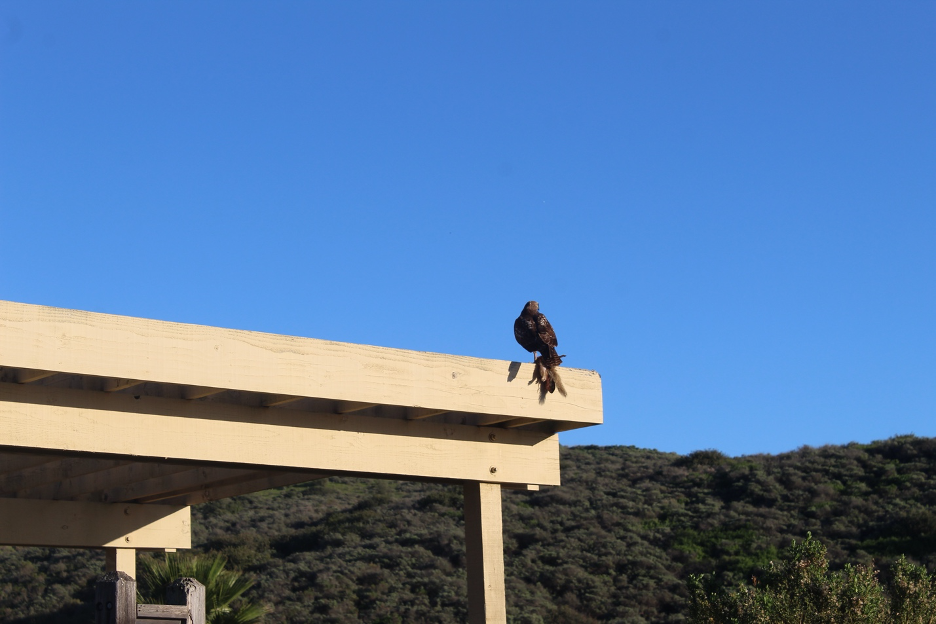
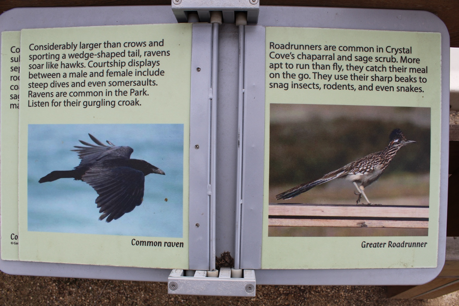
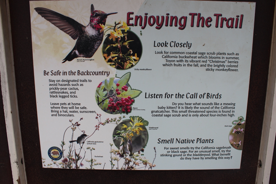
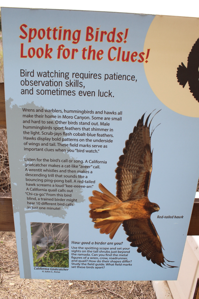
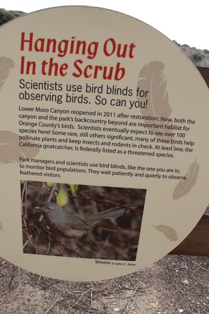
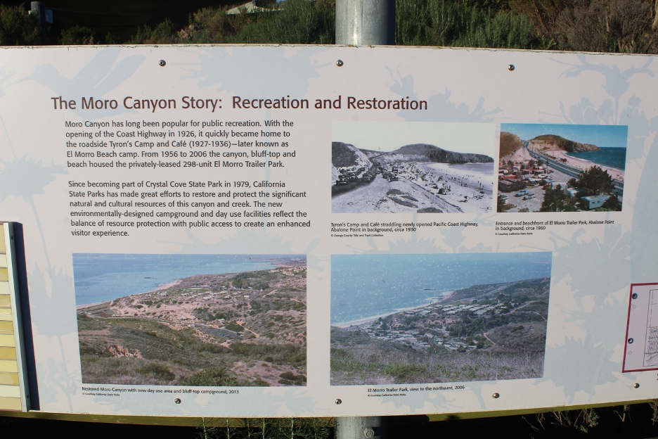
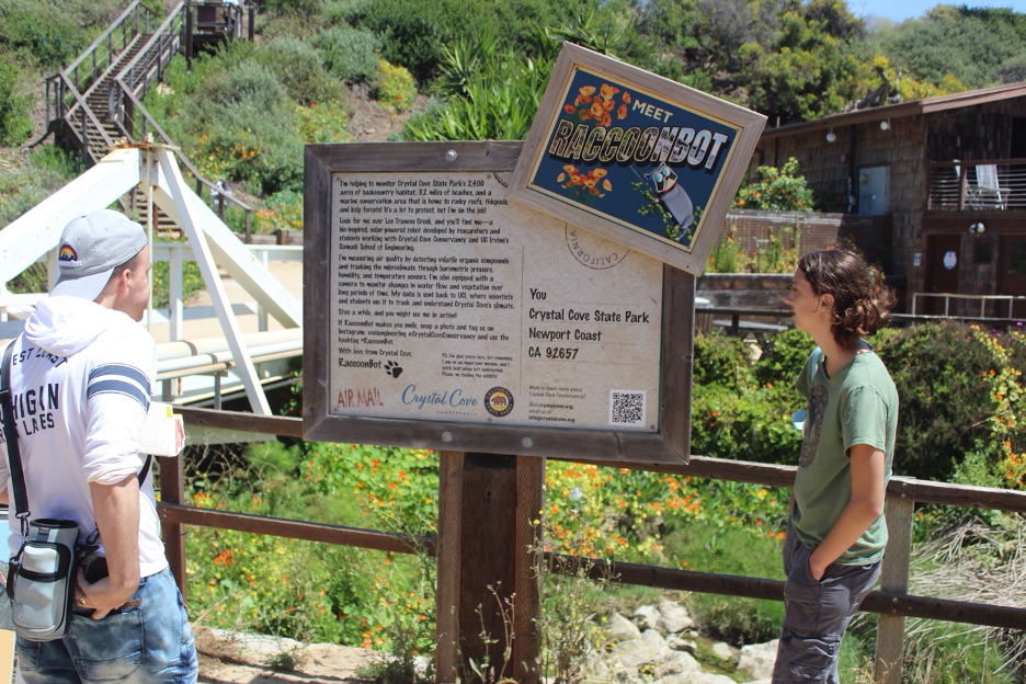
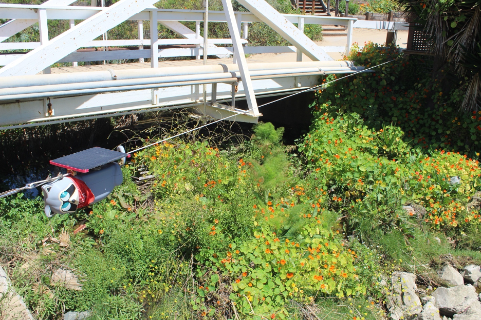
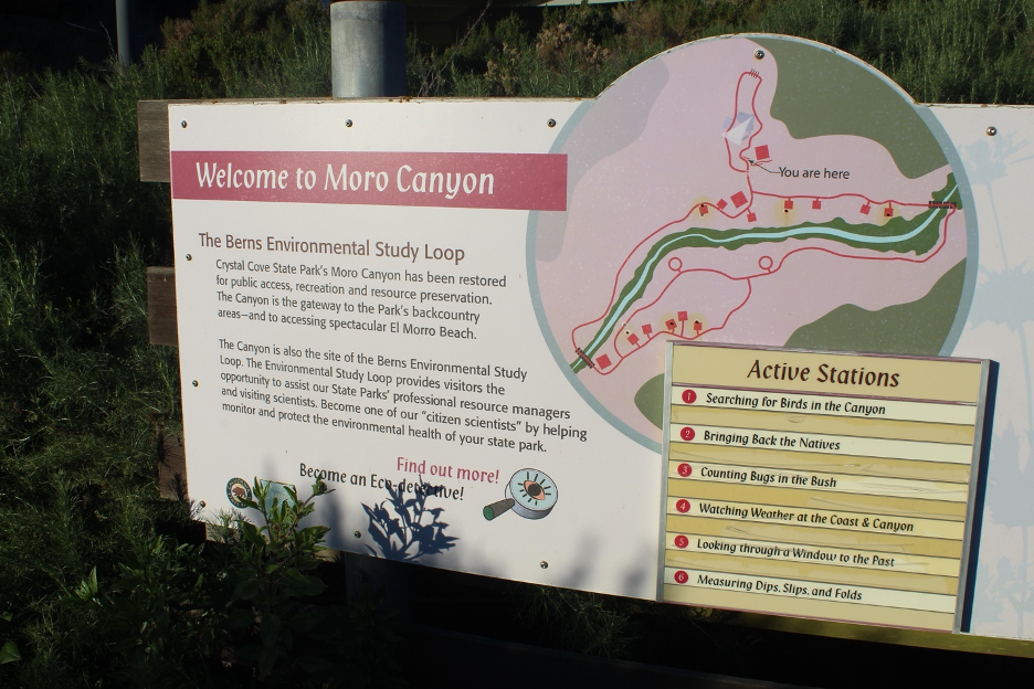
The next several images will guide you through some educational signage spotlighting some of the wildlife at Crystal Cove. Later, I’ll meet you at the beach.
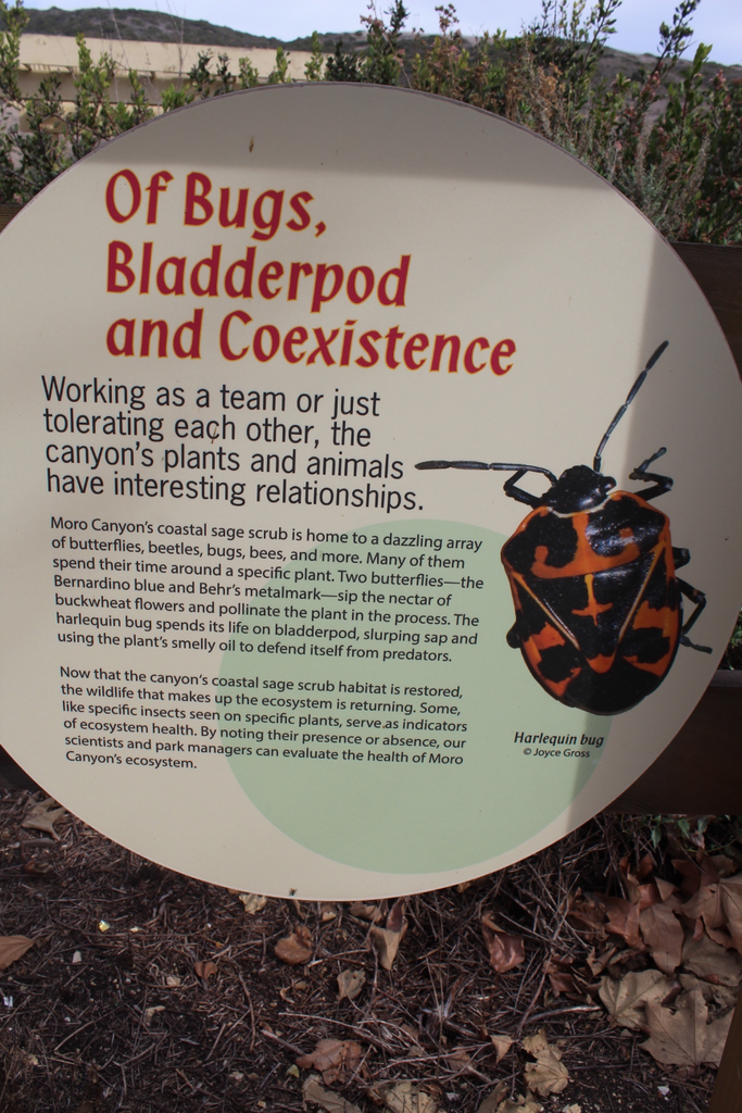
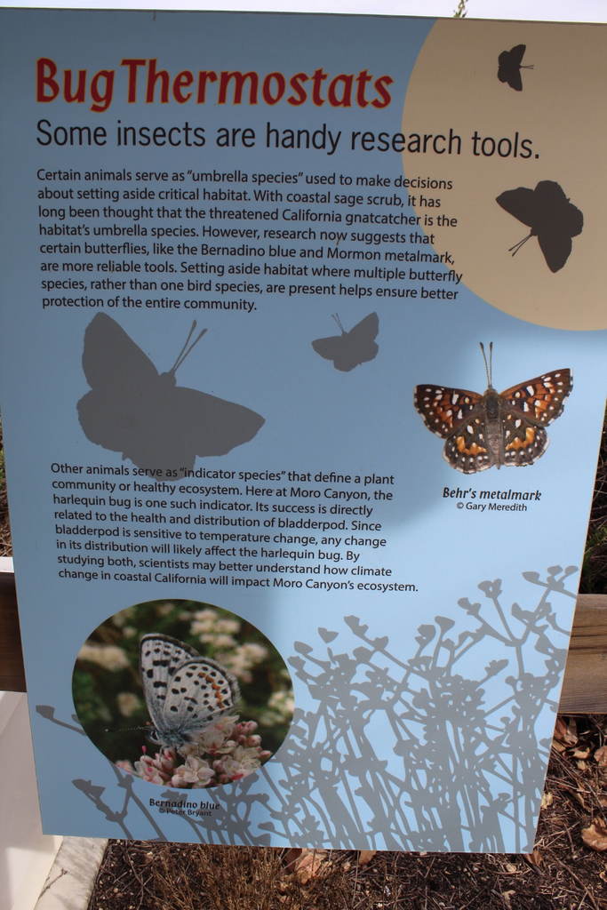
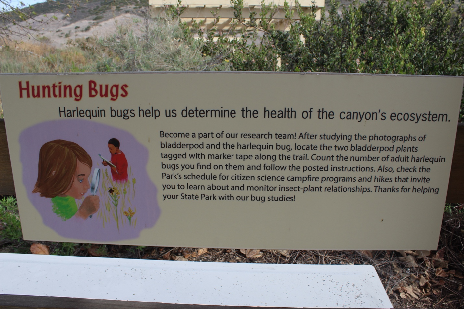
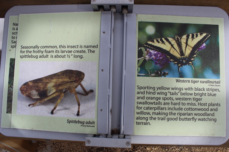
Look out for herbivores scurrying by, gathering food and attempting to avoid the carnivores. What might appear as a peaceful, easy going nature scene can quickly morph into a life and death predator-prey drama right out of a PBS nature documentary. Ground squirrels, cottontail rabbits, and western fence lizards are difficult to miss. Western toads start their lives as herbivores and eventually mature to become carnivores. If temperatures aren’t too hot or cold, you might be surprised to find a rattlesnake, gopher snake, or kingsnake on or near the trail, searching for their next dinners. Deer, coyote, and bobcats (more active near dawn and dusk) aren’t as numerous, but they’re out there. A rarely seen mountain lion represents the classic keystone species (at the top of the food pyramid), wandering in to help keep deer and other prey populations under control. Some mammals and reptiles.
When times get tough, local birds have the advantage of easy travel to more distant food and water. Tread lightly and with some patience, you might be rewarded when a California quail family bobs by or as a roadrunner races toward its latest meal. Tiny gnatcatchers and larger thrashers feast on insects and spiders. Small brownish Wrentits (Chamaea fasciata) are secretive songbirds common to coastal sage scrub and chaparral throughout California; but they can’t be missed because their call sounds like a bouncing ping-pong or golf ball with shorter intervals between each ping. Their avian vocalization is so recognizable, it’s called the song of the chaparral. Watch overhead for soaring red-tailed hawks and other raptors as they leverage their keen eyesight to search for morsels in nature’s buffet. Dark and bald turkey vultures commonly soar titling and seesawing in the thermals, displaying the silver-tipped undersides of their wings, and catching the latest scents from carcasses that fell victims to drought and/or hungry predators. Here are some Crystal Cove birds.
Episode IV: Life On the Beach and In the Ocean
We’ve already looked across the ocean, sailed along the California Current, and surfed over the upwelling that brings cold, nutrient-rich waters toward the surface. These conditions stretching along Crystal Cove support some of the most productive coastal waters in the world. Volumes have been written about the astounding biodiversity and biomass just below the surface, so we won’t try to duplicate such efforts here. But you can look out at the massive patches of brown algae or snorkel or dive into the giant kelp forests that, anchored on rocks by their holdfasts, have been known to grow up to 200 feet tall and a foot/day as they reach for sunlight.
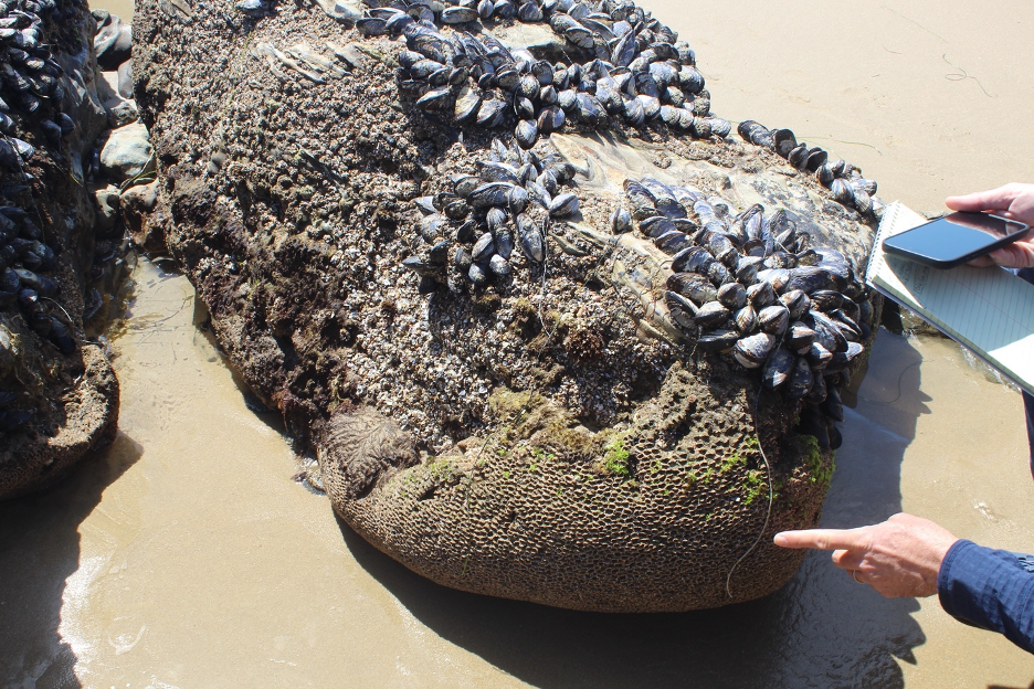
For the less adventurous, some of that biomass occasionally detaches or dies and washes ashore for closer examination. Check out the seaweed debris (wrack) which is often deposited in strand lines marking the extent of the most recent high tide. Notice how marine debris attracts the insects, sand crabs, and other invertebrates which will attract larger animals. Show some respect for the nutrient recyclers that play vital roles cleaning up organic debris that floats in the water and washes ashore. Those annoying kelp flies, beach hoppers, and other tiny critters grazing underneath the decomposing kelp are processing and leaving behind nutrients in forms that fuel these ecosystems. Pick up a rock with its honeycombs of drilled holes, imagine the clams that spent their lives boring into it, and discover how all this unveiling of nature’s secrets is far from boring.
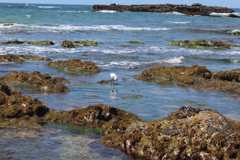
Check out the tide pools at low tide, but be careful not to crush or disturb the resilient organisms clinging to or hiding beneath rocks, awaiting the next high tide for cover. Within these intertidal zones, species are arranged in vertical layers that offer different amounts of air and water coverage during the day and month. You may be most familiar with the high splash zone, where organisms have adapted to being exposed to air and sunlight for long periods. The lowest zone supports species that can only be exposed above the water for short periods during lowest tides. The middle zone nurtures in-between species and short-term migrants that can follow tidal oscillations. It’s a bustling city down there. A partial list of actors in this play are found in links at the end of this story, but it all starts with the producers, such as surf grass, rockweed, and giant kelp.
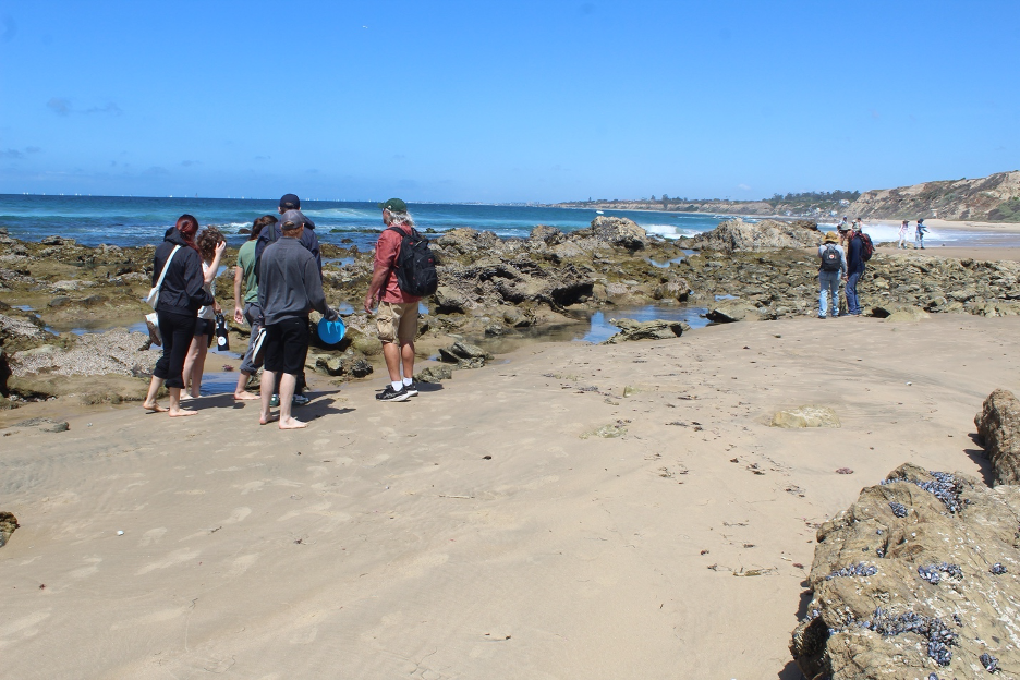
Look for the scrapers, grazers, and filter feeders attached to the rocks (such as limpets, mussels, barnacles, and anemones) that have perfected sweeping, gathering, and stinging for their next meals. At low tide, you can find sea anemones covering themselves with shells and other debris to guard against drying out until the next high tide.
Biologists classify residents of this intertidal city with terms that reflect the dizzying array of species. Invertebrates include crustaceans, such as barnacles and crabs; mollusks, such as mussels, limpets, chitons, snails, sea hares, and scallops; and echinoderms, such as urchins, stars, and sea cucumbers. Get lucky in deeper pools and you might find fish such as sculpins, perch, and garibaldi. You might rarely find octopuses using camouflage and agile arms to hunt their prey.
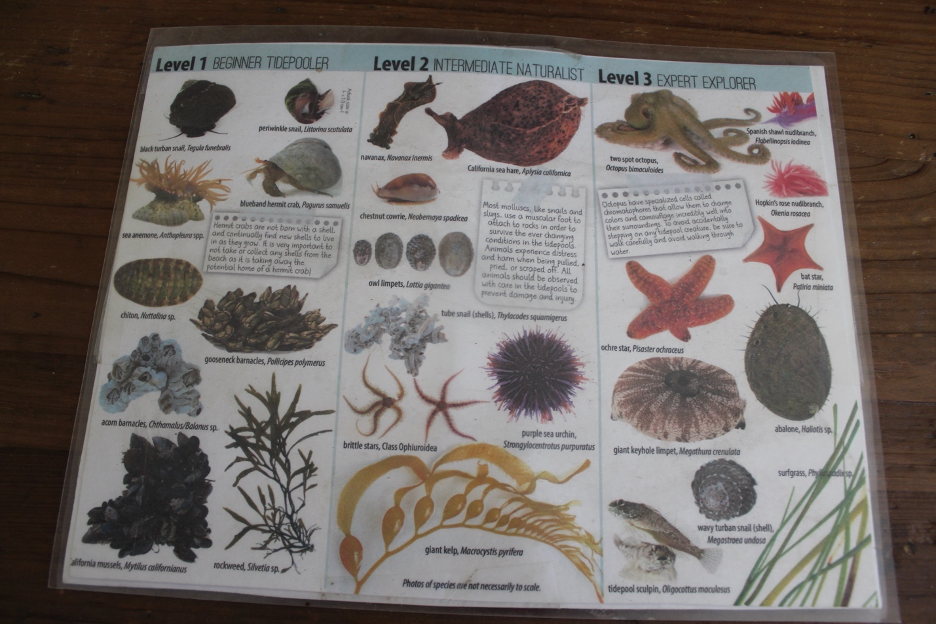
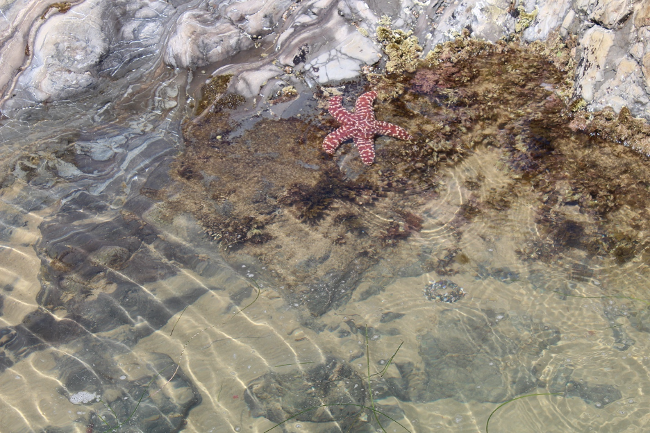
The Ochre Star (Pisaster ochraceus) has a particularly interesting story that involves a close call. Just more than a decade ago, bacteria attacked our sea stars, causing an explosion of sea star wasting disease. Billions of ochre stars and related species were killed off along the California coast. The once ubiquitous and beloved ochre stars nearly disappeared from Crystal Cove, thanks to this fast-spreading menace. More recently, these chromatic sea stars have been gradually returning to the delight of lucky tide poolers. But they still face ongoing challenges that include prolonged ocean heat waves delivering some of the warmest water temperatures in history. Look carefully, but don’t cause further stress by picking them up.
Episode V: Human History, a Paradise People Primer
Palimpsest refers to a reused writing surface where older layers still show beneath the most recent writing. Geographers use a similar concept called sequent occupance to describe how successive groups leave distinct cultural imprints on a landscape over time. Nearly every civilization and occupied or abandoned space on Earth has been impacted by invaders, colonizers, and settlers who swept away the old to make way for their new, more dominant cultures. We often rely on archeologists and other anthropologists or those who remain from past cultures to discover and decode these footprints of the past in places such as Crystal Cove.
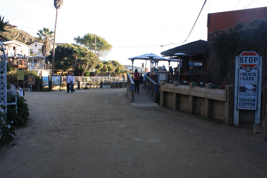
Humans wandered into California more than 10,000 years ago. Their impacts increased over time as their improving technologies supported larger populations. More than 40 historical sites have been recognized at Crystal Cove State Park. Three Native American groups lived in the region when the first Spanish explorers arrived. They are (by Native American name/Spanish name): Tongva/Gabrieliño, Acjachemen/Juaneño, and Payómkawichum/Luiseño to the south and east. They were skilled hunters and gatherers who clustered in villages along reliable freshwater courses. A few thousand years ago, local Native Americans had developed food processing tools and stone implements such as mortars and pestles. They gathered fish and other marine resources from the surf and kelp forests, thanks to improved fishhooks, nets, and wooden plank tule canoes (tomols). Such technologies extended their range and impacts into the open ocean, which supported larger populations, especially during droughts and food scarcity on land. Volumes have been written and a few stories on our website have highlighted the rich history of these native people. Here’s a start.
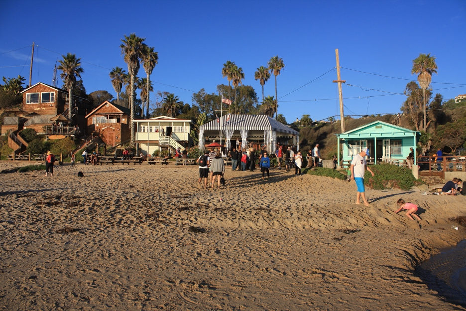
After the Spanish arrived and began settling in 1769, a series of events transformed this region and its landscapes in relatively rapid succession. By 1822, Crystal Cove was part of Mexico until the Americans took control by the late 1840s and made California the 31st state in 1850. By 1889, Orange County separated from LA and it has grown to become the 2nd most densely populated county in the state. Today, this diverse county that surrounds Crystal Cove harbors more than 3 million people, roughly 1/3 white, 1/3 Hispanic, ¼ Asian, and a few percent black and Native American. The Spanish names that remain etched on the signs and maps are joined by English, Asian, Native American, and other languages and cultures that decorate today’s crowded OC. No wonder so many cherish what remains of their wild open places.
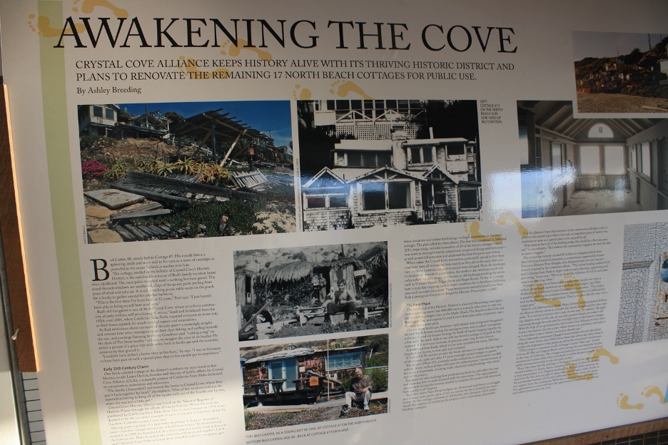
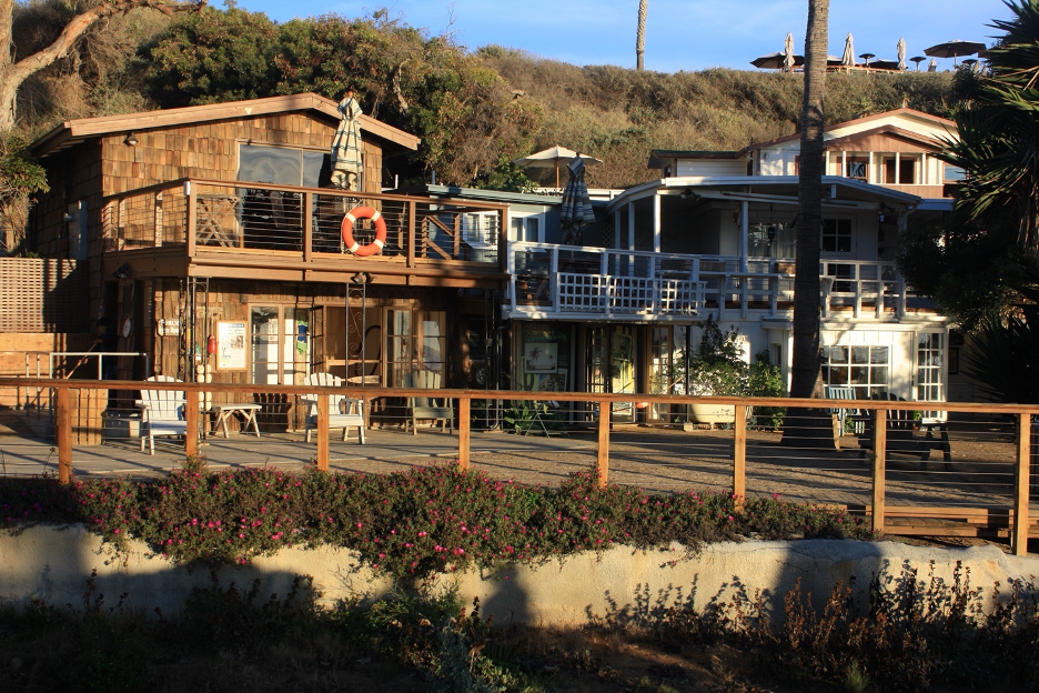
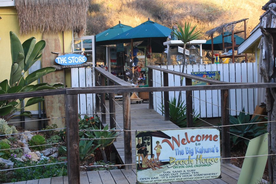
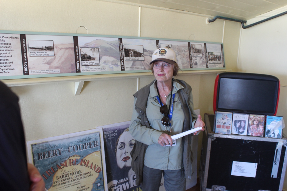
We could continue with more volumes of this human history that would necessarily include how land grants became the storied colossal Irvine Ranch that recently dominated in this region and how it evolved as the plein air epicenter of the West. And how Hollywood discovered Crystal Cove to represent tropical islands in early 1900s films. But it has all been written elsewhere and this story was designed to focus on, summarize, and celebrate natural history and the natural science behind the scenes. Though our story must come to an end, you can continue to enjoy these landscapes and investigate the literature (check out the links that follow) that tell more details. Today’s Crystal Cove is our natural refuge, a miracle that was spared from the bulldozers and urban chaos by heroes of the past who recognized that we must remain connected to our natural world if we are to survive and thrive.
Concluding Thoughts
The astronomical property values surrounding Crystal Cove are more evidence of what a cherished and celebrated coastline this is, and how lucky we are that is has been preserved for all of us and future generations as a natural laboratory that educates, inspires, and rejuvenates. Our lives may have grown out of balance, Koyaanisqatsi style, detaching us from the nature that nurtures our essential air, water, food, shelter, and our physical and mental health; but Crystal Cove endures as a vital prescription to treat our nature deficit disorders.
Searching for More Science Behind the Scenes? Following this list of relevant links (roughly arranged in the order that episodes and topics appeared in this story), you will find an appendix with a partial plant list:
Uplift of the San Joaquin Hills
Some Geology Details at Crystal Cove
Facts from a Diatom Paleontologist (think Monterey Shale)
June, 2026 Beach Erosion:
Article
YouTube
Facebook
Plants:
UC Santa Cruz Sea Star Wasting Study
Discovery of the Bacteria that Causes Sea Star Wasting
Oregon State University Study Showing Ochre Recovery
Human History:
Partial Plant List Appendix
The following is a partial list of Crystal Cove State Park plants that caught my attention. They are in alphabetical order according to common names. I added an occasional species name to go with the common names, but you are encouraged to consult Calflora OR the California Native Plant Society and their Calscape for more details.
Let’s start with a brief description of two dissimilar stand-out charmers:
Two very common plants that are hard to miss at Crystal Cove State Park are coyote bush, which we highlighted earlier, and Bush Sunflower (Encelia californica). When you see this attractive Encelia’s big yellow flowers blooming from winter through spring, you won’t be surprised to learn that it is a member of the Daisy (Asteraceae) family. It attracts insects and pollinators such as bees and butterflies, and birds feast on its seeds. Bush sunflower is a hardy plant and a popular choice for native gardens. It loves the sun but doesn’t tolerate long periods of cold, which makes it perfectly suitable for Crystal Cove habitats.
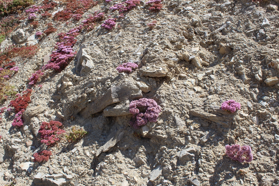
Search along the bluffs for the rare and threatened Dudleya. Species of these isolated liveforevers pop up to anchor on the rock outcrops. Please don’t disturb them. Poachers throughout the Southwest have stolen and sold them for small fortunes and then the new owners discover how they die after being removed from unique habitats that were decades-long homes for these venerable beauties. You can see why such greed-motivated violators are subject to big fines and jail time.
Partial Plant List
Artichoke Thistle
*Beach Primrose
Bladderpod
Broom Baccharis (Baccharis sarothroides)
*Blue-eyed Grass
California Buckwheat
Coastal Cholla
*Common Fiddleneck
*California Fuchsia
Castor Bean
Cholla (Coastal)
*Common Goldenstar (Bloomeria crocea)
*Caterpillar Phacelia
Bush Mallow
*Coastal Paintbrush
*California Poppy
Coyote Bush (Baccharis pilularis)
Deerweed
Dodder (Witches Hair)
Dudleya
Elderberry (Blue Elderberry)
Everlasting
Sweet Fennel
*Fiesta Flower (Pholistoma auritum var. auritum)
Fleabane
Fuchsia-flowered Gooseberry
Coyote Gourd Gumplant (Grindelias genus)
Hedge Nettle
Heliotrope (Wild)
*Hyacinth (Wild) (AKA blue dicks)
Jimson Weed
Laurel Sumac
Lemonade Berry
*Lupine
*Mariposa Lily (Splendid)
Monkey Flower
Morning Glory
Mugwort
Mulefat
*Black Mustard
*Parry’s Phacelia
Poison Hemlock
Poison Oak
*Purple Owl’s Clover
*Popcorn Flower
Prickly Pear Cactus
Douglas Nightshade
Purple Nightshade
*California Poppy
Wild Radish
Wild Rose
California Sagebrush
Black Sage
White Sage
Sugarbush (Rhus ovata)
Bush Sunflower (Encelia californica)
Salt Bush
Sand Verbena
Tarplant
Telegraph Weed
Tidy Tips
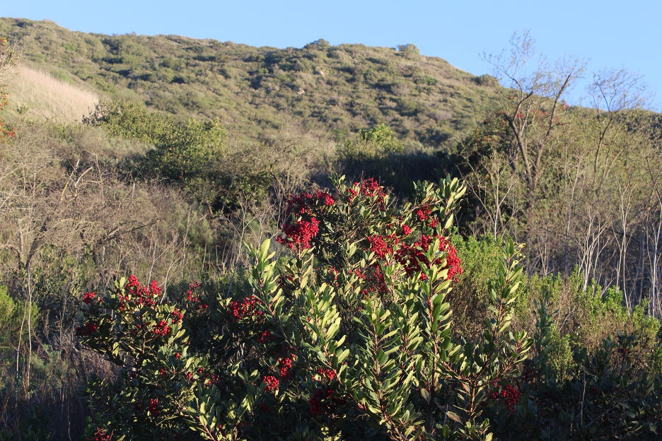
Toyon (Christmas Berry)
Tree Tobacco
Turkish Rugging
*Twiggy Wreath
Wishbone Bush
THE END