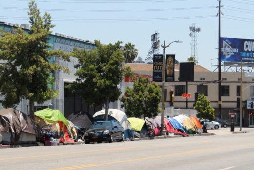
Nature conducted another round of spectacular scientific exhibitions and experiments in the atmosphere above California last summer. When such aesthetic skies are on display, we are given opportunities to incorporate the “A” for Arts into more traditional STEM (Science, Technology, Engineering, and Math) research and disciplines. We are also motivated to explore the science behind nature’s beautiful artwork, which leads us toward a more holistic understanding of the interconnected natural systems and cycles that rule our surroundings and our world. Here, we follow in pictures some weather patterns that decorated the skies above two very different regions of our state, places that might seem separated by thousands of miles, but are less than 200 miles (320 km) apart as the crow flies. We hope this story will simultaneously stir your analytical and creative juices while we recognize and celebrate that bridge between science and art as it was displayed in our California skies and weather patterns during the summer of 2022. We’ll set the stage with some maps and satellite images on this page before plunging into the sky displays in the two following pages.

Unprecedented Patterns
California’s bizarre-turned-unprecedented previous (2021-22) rainy season may have been a clue to expect another round of the unexpected for the summer. We had experienced one of the wettest “winter” storms to ever soak our October. December brought a dramatic repeat performance with a storm that dumped record snowfall in the Sierra Nevada. Our winter season was off to a rousing start. But it suddenly stopped. Our traditionally wettest months (January and February) were perfectly dry in many parts of the Golden State in 2022, especially where we depend on accumulated snow packs for our water supply. As winter and spring progressed, it became clear that California was in big water trouble again. The stage was set for another year of weather patterns that would make seasonal weather averages seem meaningless.

Pressure on the Golden State
Many Californians, particularly in our inland regions, may remember the summer of 2022 as another series of searing and sometimes record-breaking heat waves. The culprit was an enormous oscillating high pressure system that wobbled over the western states, compressing and further heating summer air masses. But that wasn’t true everywhere. Along the immediate central and north coast, a rather shallow but dominant marine layer often spread familiar cool and misty fog and low stratus through July. The coastal strip was frequently stranded beyond the far western edge of that big high pressure dome. Meanwhile, an odd series of stubborn cut-off low pressure systems often stalled off the north coast, spinning just close enough to occasionally enhance the marine layer, but offering little or no relief farther inland.

On the Edge of the Southwest Monsoon
Another form of heat relief arrived in our deserts. Clockwise circulation around that same southwestern high pressure (often labelled as summer’s familiar Four Corners High) carried moist, subtropical air masses up from the southeast. This fueled another intense, soaking monsoon season in the desert southwest that started in late June and continued on and off into October. As thunderstorms rumbled across northern Mexico and Arizona, their showers and/or debris clouds often slopped into southeastern California. The moisture and cloud cover, though adding sticky humidity, provided some temporary relief from otherwise oppressive desert heat. And when the Four Corners high pressure wobbled into more favorable positions, clouds and storms briefly flooded north along the spine of the Sierra Nevada Mountains and into the Basin and Range, and more briefly invaded other parts of the state where they are rarely observed during summer.

All-time Heat Records Fall
September brought historic changes. The massive high pressure system that had dominated the west expanded over California during the first week of the month. Tall, dense, heavy stacks of air descended on the state, as if a pressure cooker was compressing the air masses toward the surface. Weather stations from Reno to the Bay Area to the Oregon border broke September high temperature records. Redding made it to 115°F. September 6 was the big winner. Parts of the Central Valley measured the hottest temperatures EVER recorded, including Stockton (115°F) and Sacramento (116°F). All-time records were also set across and around the Bay Area: Santa Rosa (115); Napa (114); Livermore (116); Redwood City (110); and San Jose (109). The heat spread into places such as the Salinas Valley, where King City sizzled to a record 116°F. (Thanks to the National Weather Service for these official readings.)

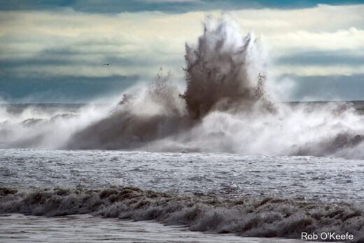
Unseasonable Rains Chase the High Heat
Just more than a week later, yet another very different record-breaking weather pattern formed; but this loomed off the coast. Another closed low pressure system, spinning off the north coast, intensified until it began resembling one of winter’s North Pacific middle latitude cyclones. As it approached, it tossed moisture and instability into northern and central California. Scattered thunderstorms, heavy downpours, and local flooding swept inland. The heaviest rains circulated through on September 18 and 19. Storm winners included a large area around Davis, which received nearly 4 inches of rain in less than two days. Local power outages and flooding prompted officials to respond to freak weather patterns they had never observed in September, in places that average about 1/10th of an inch of rain for the entire month. A bizarre September capped another odd summer; flash flood watches and warnings spread especially into areas that had been burned into vulnerable landscapes during scorching heat waves and damaging wind storms of previous years.

Exploring Disparate Weather Patterns, Climates, and Landscapes
We can see how observing and noting each year’s weather patterns has increasingly resembled science fiction movie scripts. But we don’t have to ignore the effects of climate change to appreciate and marvel over some of the sky décor painted by these weather patterns. So, the remainder of this story is a sky appreciation photo essay. Our text here lays the foundation and sets the stage so that we may explore the “why” of spectacular and sometimes breathtaking weather as it was displayed for our enjoyment. This first page also displays a few weather maps and satellite images during some of our unusual summer weather patterns. The second page takes you to the unstable skies of the eastern Sierra Nevada and Basin and Range to explore summer’s turbulent clouds and storms. The third page transports you just 200 miles west to the central coast, where we observe summer’s moist, stable marine layer fog and relatively routine, innocuous low stratus. Only two hundred miles separate these two Californias that seem worlds apart just about every year, including this one month in the summer of 2022. After viewing the exceptional maps and satellite images on this page, click to the next pages to follow us on this latest amalgamate of art and science. Our efforts will eventually lead us toward a much larger project and publication on California’s weather and climate. Stay tuned.


August Skyscapes: Click on to Page 2 to view unstable summer clouds and storms above the eastern Sierra Nevada and Basin and Range. Click on to Page 3 to view the relative calm and stable marine layer along the central coast (only 200 miles from our Page 2 images) during the same summer of 2022.